


Storm Amy will jettison Britain with a 100mph explosive "weather bomb" as the nation braces for travel chaos, building damage and power cuts.
Northern Britain is in the firing line for 80mph winds and torrential rain as the first storm of the season roars in tonight, while schools across parts of Northern Ireland have been forced to shut.
Powered by a raging jet stream, Amy will undergo "explosive cyclogenesis" into a hurtling "weather bomb".
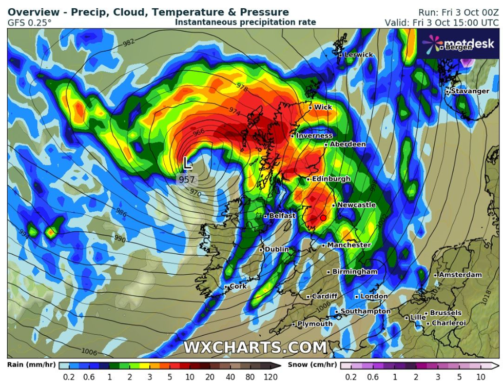
The term describes the central pressure of a storm dropping more than 24millibars in 24 hours, as Amy plunges from 988mb to 960mb.
TRENDING
Stories
Videos
Your Say
Amy will be boosted by two tropical hurricanes in the Atlantic – Humberto and Imelda – as their dying remains sweep into the North Atlantic.
Met Office meteorologist Aidan McGivern said: “There is a complex interaction between Humberto and Imelda, and then the remnants of Humberto being swept up by the jet stream before an explosive deepening.
“The remnants of Humberto will form a new low which will move into the Atlantic and get picked up by a very powerful jet stream coming out of America.
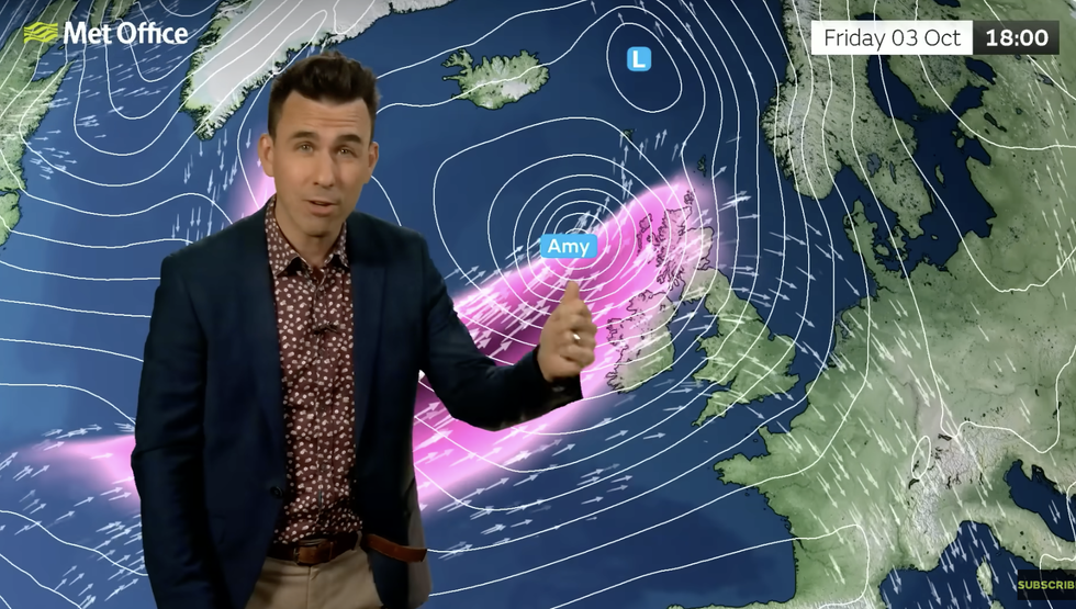
“By Friday evening, Amy will bear down on the UK as a very deep area of low pressure.”
LATEST DEVELOPMENTS:
Storm Amy will batter the UK today
|WXCHARTS
Schools across Counties Antrim, Londonderry, Tyrone and Fermanagh have been advised by the Education Authority in Northern Ireland to close at noon to ensure the safety of pupils and staff during Storm Amy.
The Met Office has warnings in force for wind and rain through tonight and into the early hours of Saturday.
Torrential downpours dumping more than three inches across Scotland and northern England threaten flooding and travel disruption.
Weather models reveal strongest gusts around the Scottish coasts of 100mph with more widely between 50mph and 80mph.
Aidan McGivern warns Storm Amy will bring 80mph gusts
|MET OFFICE
Government forecasters warn strong winds will bring the risk of flying debris, damage to buildings and power outages.
McGivern said: “Storm Amy is going to bring many impacts to the UK, but particularly northern parts on Friday night.
“Rain is going to really mount up, and over the next few days we will see 50 to 80mm adding up over some of the most exposed hills of northern Scotland.
“Storm Amy will cross the north of the UK, bringing a broad swathe of 50mph to 60mph gusts, but the most exposed spots are likely to experience gusts of 70mph to 80mph.
“These kind of wind gusts can cause disruption to transport, power supplies, dangerous conditions around coasts with large waves, and flying debris.”
Heavy rain in northern regions will bring the risk of flooding, he warned, with southern counties at risk of intense showers.
Driven by strong winds, this will bring a spell of ‘lively weather’ through the early hours of Saturday, he added.
Amy will clear by Sunday night leaving a blustery, showery picture and temperatures in the high-teens.
The jet stream will shift northwards after the weekend driving a calm, mild spell of autumn weather.
Weekend rainfall will dry to bring another spell of rainless skies which could hold out into the end of autumn.
Jim Dale, meteorologist for British Weather Services and social commentator, said: “The south of the country is still in a deficit after the very dry spring and summer, and the rain we are seeing over the next week or so is not going to be enough to replenish that.
“There is a risk that groundwater and reservoir levels will not recover, and this could have implications through the start of next year.”