


A muggy burst of Indian summer will waft in with a spooky tinge as a creepy fog dome smothers Britain.
Clear overnight skies and falling temperatures followed by warm days, will drive sheets of eerie radiation fog.
Thick morning mists may trigger travel disruption in parts of the country, experts warn.
However, as temperatures rise to a possible 70F, fog will burn off with much of Britain looking forward to a balmy run-up to mid-October.
TRENDING
Stories
Videos
Your Say
Jim Dale, meteorologist for British Weather Services, said: “Over the coming days, fog and mist in the mornings may be an issue, and it could be quite extensive.
“This could cause some travel issues in parts, but once the fog clears, we will be into Indian Summer territory.
“Where the sun comes through, temperatures this week could hit 21C in the south and more widely in the mid- to high teens.”
Fog will be stirred up by warm, humid days followed by cold nights as heat ‘radiates’ from the ground.
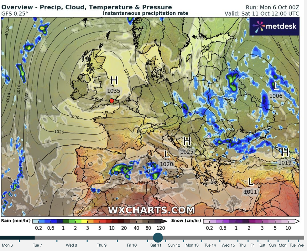
High pressure builds up again over the UK
|WX CHARTS
Moisture in the air close to the ground condenses into water droplets, forming blankets of thick ‘radiation fog’.
The spooky phenomenon is more common at this time of year when high daytime temperatures are often followed by chilly nights.
Dale said: “An interesting feature of the next week or so will be the big shift in diurnal temperatures, the large swing between daytime and night.
“Mild days could precede temperatures in exposed spots dropping to freezing.
“This all adds to what is needed for foggy and misty mornings.”
LATEST DEVELOPMENTS: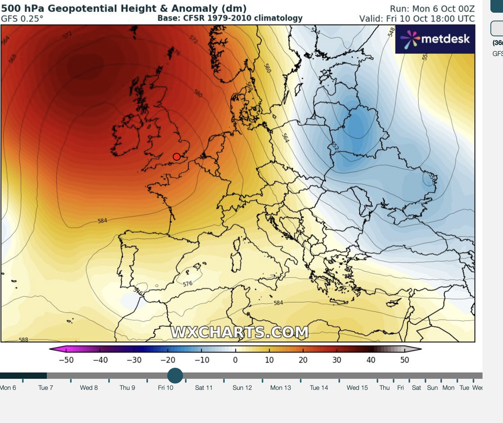
Daytime temperatures will rise, maps show
|WX CHARTS
The stormy start to the week will give way to what could be another fortnight of settled calm.
High pressure will once again shift over the UK, for most, keeping Atlantic storms at bay.
Wet and windy lows coming in from the west may clip the edge of western Scotland, leaving the rest of Britain unscathed.
Met Office meteorologist Aidan McGivern said: “Higher pressure becomes increasingly dominant later in the week, firmly in place across the south of the country, and with below-average rainfall across the country.
“It will be drier and more settled with misty mornings, but there are hardly any low-pressure systems affecting the UK.
“Most of them are to the north, and most of them avoid the UK.”
High pressure will build through the second half of the week as rain clears from the east.
Met Office meteorologist Ellie Glaisyer said: “It is quite a mild and damp start to the day on Tuesday, with outbreaks of rain continuing to sink south and eastwards.
“As rain sinks south and eastwards, we see high pressure building from the west through the second half of the week, and that will turn things a little more settled.
“But that does mean an increasing risk of fog overnight over the next couple of nights.”
Our Standards: The GB News Editorial Charter