


‘Battling’ weather systems threaten a bank holiday deluge before a tropical blast rescues the start of summer.
Britons will be dodging downpours through a “mixed” weekend as forecasters pull their hair out over chaotic pressure patterns.
Once again, weather models vastly disagree, promising a warm “plume” on Monday or a near washout.
In the longer term, high pressure is expected to build from the tropical Azores islands, meaning summer could finally sizzle after the weekend.
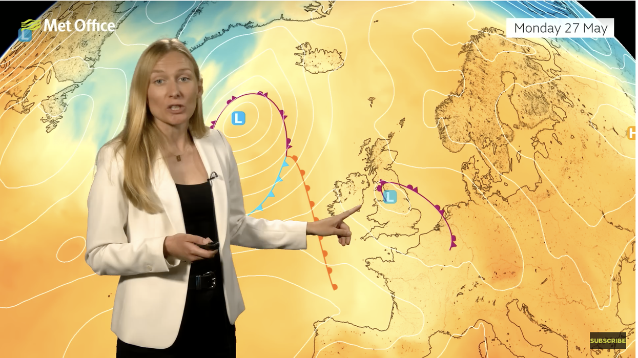
Met Office meteorologist Annie Shuttleworth said: “The bad news is the weather is a little bit uncertain for Bank Holiday Monday.
“The Met Office model has a plume of warm air coming up from the south and east and as a trough develops across Europe, it will allow a low-pressure system to develop across the UK.
“This is quite a change from other models, the Met Office model has low pressure right over the UK on Monday.
“The European long-range model has a ridge of higher pressure building in and cooler air, and this would bring a more widely showery picture.”
Saturday will bring the best of the weather although temperatures will hover in the high teens to low-20Cs through the weekend.
Heavy rain will move in on Sunday with parts of the country facing some “hefty showers”, Shuttleworth said.
LATEST DEVELOPMENTS: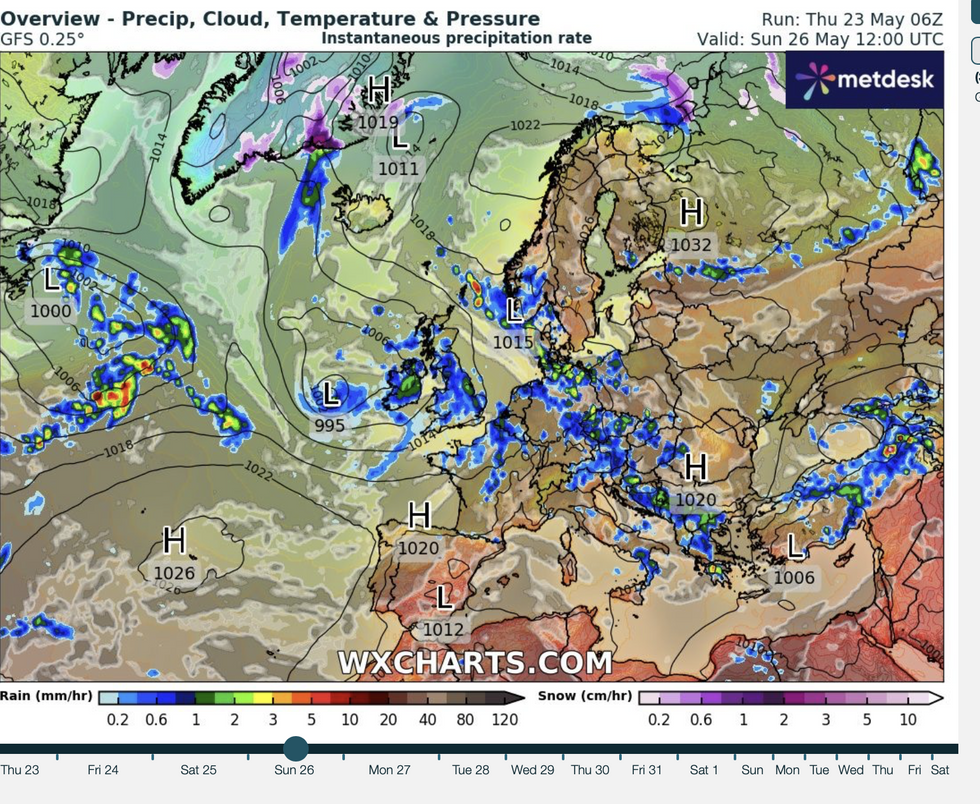
Some models bring the risk of rain for the weekend
|WX charts
However, at the start of next week the Azores High–a system of high pressure over the tropical Atlantic that can bring hot weather to the UK–will nudge UK-wards, she added.
She said: “Our friend the Azores high is expected to build in.
“That would bring drier weather to many southern areas, but there is still some wet weather around with the jet stream meandering to the north of the UK.
“As is often the case as we get between these highs and lows there is a bit of a battle between the highs and the lows, and some days one will win out over the other.”
Long-range experts agree Britain could be about to ditch the wet weather and head into the sunshine.
A strong Azores High was the driver for very hot periods of weather, including 2022’s record 40.3C.
James Madden, forecaster for Exacta Weather, said: “Temperatures are now expected to remain largely above average beyond the bank holiday and into the start of June.
“It will also turn significantly drier for many and from the weekend, we will see strong high pressure taking over and influencing our overall weather pattern.
“There is now a moderate to high chance for some even warmer or hot conditions to develop into early June.”
Warm air from the Continent and North Africa is likely to join forces with the Azores high to bring a sizzling start to summer.
Jim Dale, meteorologist for British Weather Services and social commentator, said: “There is no reason now why we shouldn’t see hotter weather develop through the start of summer.
“The synoptics have to be there, but with high-pressure building from the Azores, a waft from the Continent or Africa would push those temperatures up.
“In line with an overall change in the climate, there is no reason why we shouldn’t start to see temperatures in the high-20Cs.”