


A weather alert for snow has been extended with disruption caused by wintry weather is expected to continue.
Rain and snow could bring some disruption to parts of Wales, central England and the southern Pennines with the alert in place from 4pm today to 6am tomorrow.
Some 10-20mm of rain is expected to fall widely, although areas near the south coast could see up to 30mm of rain, while Dartmoor, Devon, could be battered with as much as 50mm.
The Met Office has warned there is a small chance that disruption caused by the snow, accompanied by strong winds, could see flights and train services cancelled and leave vehicles stranded on roads.
TRENDING
Stories
Videos
Your Say
In Northern Ireland, outbreaks of rain, hill snow and strong gusts of up to 50-55mph winds are expected to bring disruption, with a yellow warning in force until 8pm on Wednesday.
Senior Met Office meteorologist Craig Snell said many will see "a very wet and windy morning" on Wednesday, but added those in northern England will be "wondering what’s going on" with a dry day expected for many.
He said: "By the time we get into the late part of the day on Thursday, by that stage, the winds should be clearing away and Thursday will just be a slow improvement day.
"It’s all change after that, by the weekend it will be feeling much, much milder with temperatures reaching the low-to-mid teens, if we see some sunshine.
"There will be further spells of wind and rain but most of us will certainly see an uplift of temperatures as we go into the weekend."
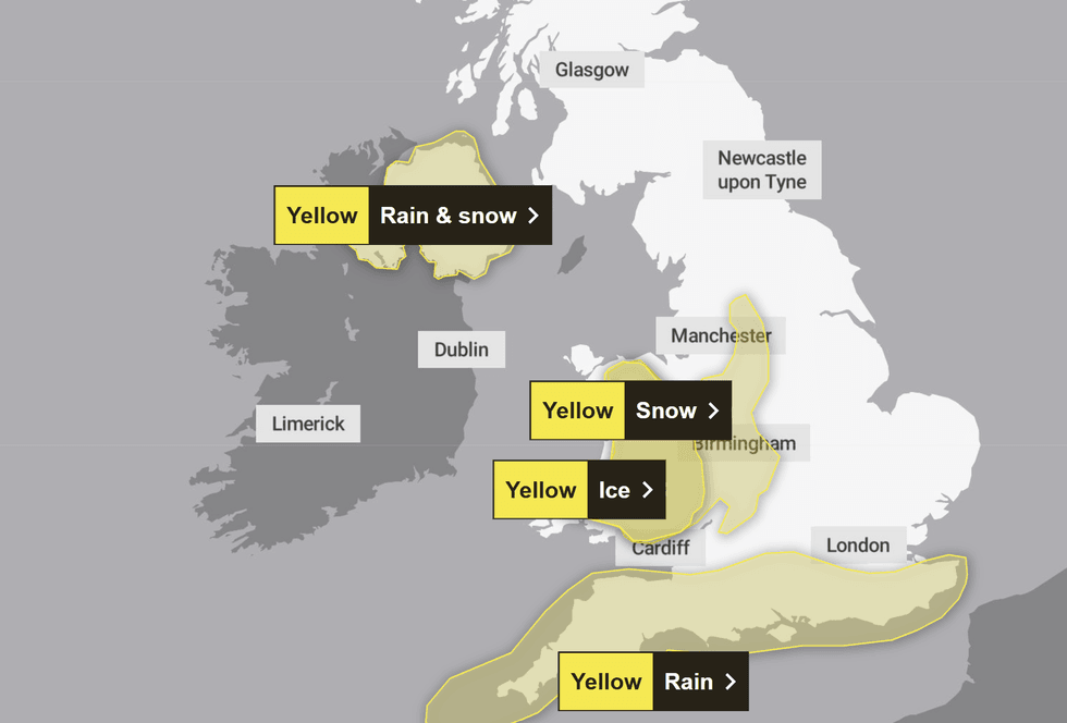
Snow alert has been extended for large parts of Britain
|MET OFFICE
Met Office Deputy Chief Forecaster Steven Keates added: "On Wednesday, weather fronts are expected to move in from the Atlantic into some western, southern and central areas of the UK.
"As they bump into the cold air already in place, we are likely to see some snow developing, although there is still some uncertainty around the details.
"Initially, we may see some snow over the highest parts of southern England, such as Dartmoor, but the main chance of snow will be across higher parts of the Midlands and mid and southeast Wales.
"Above 150 to 200 metres, two to five cm of snow may accumulate, with a few places-most likely above 300 metres-possibly seeing 10cm or more."
LATEST DEVELOPMENTS
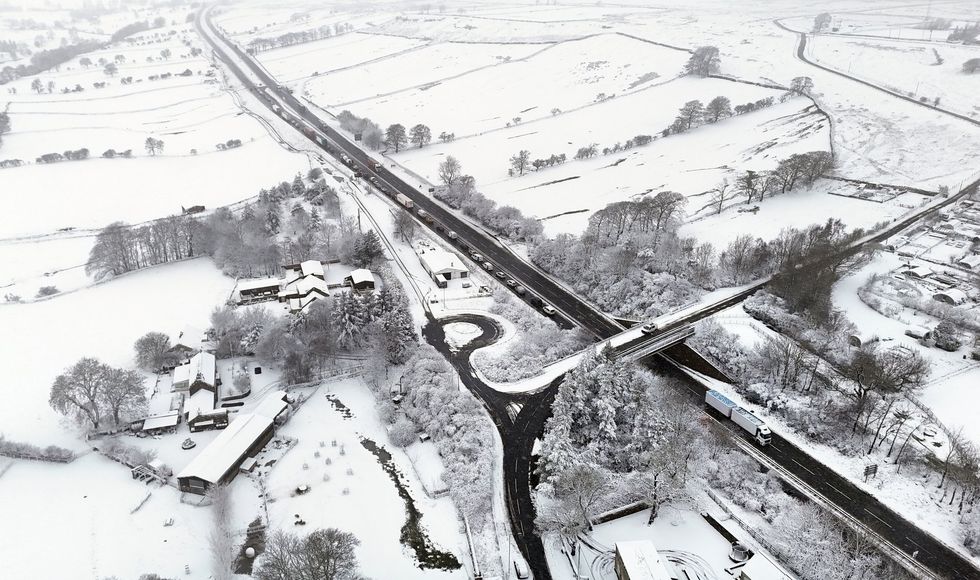
Snow has hit much of the UK
|PA
In addition to the rain, there will be strong winds east to northeasterly winds will accompany the rain and/or snow, which could exacerbate impacts in places.
Large waves could affect some east-facing coasts, especially along the English Channel.