


A 180-flip in Britain’s weather will bring sunshine to the north while southern regions brace for wind, rain and snow.
Scotland and northern England are promised a break from the deluge over the next 48 hours as the rest of the UK grits its teeth for winter’s return.
After a brief respite in the rain, the drenching weather system lurking to the west will make its return mid-week.
A deep storm system hovering close by will collide with cold air over the UK to bring southern counties late-winter snow.
TRENDING
Stories
Videos
Your Say
Met Office meteorologist Aidan McGivern said: “Weather systems are wanting to return from the southwest, and a more active weather front will move in on Wednesday, bringing heavier rain to the south and perhaps causing issues with rain, wind and snow across southern and maybe central parts of the UK.
“We have a north-south gradient with the weather, with a lot of fine weather in the north but thicker cloud and heavier rain in the south and bumping into the cold air could bring some snow over the hills.
“It’s another chilly start on Wednesday morning, and a lot of cloud around, and the best of the sunshine will be in Scotland.”
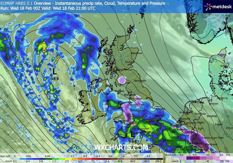
Downpours will hit areas covering millions of Britons across the South of England
|WXCHARTS
The nation’s weather woes will crank up today as a deep storm system in the Atlantic sweeps the southern coast.
Guided by the jet stream and high pressure to the northeast, it will plough bands of rain into freezing air over the country.
Snow is most likely over the high ground of the south, while Scotland and the north will dodge the assault.
LATEST DEVELOPMENTS
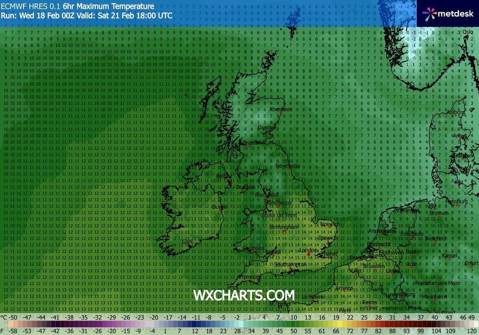
Temperatures could soon tick up above 14C
|WXCHARTS
Met Office meteorologist Annie Shuttleworth said: “Into Wednesday, we see an area of low pressure move in from the Atlantic, and it extends a weather front into southwestern areas.
“Rain will move into the south and west slowly and surely, and there will be a chilly wind, with winds starting to strengthen towards the southwest.
“The development of this area of low pressure will have knock-on effects as to whether we have heavy rain or snowfall across the south of the UK.
“As we get colder air mixing in with this area of low pressure, there is the risk of snow above around 100 metres across southern areas.”
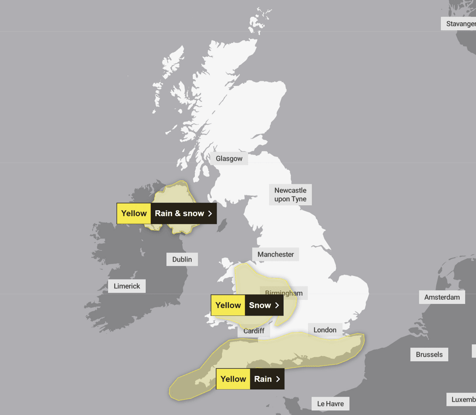
The Met Office has issued three yellow weather warnings for rain, snow and wind today
|MET OFFICE
With the cold will come a risk of ice, frost and freezing fog as temperatures dip to freezing or below.
Under clear skies to the north, lows of minus 10 will drive some of the coldest nights of the year.
Jim Dale, meteorologist for British Weather Services and co-author of ‘Surviving Extreme Weather’, said: “There will be cold winds and across the Highlands and glens we are looking at lows of minus 10C, or possibly lower.
“Widespread inland frosts and the risk of ice may cause some issues through the week, before it turns milder into the weekend.
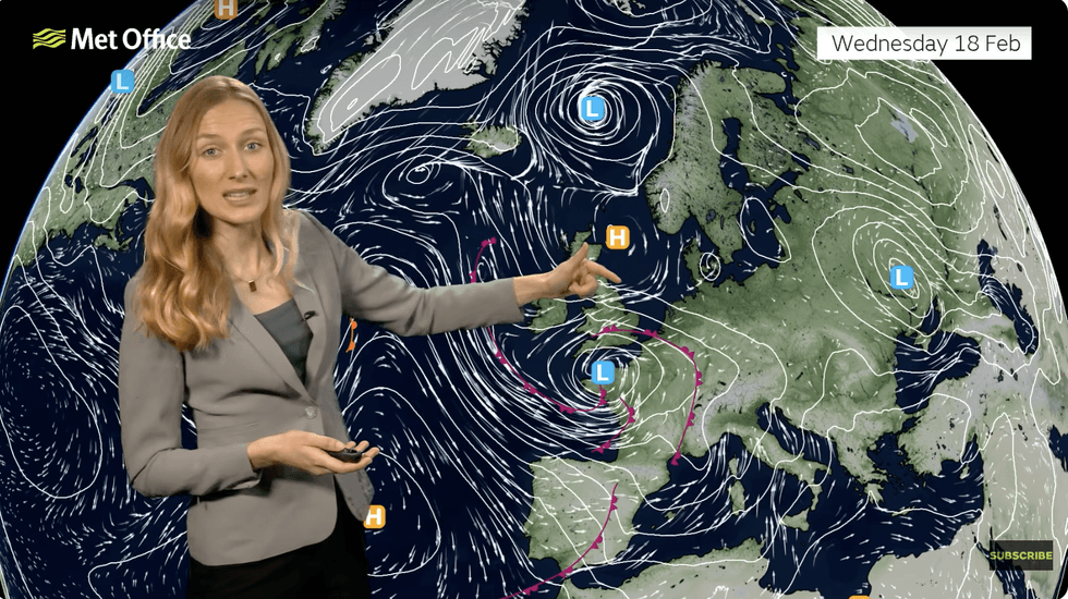
Annie Shuttleworth describes low pressure from the west bringing the risk of snow
|MET OFFICE
“Fog and freezing fog across the south will be an issue first thing, particularly when it comes to visibility on the roads.”
A Met Office spokesman added: “With cold air in position over the UK, further winter hazards are possible on Wednesday.
“Low pressure from the west and southwest brings the possibility of rain, sleet and snow for parts of southern England and Wales.”