


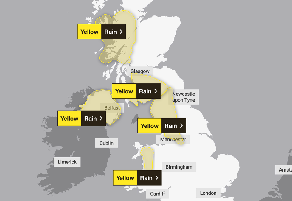
Britons have been warned of flooding and travel disruption ahead of a washout weekend as the Met Office has issued five separate weather warnings for rain.
The forecaster said heavy rain will fall across many parts of the country this weekend.
It has put five separate yellow weather warnings in place, spanning from Scotland to parts of Wales.
Several of the warnings will be in effect for at least 24 hours, including in the East Midlands, North East, North West and Yorkshire & Humberside, where a warning will span for 48 hours.
Five separate weather warnings have been put in place
|MET OFFICE
The Met Office said: "Outbreaks of rain will spread in from the west during Saturday evening, persist through Sunday before eventually clearing away during Monday afternoon and evening.
"The rain will be heavy at times with accumulations of 50-70 mm developing quite widely across the warning area and over 100 mm across high ground.
"Totals will be highest across Cumbria, where over 200 mm could accumulate in places during this 48 hour period. Strong southwesterly winds are also possible at times."
In Scotland, a weather warning is in place for 24 hours from 12pm tomorrow affecting the Highlands & Eilean Siar and Strathclyde.
LATEST WEATHER NEWS
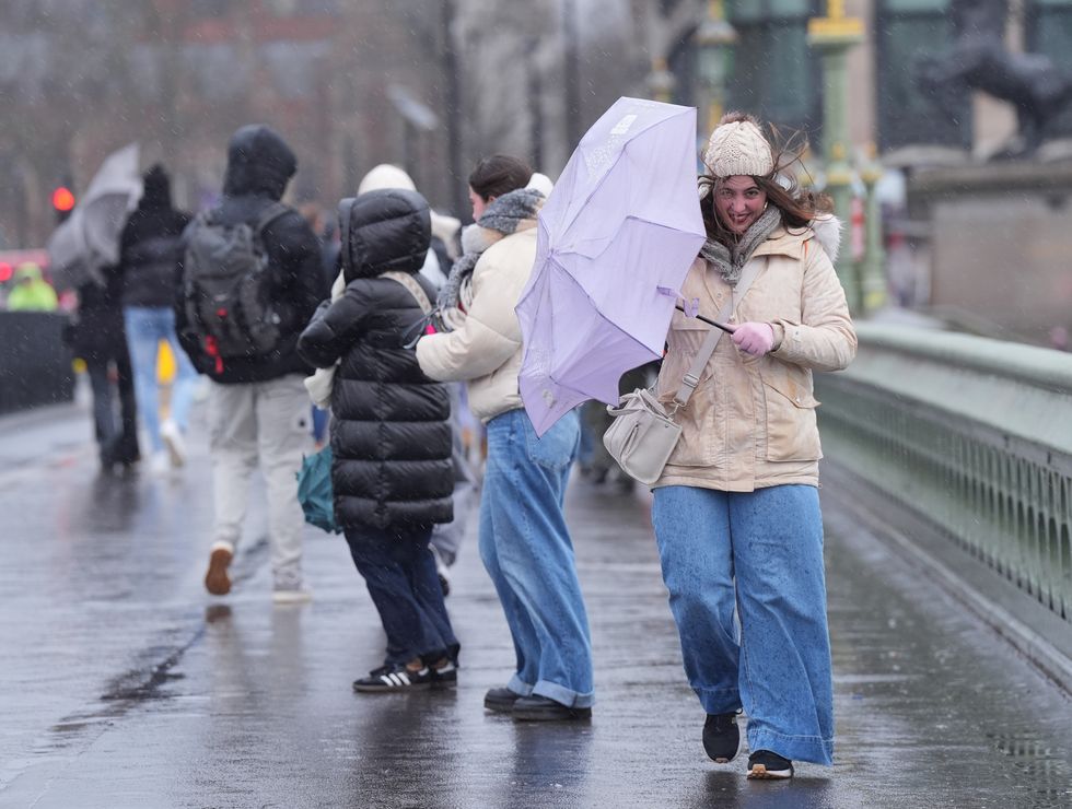
Britons are braced for a weekend washout (file photo)
| PA
Most areas within these regions will see 30-50mm of rain though up to 100 mm could fall, the Met Office said.
A separate yellow warning has been issued for south west Scotland, with strong winds and heavy rain bringing the threat of flooding.
Flooding is also likely in Northern Ireland and Wales, where weather warnings will come into effect from Sunday.
Met Office Chief Meteorologist, Rebekah Hicks, said in a statement yesterday: “While there is still some uncertainty around the timing of individual pulses of heavy rain, the combination of prolonged rainfall and already saturated ground means there is a chance of further disruption to travel and localised flooding.
"We expect further unsettled conditions to continue into next week and are closely monitoring developments."
The forecaster has advised those living in an area covered by a weather warning to prepare for possible power cuts by gathering torches and batteries.
It further says people should assess road conditions before driving, check public transport timetables ahead of travel and stay up-to-date with local weather forecasts.
Wet and windy conditions are set to continue into the start of next week across Scotland and Northern Ireland, though drier and brighter conditions are expected elsewhere.
Looking ahead to the weather from the start of next week to Christmas Day, there is initially expected to be spells of rain as well as strong winds, particularly along coasts and above high ground, though temperatures are likely to be "above normal overall".
The Met Office said: "Later in the period, conditions may start to become a little more settled, with rainfall amounts decreasing and drier weather becoming more prevalent, especially in the south.
"This may mean an increasing amount of overnight fog and frost."