


Britain will glow in the tropical tail of Storm Bram as Christmas snow hopes melt in 10 days of spring-like warmth.
As the worst of the storm passes today, a plume of southerly warmth will push the mercury into double figures.
Southern and southeastern regions may catch a glimpse of sunshine before the next storm steamrolls through.
The monsoon pattern is being driven by a ‘buoyant’ jet stream dragging Britain with a conveyor belt of low-pressure cyclonic weather systems.
TRENDING
Stories
Videos
Your Say
Met Office meteorologist Aidan McGivern said: “We have heavy rain moving through north and northwest parts of Scotland on Wednesday and gale-force winds, but further south there will be brighter skies with plenty of sunshine.
“Temperatures will be above average for the time of year, and then into Thursday another low sweeps in and it is going to take a long time to cross the UK because it is being held up by high pressure to the southeast.
“The winds start to pick up during the day, and it is another relatively mild day, and winds start to pick up in the northwest of Scotland with some showers here.
“Then we have another low pressure moving in for the weekend, with the jet stream in a very buoyant mood, sending low after low on Saturday, Sunday and into the start of next week, with Sunday looking like a very unsettled day.”
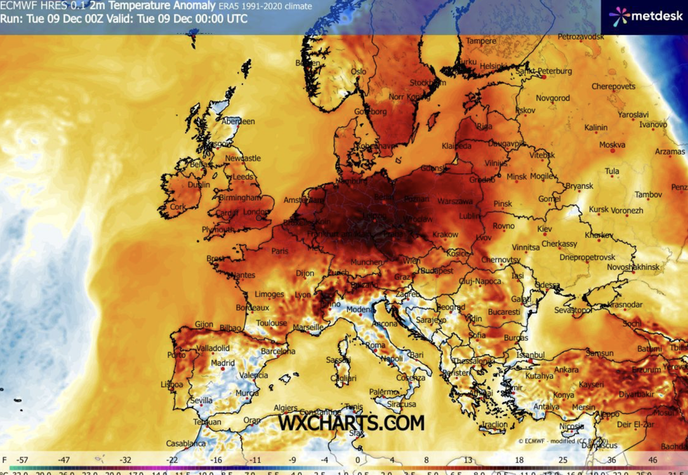
Southern and southeastern regions may catch a glimpse of sunshine with warmer weather than normal
|WX CHARTS
Weather models show temperatures wedged in double figures beyond mid-month with above-average highs into Christmas week.
The mercury hovering several degrees above the December average is thanks to mild gusts from the tropics.
Long-range forecasters predict unusually warm weather will dig in up to the start of Christmas week.
But the jet stream firing nearby will keep the risk of wind, rain and possibly another named storm.
LATEST DEVELOPMENTS:
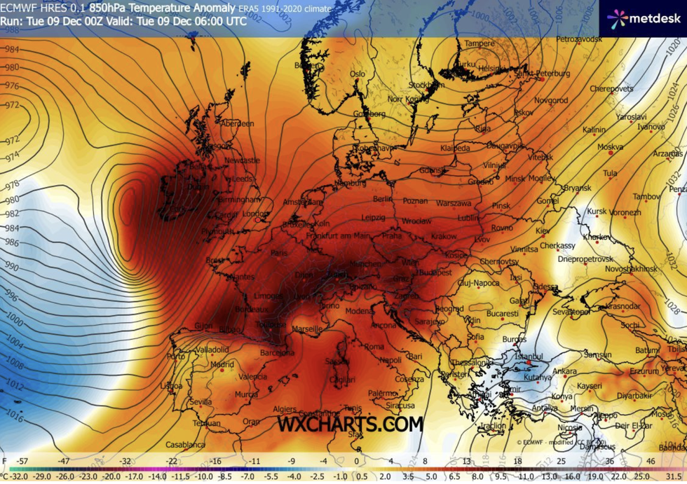
Meteorologist Jim Dale said 'the next 10 days are looking relatively mild'
|WX CHARTS
Jim Dale, meteorologist for British Weather Services and co-author of ‘Surviving Extreme Weather’, said: “The next 10 days are looking relatively mild, and there is little to no sign of anything in the way of snow for most of the country.
“But it is going to be unsettled through this period, with a strong jet stream acting like a conveyor belt for low-pressure systems off the Atlantic.
“There is the chance of seeing another named storm before Christmas week, although how many is difficult to predict.
“We could see another two, or none, it is a case, now of watching our backs as we go through this unsettled period.”
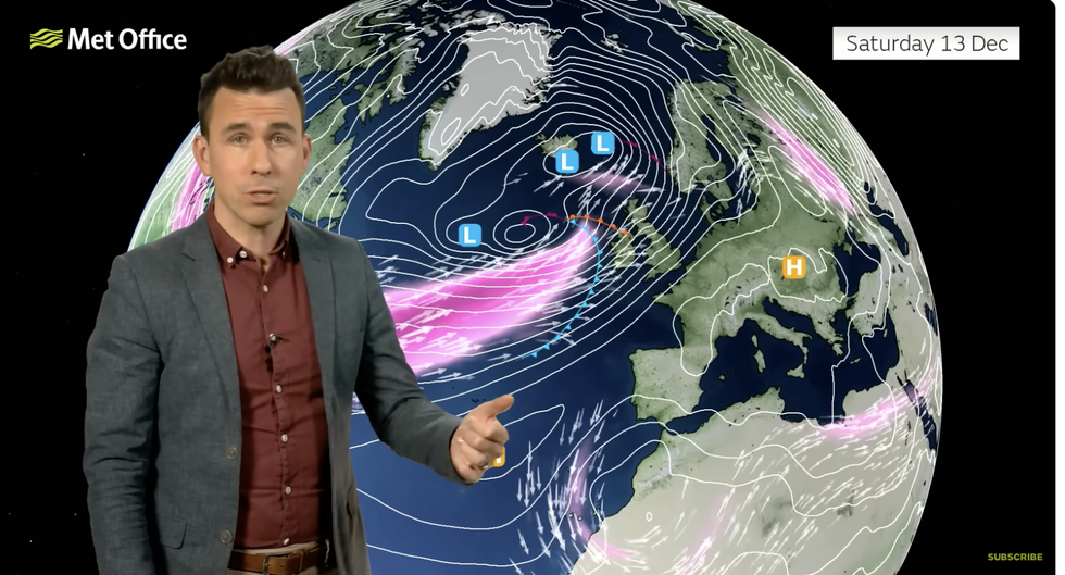
Aidan McGivern describes Britain coming under attack from the jet stream
|MET OFFICE
Swathes of the country are reeling from Storm Bram, which will continue to hit parts of the country through today.
Coastal regions in Scotland and northern England bore the brunt of the winds, while heavy rain threatens ongoing flooding.
Charlotte Morgan, Natural Resources Wales’s Duty tactical manager, said: “With some rivers already swollen and the ground saturated, we expect to see a number of flood alerts and warnings issued. “We’re urging people to be vigilant and to prepare now for potential flooding.
“We also want to remind people to keep away from swollen riverbanks and not to drive or walk through flood waters as you don’t know what lies beneath.”
Our Standards: The GB News Editorial Charter