Heavy snow warning: Britain to be plagued by biggest winter blast in FIVE YEARS as Sudden Stratospheric Warming plunges UK into 'prolonged' cold spell

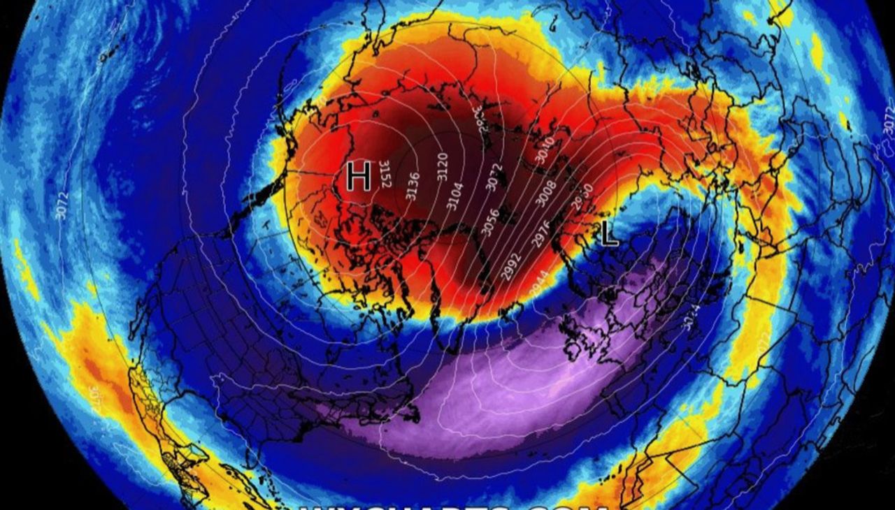
Polar Vortex slips south as warming occurs | WX CHARTS

Meteorologists have confirmed a significant Sudden Stratospheric Warming has set in over the North Pole
Don't Miss
Most Read
Latest
A ‘major U-turn’ in weather patterns over the Arctic stratosphere could be about to plunge Britain into the most savage late winter snow blast for five years.
In the past 24 hours, meteorologists have confirmed a significant Sudden Stratospheric Warming (SSW) has set in over the North Pole.
An SSW event drove the 2018 Beast from the East big freeze which roared in during the final weeks of winter grinding the nation to a standstill.
Weather experts are now playing a ‘waiting game’ with impacts from the warming possibly affecting the UK later next week and into the start of March.
While meteorologists are not promising wall-to-wall snow, some experts say this is a mounting threat.
James Madden, forecaster for Exacta Weather, said: “There has been a major U-turn, and we now see a significant wintry blast hitting the UK around the middle of next week.
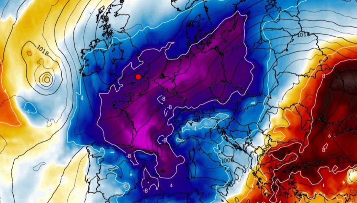
Cold air swamps Britain towards the end of the month.
WX CHARTS
“This will bring the risk of bitter northerly winds and the possibility of heavy snow, which could be widespread.
“Initially, these will hit the north, but could reach southern England, and we expect this to happen from the middle to latter part of next week.
“Weather models are starting to suggest this outcome, and although they are still to confirm any effect on the UK weather, the overall set up suggests the development of a prolonged cold period with the risk of significant snowfall.”
After weeks of speculation over whether an SSW event was imminent, meteorologists have confirmed the tell-tale slowing of winds high above the North Pole in the stratosphere, around six miles above sea level.
Atmospheric scientist Dr Simon Lee, co-editor in chief of the Royal Meteorological Society journal ‘Weather’, tweeted that a ‘major sudden stratospheric warming (SSW)’ occurred on Tuesday.
SSW events cause air in the stratosphere to fall and warm, forcing the Polar Vortex in the troposphere–the layer of the atmosphere below the stratosphere–to spill out of the Arctic into lower temperate regions.
The change in Polar weather patterns can also buckle the jet stream, building high pressure which drives easterly winds into Britain.
This is what happened in 2018, although meteorologists say the consequences this time round could range from a deep freeze to storms, to nothing at all.
Jim Dale, meteorologist for British Weather Services, and author of ‘Weather Or Not?’, said: “We are now playing a waiting game to see what happens as a result of this warming event which has now been confirmed.
“We expect the Polar Vortex to dislocate, it just depends on where it ends up, and this could be over the United States or over Asia.
“It is too early to say whether it will come over the UK, it could be that we are waiting for something similar to 2018, with something coming in from the east and lasting for a couple of weeks.
“But at the moment, that is not showing up on the weather models.”
Another possibility is that cold air will sweep over the Atlantic, bumping into milder air and triggering a barrage of storms.
This would fire up the jet stream spawning vicious low-pressure systems bringing a turbulent start to spring.
Dale said: “This is more of an unusual outcome, but if the cold air ended up coming down over the Atlantic, then it would bump up against milder air and this would fire up the jet stream.
“We could then be in a position where low pressure cyclonic storm systems would be pulled towards the UK, and we would see a more volatile weather period.
“We have also got more heat coming off the sun, so this would help to drive storms if this did happen.”
Weather impacts from SSWs affect the northern hemisphere around 10 days to a fortnight after the event.
Whether Britain will be shivering in a late winter blast or battling storms will become clearer by the middle of next week, experts say.
Warming of the Polar stratosphere.
WXCHARTS
Dr Todd Crawford, meteorologist for The Weather Company, said: “The potential SSW may delay the onset of spring, but climate models are generally cooler/wetter than they have been in recent years, which would be a welcome outcome after the very dry and warm year last year.”
In the meantime, the Met Office has issued severe weather warnings for wind snow and ice this weekend across Scotland and parts of northeast England.
Milder breezes across southern Britain, however, will push temperatures into double figures.
Met Office meteorologist Alex Deakin said: “Above three or four hundred metres we could see three or four centimetres of snow.
“Rain will pep up a little bit late in the day bringing a bit more snow in parts of Scotland during Saturday night.
“There will be further wet and windy weather in the northwest on Sunday.
“There are signs of things turning a little bit colder into next week.”


