


Volatile atmospheric conditions will form a “dynamic interaction” with a tropical plume to drive 135-mph tornadoes and hail “bigger than golf balls”.
A massive storm brewing over the United States has prompted meteorologists to sound alarm bells for damaging winds and flooding.
Due on Wednesday, the storm threatens “multiple” violent thunderstorms and tornadoes of level EF2 (111 to 113mph) on the Enhanced Fujita Scale.
Extreme weather will be driven by cold air sweeping around low pressure clashing with a warm, moist surge from the Gulf of Mexico.
Major storm threatens 135mph tornadoes and ‘golf-ball’ hailstones
|The Weather Channel
Weather Channel meteorologist Chris Dolce said: “We are expecting multiple rounds of severe thunderstorms through Thursday, and with these, there will be a threat of tornadoes, destructive winds and large hail.
“Some tornadoes could be strong, hitting EF2 or greater, and over golf-ball size.
“Damaging thunderstorm winds are also possible, while a round of heavy rainfall will raise the risk of flooding.”
It follows a pattern of unsettled weather across America which has been largely driven by the jet stream acting as a storm conveyor belt.
WEATHER LATEST: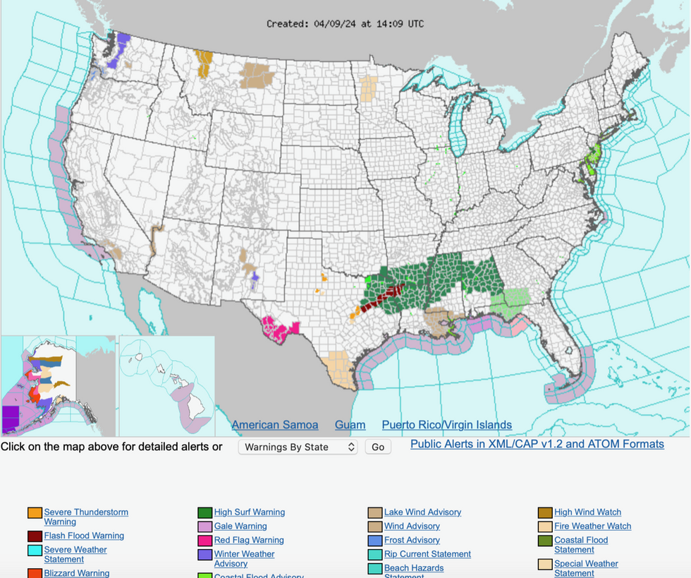
NOAA issues storm warnings for southeast US
|NOAA
The jet stream, strengthened by straddling regions of warm and cold air, has swept over the US to bring bouts of unsettled weather since the start of the month.
Strong and potentially damaging winds are forecast to whip up across the lower Mississippi Valley and Gulf Coast states on Wednesday night.
Then a more “severe threat” of stronger storms will arrive to the east, hitting Ohio, Kentucky, the Carolinas, Georgia and northern Florida.
Dolce said: “Damaging thunderstorm wind gusts and perhaps a few tornadoes are the main concerns.
“An increasing threat in the south will be flash flooding, and this is due to multiple days of heavy rain and thunderstorms.
“The National Weather Service (NOAA) has issued flood watches from northeast Texas into the lower Mississippi Valley and central Alabama.”
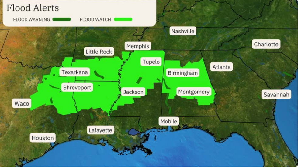
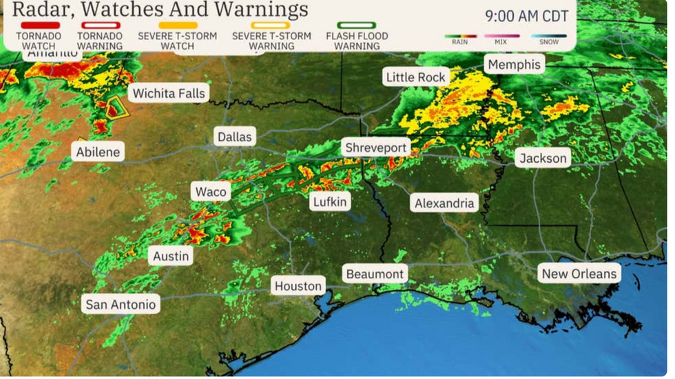
Flood alerts issued as storms to hit US
|The Weather Channel
The NOAA has warnings in force for flash flooding, and high surf across south-eastern states, with a separate alert for coastal floods across New Jersey, Delaware, south-eastern Pennsylvania and eastern Maryland.
A spokesman said: “A dynamic interaction [between an upper-level trough system and moisture from the Gulf of Mexico] will intensify a low-pressure system over eastern Texas.
“A potent cold front trailing south from the low centre will be the focus for strong to severe thunderstorms across eastern Texas Wednesday morning, through the lower Mississippi Valley on Wednesday, before reaching into the eastern Gulf states and the Florida Panhandle by early on Thursday.”
Outside the storm zone, a slightly less disruptive spell is predicted over the next 24 hours, the NOAA said.
With strong winds and heavy rain, southern states will feel cooler compared to late, it added.
Thunderstorms will act as hail-storm factories, churning out rocks of ice built by strong winds circulation in towering clouds.
Jim Dale, US weather correspondent and meteorologist for British Weather Services, said: “These hailstones are kept circulating in giant cumulonimbus clouds, building layer upon layer of ice until they eventually fall.
“This is the risk we are expecting to see this week, and there could be very large hailstones being produced in these clouds.”