


An atmospheric pressure overhaul will finally call time on the spring deluge, opening the doors to sunshine and rising temperatures.
Weeks of wind and rain which yesterday culminated in another named storm Pierrick–has resulted from low pressure ploughing in from the Atlantic.
This dominant theme is about be squeezed out by high pressure in from the south, allowing wind and rain to give way to clear skies and warm sunshine.
It will spell the end to months of persistent rainfall which has left water tables at capacity and swathes of the country at risk of floods.
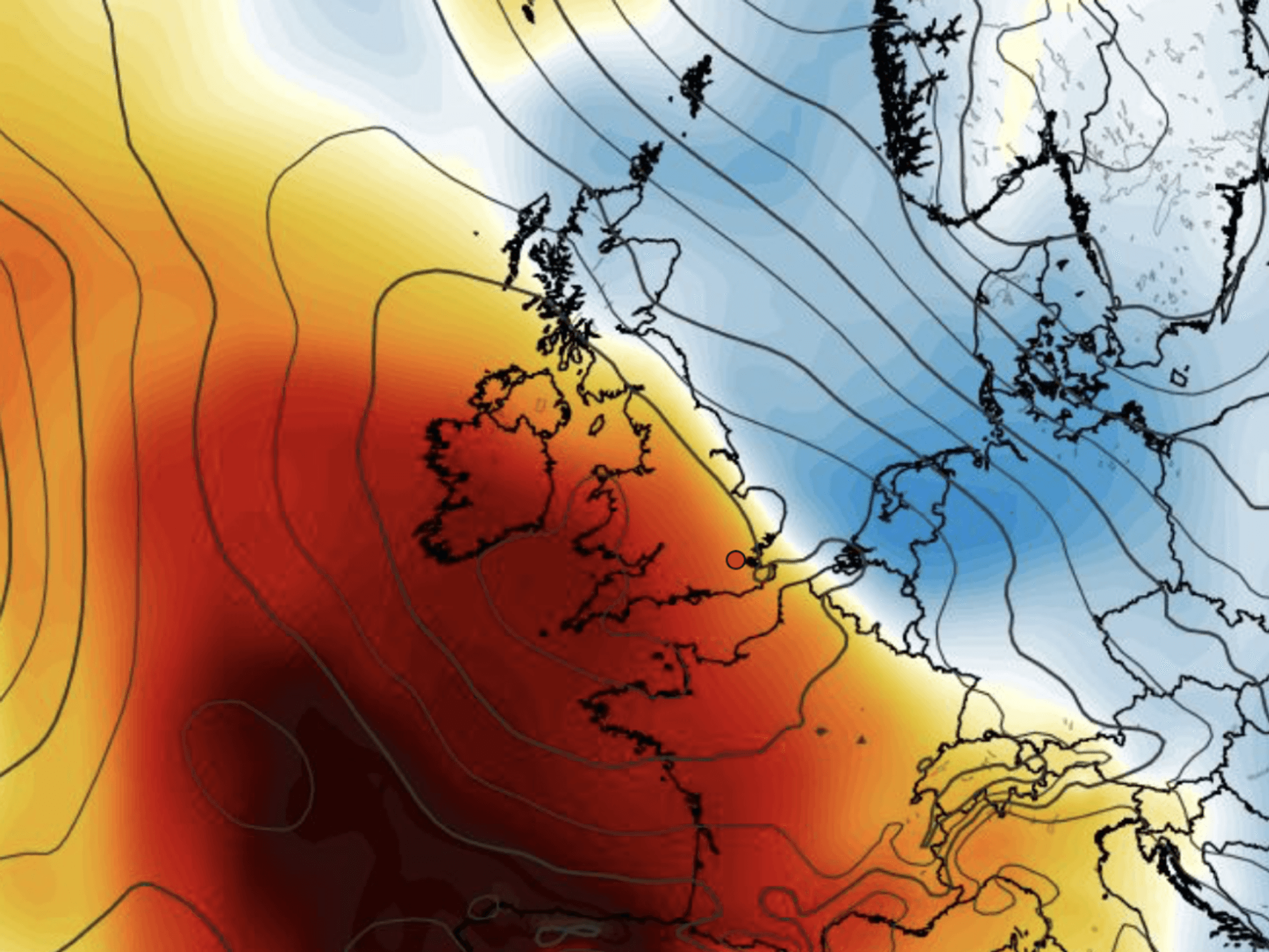
Higher pressure builds to bring in warmer weather
|Netweather
Jim Dale, meteorologist for British Weather Services and social commentator, said: “We are going in the right direction, although the weather is going to be a bit up and down through the coming days.
“It is not going to be great over the next 48 hours, but then we start to see high pressure building from the south.
“The weekend is starting to look reasonable, and again, this is the result of the pattern of change from low pressure to high pressure.
“From mid-month, we expect the high to build, and we could see an influence from the Azores High, and this will bring the potential for hot weather.”
But sun-starved Britons will have to wait a bit longer with more wet and windy weather on the way through the start of this week.
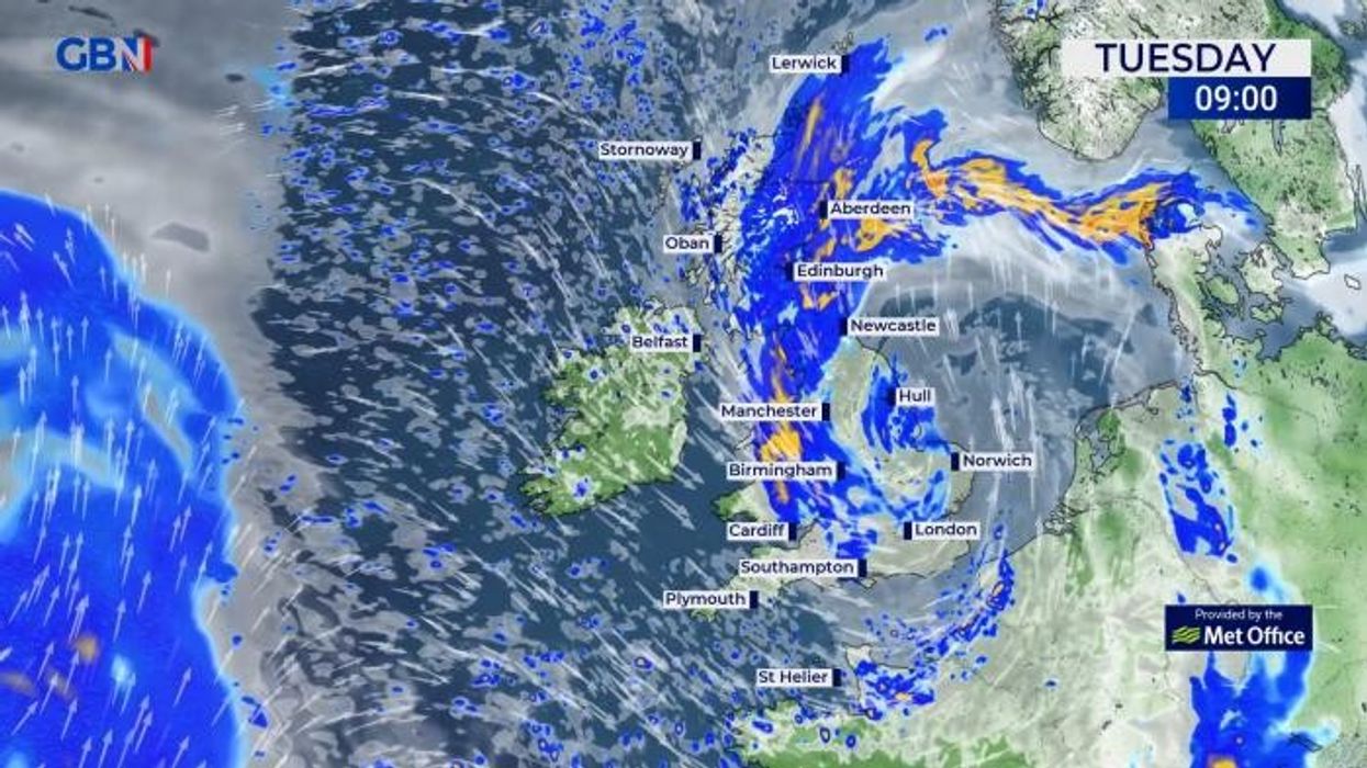
Met Office warnings are in force for wind and rain across parts of the UK today in the wake of Storm Pierrick which crept in on the heels of Kathleen at the weekend.
An alert for more than two inches of rain covers southern Scotland while western and southern coasts brace for 65mph gusts.
Coastal regions are warned high waves could overtop sea defences, with unsettled weather threatening disruption to travel and loss of power.
LATEST DEVELOPMENTS:
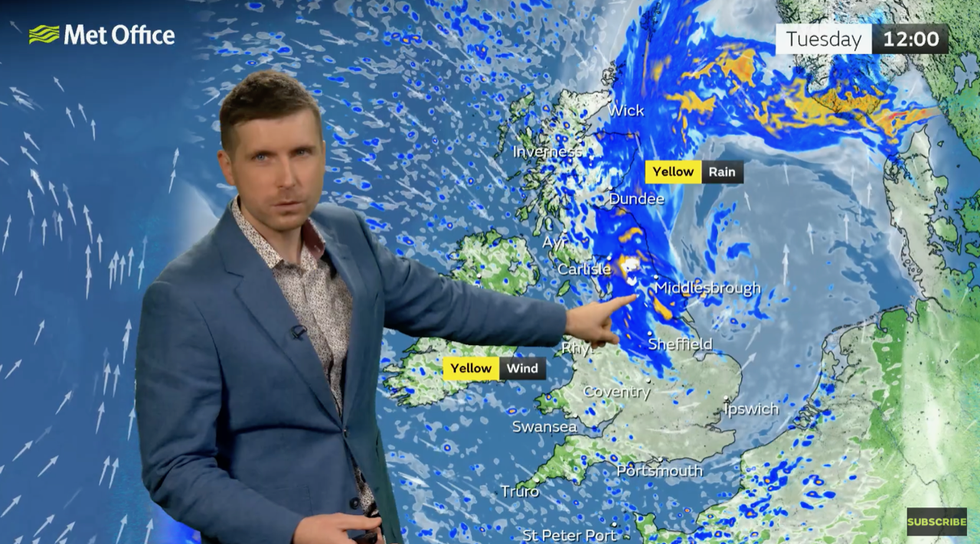
Met Office’s Alex Burkill describes unsettled start to the week
|Met Office
A Met Office spokesperson said: “A spell of strong winds blowing from the northwest will affect this region on Tuesday.
“Initially arriving across Southwest Wales, in the early hours of Tuesday, and reaching North Wales and Northwest England during Tuesday morning.
“Gusts will reach 40-50 mph widely, with 60 or 65 mph gusts expected for exposed coasts of Southwest and West Wales overnight.”
Met Office meteorologist Alex Burkill added: “There is something a bit drier developing as we go through Tuesday night into Wednesday, and we could get off to a bit of a chilly start.
“But a dry and chilly theme doesn’t last very long before wet and windy weather arrives as we go through the day.
“Later on in the week, there is something of a drying trend across southern parts, but further north is likely to see wet weather at times and even further south it will not be completely dry.”
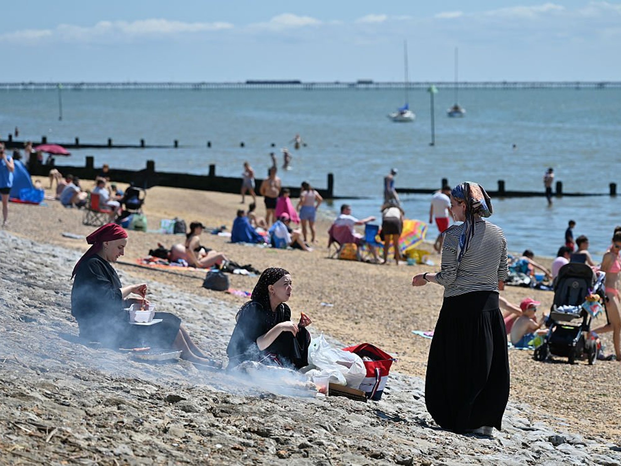
Temperatures will rise during the week, with highs of 20C forecast in parts of the south and the east.
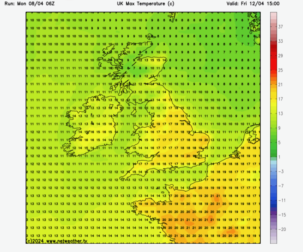
Temperatures rise by the end of the week
|Netweather
However, thermometers will drop towards the end of the week with a chilly weekend on the cards for some.
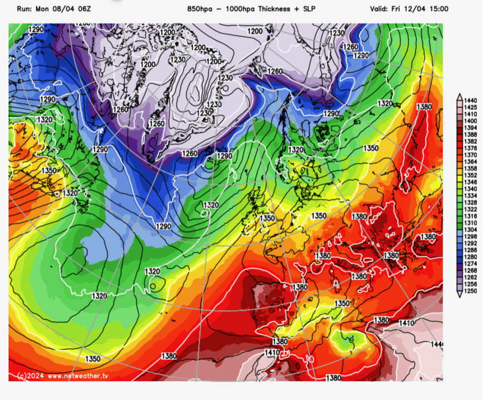
Long-range forecasters, however, say higher pressure will dominate during the run up to mid-month, meaning more frequent dry and sunny spells.
The change in atmospheric patterns could even be stocking up a late-April heatwave, according to some experts.
Exacta Weather’s James Madden said: “A pattern change is in the offing to something much more settled and warmer to even hot conditions during the second half of April.”
Over the past months, the position of the jet stream has steered a barrage of lows into the UK, leading to frequent bouts of heavy rain and strong winds.
Water tables are reaching capacity with further rain threatening floods in the worst-hit regions.
A switch to drier weather will come as a relief across southern regions where the Environment Agency still has a raft of alerts and warnings in place.