
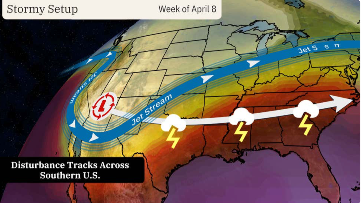


A ‘plunging jet stream’ will power a 1,500-mile conveyor belt of storms charging across the US laden with torrential rain, thunder and hail.
‘Damaging’ winds and tornadoes and towering clouds loaded with rocks of ice threaten a week-long assault, experts warn.
A loop of the jet stream swooping over western America will light the touch paper on Monday as millions of stargazers head out for the rare solar eclipse.
As a winter snowstorm finishes blitzing the northeast, a volatile weather system will begin its separate journey from the west.
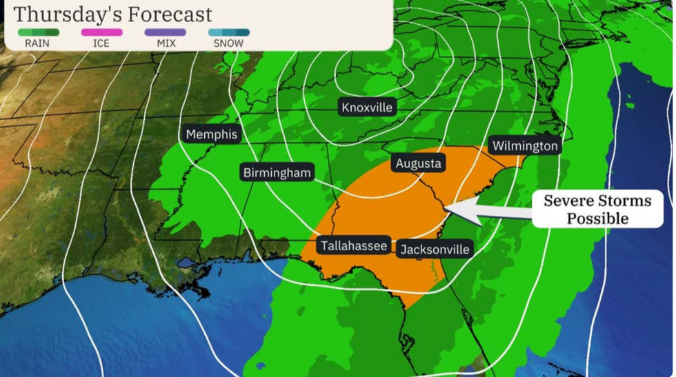
The southeast will be particularly hard hit
|The Weather Channel
In the firing line at the start of the week will be the Southern Plains and the southeast, Ohio, Texas, Arkansas and Louisiana.
Weather Channel senior meteorologist Chris Dolce said: “April's reputation for stormy weather in the Plains and South is returning and will last into late week, including severe thunderstorms and flooding rainfall.
“Through the week, hail, damaging winds and a few tornadoes will all be threats, while rounds of heavy rainfall will raise the risk of flooding through Thursday.
Foul weather is being driven by the jet stream swerving over southwestern states pushing a series of ‘disturbances’ towards central and southern America.
The first hit at the weekend with a second to fire into action on Monday triggering a week of storms as it scours the width of the US.
Texas and Oklahoma are in the firing line at the start of the week, with huge thunderclouds threatening large hail showers.
Mr Chris Dolce said: “Two disturbances will be kicked towards the central and southern US by a southward plunge in the jet stream.
“It is the second of these that will trigger storms through the week from Monday to Thursday in the south.
LATEST DEVELOPMENTS:
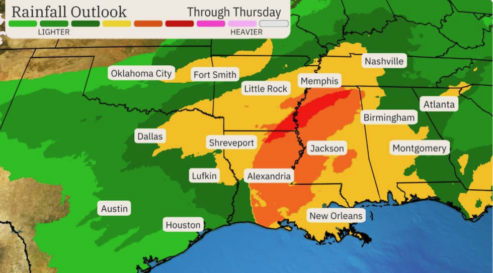
Around seven inches are likely to drench northern Louisiana, southern Arkansas and central to northern Mississippi
|The Weather Channel
“In the south, flash flooding will be a growing threat given the multiple days of heavy rain and thunderstorms.”
Up to three inches could fall in the Lower Mississippi Valley through the coming days, he warned.
Around seven inches are likely to drench northern Louisiana, southern Arkansas and central to northern Mississippi, he added.
Weather warnings come as astronomy lovers gear up to catch a rare solar eclipse on Monday.
The phenomenon will be visible along the path of totality which stretches from Texas to Maine.
Where the weather holds up, the view could be hampered by clouds, again whipped up by the unstable atmospheric conditions.
AccuWeather lead long-range forecaster Paul Pastelok said: “Most places in the vicinity of the path of totality will have to deal with some level of clouds, whether high or low clouds.
“Clouds can break for some sunshine, just in time for the afternoon viewing from Chicago to Cleveland.
“A narrow region of good viewing is expected to open up for cities like Kansas City, Indianapolis, and St. Louis.”
Strong winds and stormy conditions threaten dangerous travel conditions before and after the event.
Mr Pastelok said: “Travel could be impacted due to visibility and strong cross winds, especially along the major west-to-east highways.
“Make sure any loose material, including tents and items on top of cars and campers are securely fastened.”
A spokesman for The Weather Channel added: “Monday evening and into Tuesday there is the chance of severe storms across much of the region, and you may have a lot of people travelling in areas that they may not be all too familiar with the landscape or even the weather.”
The National Weather Service (NOAA) has flood warnings in place in Texas, and separate alerts in force across central regions.
A spokesman said: “Beginning late on Monday into Tuesday, a threat of heavy rain will quickly emerge across the western Gulf states and then expands further into the Mid-South in response to a return of Gulf moisture which will then interact with an upper trough arriving from the southern Rockies.”