


Winter is about to take a parting shot, sending a Polar air mass across the United States to dump inches of ‘lake-effect’ snow.
Eastern regions are under several severe-weather warnings this week as a low-pressure cold front ploughs in from Canada.
Freezing air will waft over the Great Lakes triggering a ‘lake-effect’ wintry deluge, according to national weather forecasters.
The phenomenon, which can bring unseasonably heavy snowfall, is triggered by moisture-laden air from the Lakes rising into cold air.
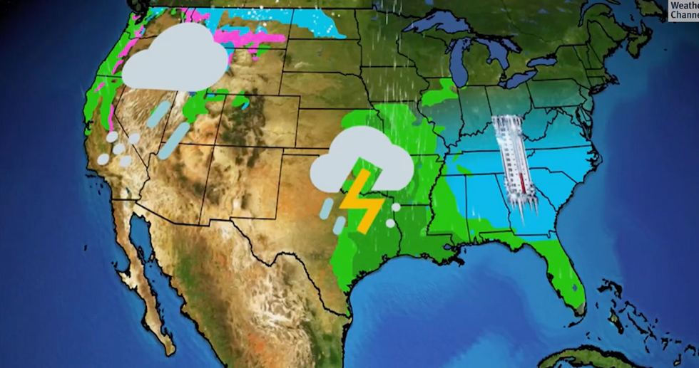
The west will see rain, the south storms, while the east plunging temperatures
|The Weather Channel
This creates a snow factory which then drifts into surrounding regions where it offloads its deluge.
The National Weather Service (NOAA) has issued an ‘urgent freeze watch’ across Michigan, New York and the Appalachians as they brace for winter to bite.
A spokesperson said: “A potent low-pressure system crossing from southern Ontario to southern Quebec, Canada will aid in lake-effect snow downwind of the Great Lakes early this week.
“The cold airmass moving from the northwest across the relatively warm lakes will allow for numerous snow showers and localised areas of moderate to heavy snow.”
Cold air sweeping eastwards from the Arctic region threatens also to plummet temperatures further south.
A NOAA ‘freeze watch’ will remain in force in Georgia, Alabama, Mississippi, and the Carolinas through the start of the week when temperatures will nosedive below freezing.
People are warned rapidly falling temperatures and hard frosts could kill crops and damage plumbing.
LATEST DEVELOPMENT:

Snow is also expected
|The Weather Channel
The warnings come after cold conditions set in at the weekend, driven by the jet stream swerving southwards pulling cold, Polar air across the eastern half of the country.
To the west, a plume of warmer air wrapped around a high-pressure system brought warmer conditions to Florida and surrounding states.
Those hit by the cold further south are in the firing line for ice and frost damage, while to the north and northeast, snow will be the focus.
Jim Dale, US weather correspondent and meteorologist for British Weather Services, said: “Northern and eastern states will turn cool, or in parts, cold this week as a cold front moves across, eastwards from the west.
“Around the Great Lakes, there is going to be snowfall, and this will affect regions including Buffalo, New York state, and Chicago.
“To the southeast, temperatures are also going to fall as this cold air moves across the region.”
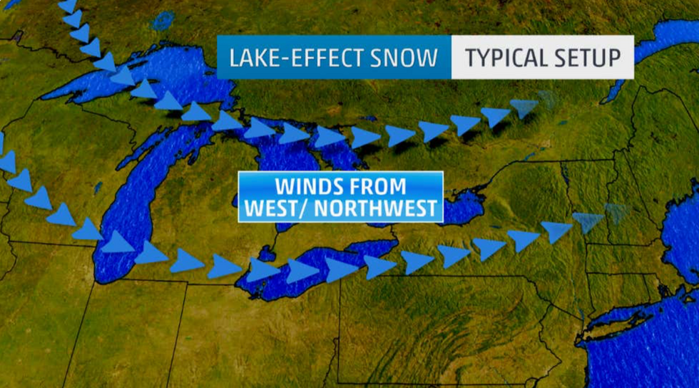
Winds are expected to come in from the west
|The Weather Channel
Accuweather senior meteorologist Alex Sosnowsk warned ‘waves of colder air’ will bring the risk of ‘snow squalls’ to the Midwest.
The cold front is forecast to move further east and clear the country by the end of the week, allowing temperatures to recover.
However, a clash of warm and cold air masses in the meantime will trigger further unsettled weather, experts warn.
Mr Dale said: “Whenever you get cold and warm air masses mixing, you see unstable and volatile conditions.
“Warm air coming up from the Gulf of Mexico will meet with the colder air from the north, and this is going to bring the added risk of stormy conditions through the rest of the week.
“It will keep the risk going of thunderstorms and tornadoes, as we have seen already this week.”