


Polar winds from the worst snowstorm in three years will battle southerly heat to spark a weekend tornado threat.
Volatile atmospheric conditions whipped up by competing air masses could drive a spate of twisters out of their usual ‘tornado alley’ target zone.
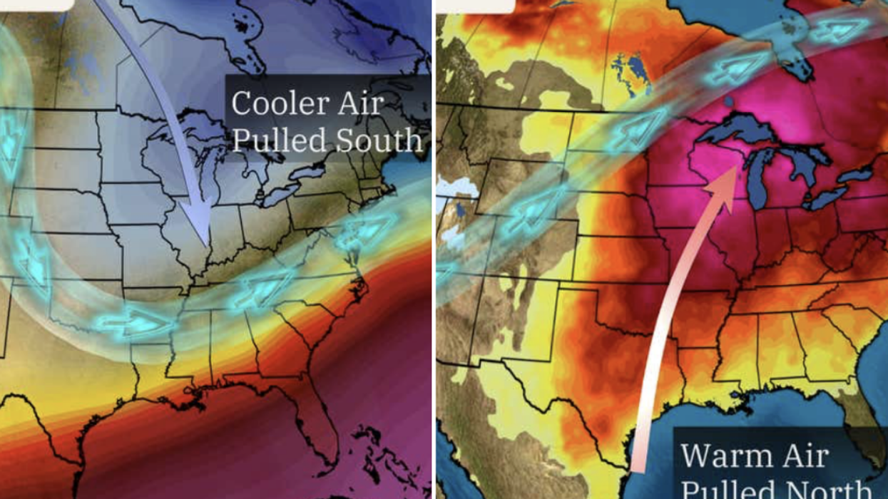
Hot air will sweep up from the Gulf of Mexico ahead of the weekend, crashing into cold air driving a major snowstorm over Colorado.
The two masses will be steered by a meandering jet stream crossing the United States to provide the ‘perfect ingredients’ for powerful storms to rage into the weekend.
Cooler air is being pulled south
|The Weather Channel
Jim Dale, US weather correspondent and meteorologist for British Weather Services, said: “This battle between air masses is really going to be a blue versus red situation, as the contrast is significant either side of the jet stream, and where they meet will be the perfect ingredients for storms.
“Some of these could be powerful ahead of the weekend, and the threat of tornadoes could push further north than we usually expect, which is Kansas, Arkansas, Alabama, and Tennessee.
“There is a huge variance in airstreams, and this brings the potential for huge storms and tornadoes in the area.”
The warning comes as Colorado and surrounding states are hit by Winter Storm Qadir – feared to be the worst winter storm for three years.
Feet of snow are forecast over the hills and mountains prompting emergency services to warn to avoid all but essential travel.
LATEST DEVELOPMENTS:
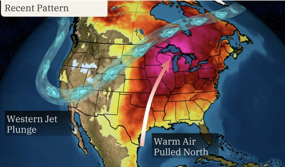
Warm air is being pulled north
|The Weather Channel
The stark contrast in weather is being driven by a change in shape of the jet stream which is about to make a 180-degree ‘flip’.
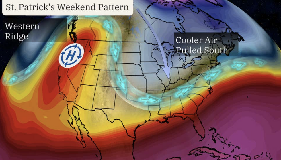
It also means a chilly weekend for St Patrick’s Day revellers while south-westerly states get an early taste of summer.
Weather Channel meteorologist Jonathan Erdman said: “A change in the weather pattern is being forecast by St. Patrick's Day weekend.
“Computer forecast models suggest the configuration of the jet stream will flip by this weekend.
“It's expected to take a sharp southward plunge over the eastern half of the country, while being diverted north into western Canada.”
The change in weather will bring warmer and drier conditions to western states this weekend.
Colder weather is likely to hold out into the final third of March, experts say, as the jet stream makes a wild U-turn.
Mr Erdman said: “The jet stream arrangement since late February couldn't have been more different than the upcoming change.
“We expect much of the West to trend drier under the influence of a sinking bubble of high pressure aloft in this pattern.
“The exception may be the parts of the southern Rockies and Southwest, where upper-level low pressure may be trapped for a few days, wringing out some rain and mountain snow.”