US weather: 'Hyperactive hurricane season' to bash America with unusually high number of storms

Thunderstorms persist
|The Weather Channel

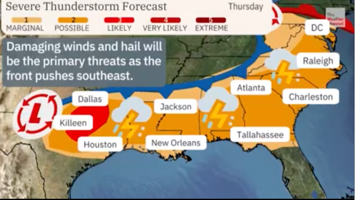
Tropical heat surging from Mexico into polar air over northern states is currently blamed for whipping up a barrage of thunderstorms and deadly twisters
Don't Miss
Most Read
America is facing months of dangerous weather with battling air masses and yo-yoing sea temperatures threatening a ‘hyperactive hurricane season’.
Tropical heat surging from Mexico into polar air over northern states is currently blamed for whipping up a barrage of thunderstorms and deadly twisters.
Swathes of the US face further extreme weather through the week, sparking a raft of flood, wind and rain warnings.
And it could be a sign of things ahead with an unusually high number of storms predicted from next month when the hurricane season kicks.

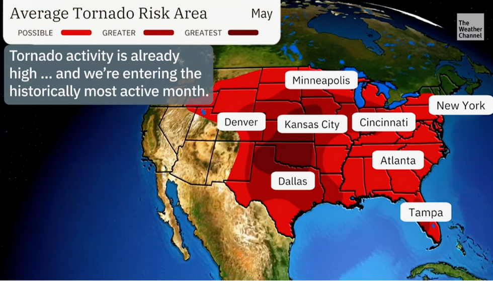
Tornado risk grows
|The Weather Channel
Violent weather will be powered by a switch from El Nino to La Nina, a rapid cooling of South American ocean waters after a lengthy warming since last summer.
Jim Dale, meteorologist for British Weather Services and US weather correspondent, said: “There is a good chance that we are going to swap the tornado season for a very active hurricane season, which will be under the influence of the transition from El Nino to La Nina.
“This is the harbinger of hurricanes, and with the heat that is expected as the summer gets going, and the generally high temperatures of the sea around parts of the country, we could be looking at an unusually high number of hurricanes through the season.
“This is also a symptom of the overall change in the climate that we are seeing not only in the United States, but around the world.”
The US hurricane season starts in June when storm activity in the Atlantic builds powered by rising sea temperatures.
The season ends in December, before which churning storms sweep from the west coast of Africa to the US.
Many fizzle out in cooler sea waters, but some make it onto land where they cause major damage across eastern states.
LATEST DEVELOPMENTS:

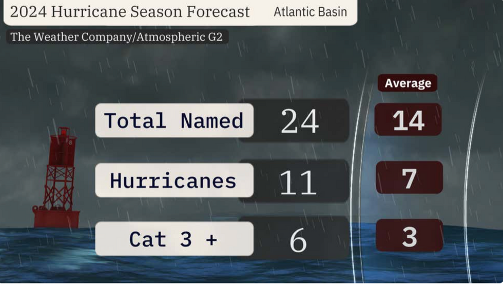
There have been a total of 24 storms named so far this year
|The Weather Company
A recent report issued by meteorologists at Atmospheric G2 warns ‘dynamical and statistical models are in agreement in suggesting a “hyperactive” North Atlantic hurricane season’.
Weather Channel meteorologist Jonathan Belles, in recent report, said: “The outlook calls for 24 named storms, 11 of which will become hurricanes and six of which will reach Category 3 status or stronger.
“That is well above the 30-year average tally for both hurricanes and storms, and also markedly above the tally of 20 storms, seven hurricanes and three Category 3-plus hurricanes in 2023.”
Higher pressure stretching from the tropical Azores Islands could steer more hurricanes towards the US, he warned.
The flip from El Nino, which set in last summer when water temperatures rose around the coast of Peru, to La Nina will drive the assault, he added.
He said: “In general, La Nina Atlantic hurricane seasons have less wind shear that can otherwise rip storms apart, and rising, unstable air that is more conducive for thunderstorms, the building blocks of tropical storms and hurricanes.
“So, this means instead of El Nino acting as a gentle brake on hurricane season, La Nina could instead step on the gas pedal.”
Meanwhile, a deadly storm mauling America will continue on its path of destruction into the weekend.
In Portland, Michigan, more than 20,000 homes were left without power as powerful winds and rain swept the region.
The Midwest and southern states including Indianapolis, Memphis, Nashville, St. Louis and Cincinnati are next in the firing line, according to The Weather Channel.
A spokesman said: “For a third day, a severe weather outbreak will continue to hammer parts of the Midwest and the south.
“This will bring tornadoes, some of which could be strong, hail the size of golf balls and rain, which could produce flash flooding.”


