


Relentless spring storms hammering the United States threaten further heavy snow and tornadoes ‘spinning in the wrong direction’.
Powerful Pacific pressure systems have unleashed a near-two-week assault of destructive gales and torrential downpours.
Fresh warnings for snow have in the past 24 hours been issued for north-western parts of the country.
In Oklahoma, violent winds spiralling into thundering storm clouds triggered an ultra-rare clockwise-churning, or ‘anticyclonic’, tornado.
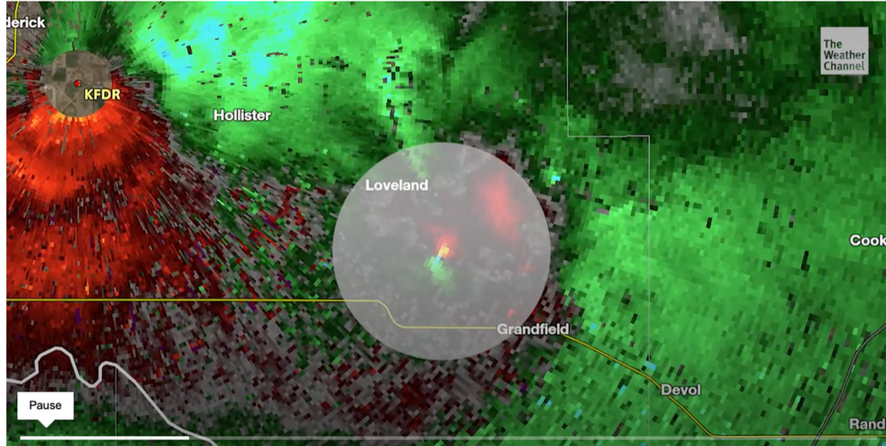
Location of freak tornado in Oklahoma
|The Weather channel
A spokesman for The Weather Channel said: “A tornado in Oklahoma on Tuesday evening did not spin in the normal direction, being one of one per cent of tornados that spin in the opposite direction.”
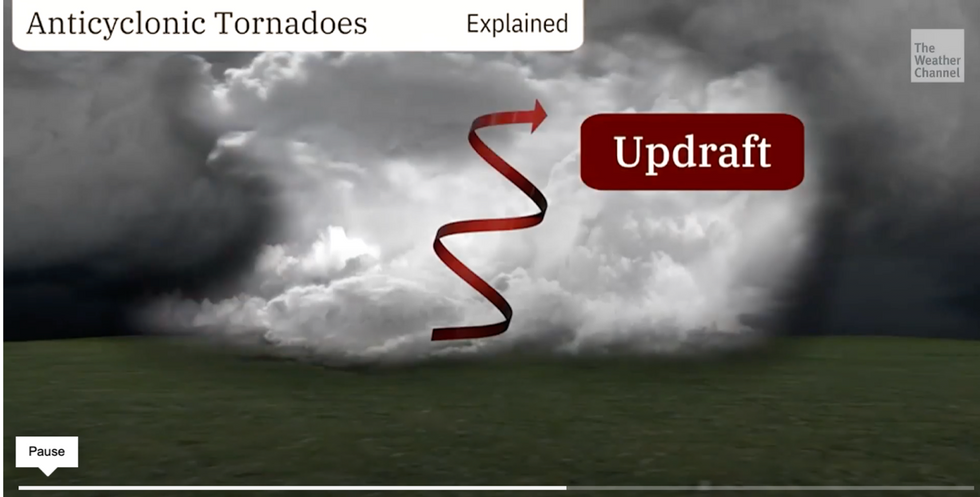
The bizarre phenomenon during a savage spate of violent twisters was probably the result of unusual thunderstorm wind patterns.
Winds are forced towards the ground as they are sucked into powerful storm systems in a so-called ‘updraft’.
Violent air currents compete within the storm pushing currents of wind in different directions.

What does a normal tornado look like?
|The weather channel
This rarely causes one spin-off tornado to start churning in the opposite direction to the norm, as was seen last week.
The Weather Channel spokesman said: “Of all tornadoes in the northern hemisphere, 99 per cent spin in a cyclonic, anticlockwise direction.
“Tornadoes that spin clockwise are in the rare one percent of those that spin in the other direction.”
Meanwhile, government officials have issued a fresh round of alerts for severe weather through the week.
Travellers are warned to take extra care as powerful gales and heavy snow in parts threaten chaos.
A ‘strong Pacific’ storm heading in from the west coast will unleash severe thunderstorms while dumping inches of snow over high ground.
Compared to a ‘wrong way’ tornado
|The weather channel
Once again, central and southern regions are on alert for the worst of the weather according to the National Weather Service (NOAA).
A spokesman said: “On Monday, the snow will continue over parts of the Northern Intermountain Region and Northern and Central Rockies, with heavy snow developing over parts of the Northern Rockies and Uinta Mountains.
“Showers and thunderstorms with heavy rain will develop over parts of eastern Kansas and Nebraska. and western Iowa/Missouri as the front moves out of the Rockies onto the Plains.
“The hazards associated with these thunderstorms are frequent lightning, severe thunderstorm wind gusts, hail, and a few tornadoes.”
Prolonged stormy weather is being blamed on deeply unstable atmospheric conditions driven by a clash between northerly and southerly airmasses.
Plumes of hot air from the Gulf of Mexico have pushed temperatures over the past week to 100F while the north has shivered close to freezing.
Jim Dale, US correspondent and meteorologist for British Weather Services, said: “There will be some more snow over the high ground to the northwest through the start of the week, but this is a short-lived feature driven by a plume out of Canada.
“Warmer air to the south, though, hitting cold air to the north is the driver for the storms, and this is going to be the theme through the week.”
A spokeswoman for the Weather Channel added: “The Central Plains are braced for a multi-day weather event.
“Storms will start on Monday afternoon and strong tornadoes are possible.”