


A killer storm ravaging America is about to ‘show its teeth’ with electrical eruptions, floods and monster hailstones threatening a ‘significant risk to life’.
Supercharged cyclonic pressure systems fed by a surge of tropical moisture from Mexico have put the US at an ‘enhanced risk’ of dangerous weather.
A massive storm system, blamed for at least one death in Oklahoma this week, shows no signs of weakening as it rages eastwards ahead of the weekend.
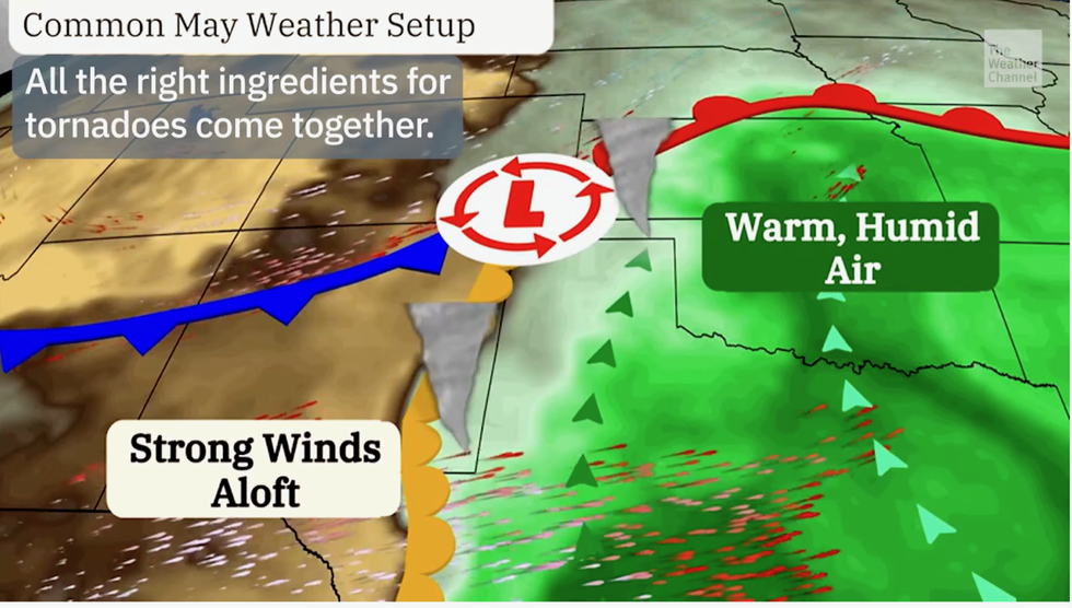
Warm air from the south will flood northwards meeting cooler air from Canada to create a ‘storm breeding ground’, experts warn.
 |
| THE WEATHER CHANNEL
Jim Dale, US weather correspondent and meteorologist for British Weather Services, said: “The storm will really show its teeth during the middle of the week and in the run up to the weekend, when there is an increased risk of damaging winds, thunderstorms and tornadoes.
“Hot and humid air from the Gulf of Mexico meeting cooler air to the north is going to create a classic breeding ground for dangerous storms and tornado activity.
“This is going to be a major storm system moving through the country through the latter part of the week, and it has the potential to have major impact with an ongoing and significant threat to life.”
The main storm threat ahead of the weekend will move to Kansas, Oklahoma, Missouri, Kansas, Arkansas and surrounding states.
“Storms have been hitting the United States for the past couple of weeks, but this looks like a very bad one,” Dale added.
The National Weather Service (NOAA) has issued ‘flood advisories’ across seven central states and a further alert in the northeast.
 |
| THE WEATHER CHANNEL
Separate ‘high wind warnings’ are in force across the Montana, Wyoming, Colorado and New Mexico with ‘wind advisories’ also covering California, Idaho, Utah, and Nevada.
Some of the most vulnerable regions near waterfronts and shorelines face up to a foot of floodwater, the NOAA warned.
A spokesman said: “As a second wave of low pressure moves out of the Southern Plains into the Middle and Lower Mississippi Valley, the storm will produce showers and severe thunderstorms over parts of Oklahoma, a small part of Texas, Missouri, Arkansas, Kentucky, south-eastern Illinois, southern Indiana, Tennessee, and a small portion of Mississippi.
“The hazards associated with these thunderstorms are frequent lightning, severe
thunderstorm wind gusts, hail, and a few tornadoes.
“Showers and thunderstorms will cause heavy rain to develop over parts of the Ohio and Tennessee Valleys and the Middle and Lower Mississippi Valley.”
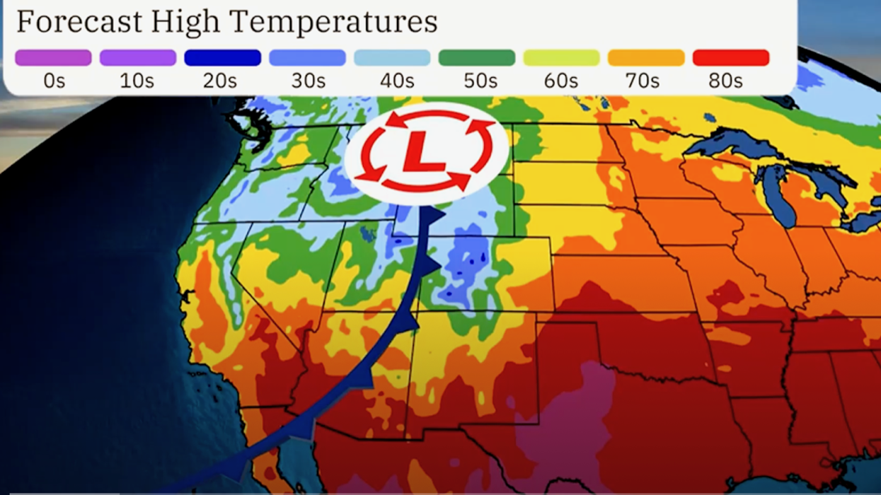
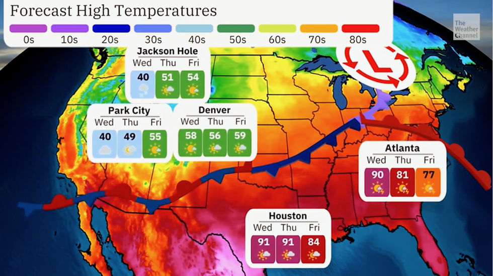
A huge temperature contrast ‘battle of the seasons’ between northwest and southern America will drive the assault.
Temperatures in the south and the east will continue to rise through the rest of the week, experts say.
Weather Channel meteorologist Dina Knightly said: “A long frontal boundary will create this temperature divide, and ahead of this front, warmer temperatures and thunderstorms are likely.
“Some areas at high elevations could even see snow this week.”
Weather Channel spokesman Chris DeWeese added: “A powerful tornado swept through Barnsdall, Oklahoma, causing significant damage and at least one death. “The rest of the week is expected to be stormy across the United States with severe weather possible across parts of the Midwest, South and East.
“Please stay tuned to our updates for the latest weather forecasts and safety tips.”