


Britain is on alert for the second named storm in almost as many days as alarm bells sound for ‘Elin’ to strike in the next 24 hours.
The UK has fallen into the firing line for a barrage of powerful cyclonic systems, Storm Debi being the latest yesterday to unleash a violent assault.
Another deepening low-pressure system is hurtling towards the west coast and could be powerful enough to earn the fifth storm name of the season–Elin.
As the country reels from the most recent windswept deluge, forecasters warn the next could be worse.
** HELP FIGHT FOR FREE SPEECH - SUPPORT GB NEWS **
Jim Dale, social commentator and meteorologist for British Weather Services, said: “The next low could turn into Storm Elin, and we expect to see it arrive between Wednesday and Thursday.
“This one could be stronger than Debi, which affected largely Ireland and Northern Ireland.
“It could affect any part of the UK, although western parts of the country are likely to see the worst of it.”
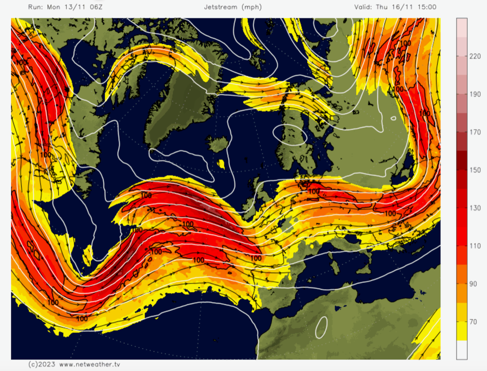
Storm Elin will crash into Britain over the next 24 hours
|Netweather
Another storm will bring the risk of flooding to regions which have borne the brunt of the rain through the past week.
Storm Debi followed Storm Ciaran last week which left swaths of the country under torrents of gushing floodwater.
The Environment Agency has more than 110 flood alerts in force, and more than 10 ‘act now’ flood warnings.
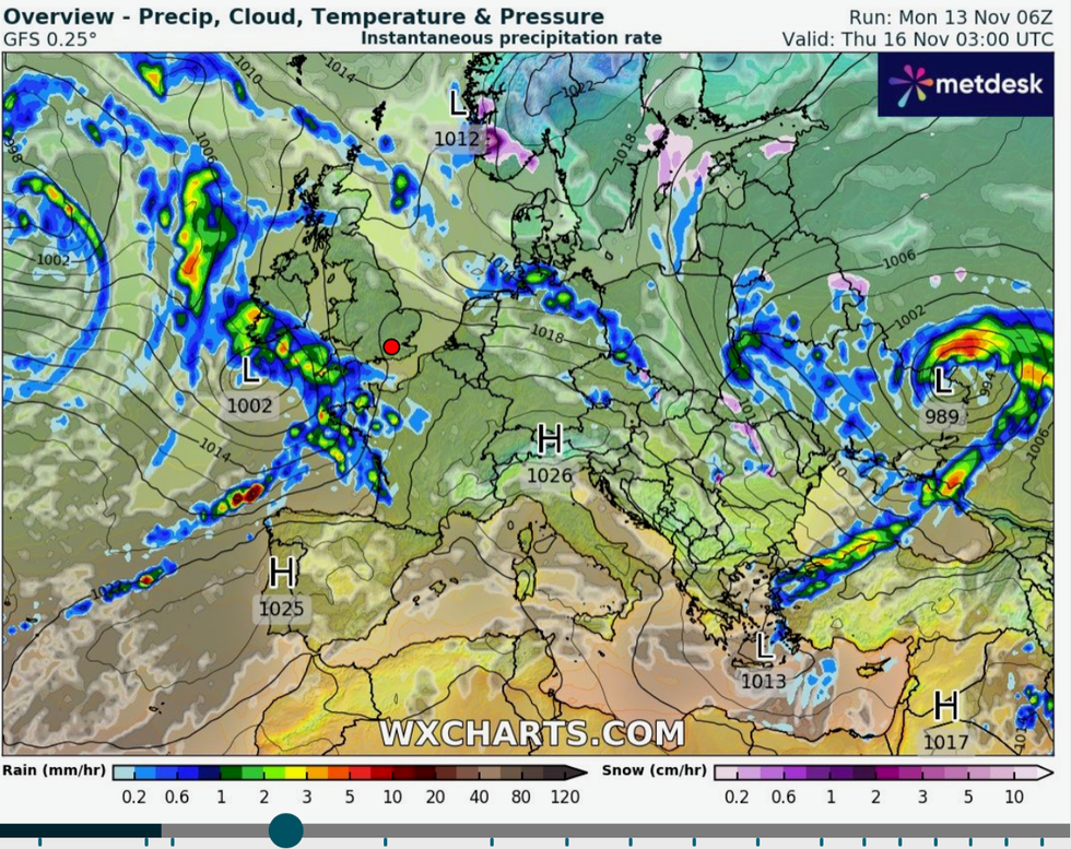
UK weather forecast: Stormy weather arrives from the south
|WX Charts
River levels are expected to rise through the week as government officials desperately pump water from flooded waterways across northern, and southern Britain.
Mr Dale said: “After Debi, the ongoing risk is going to be from flooding.
“The next system will bring more rain, so this risk is going to continue at least through the rest of the week.
“This unsettled pattern of weather looks likely to continue for the next week.”
The Met Office warned the week is looking ‘very unsettled’ with a ‘deep feature’ on the forecast charts threatening to hit on Thursday.
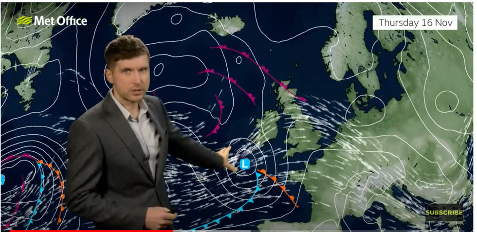
Met Office’s Alec Burkill warns about a deep low arriving on Thursday
|Met Office
Southern regions are in the firing line for further wind and rain as the low-pressure system intensifies rapidly, similar to Ciaran and Debi.
However, weather models are still to agree on the precise forecast with some predicting a calmer end of the week.
Government forecasters will be watching the models closely through the next 48 hours, according to Met Office meteorologist Alex Burkill.
He said: “As we head into Thursday, the Met Office model has the jet stream running across the UK and an area of low pressure moves across the jet and, by this model, is going to invigorate rapidly as it makes its way towards the UK arriving as a pretty low, deep feature.
“That then brings the risk of some heavy rain and some very strong winds across southern parts as we go through Thursday.
“Thursday looks like it is going to be a very unsettled day.”
In the meantime, temperatures will fall over Scotland and the north of Scotland, he added.
He said: “There will be a bit of wintriness over the higher ground of Scotland.”
Netweather forecaster Terry Scholey added: “It'll remain unsettled for most of the week, although there's a hint with some model disagreement of an improvement in the East and South towards next weekend.
“But it'll mostly remain on the mild side, except in the far North.”