


A battle between the Arctic and the tropics will stoke a brief burst of warmth across Britain before ushering a week-long cold snap.
Continental winds will thrust temperatures across the south into the mid-20Cs this weekend before the mercury tumbles into the end of spring.
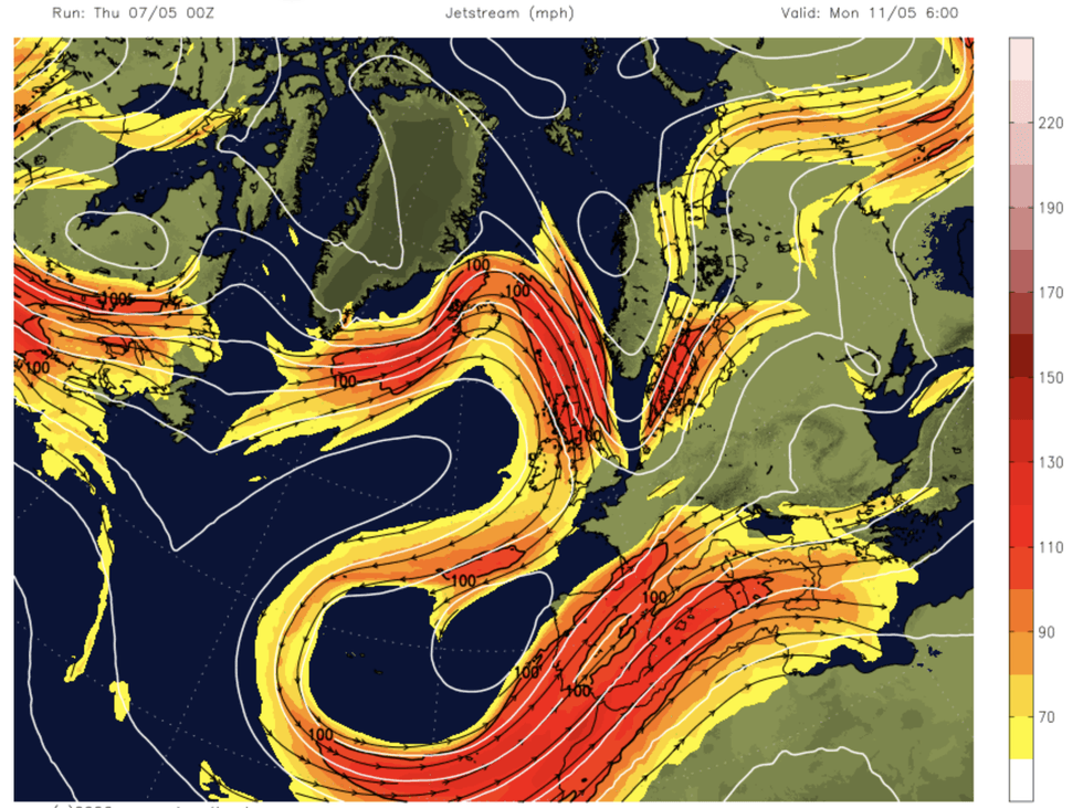
Behind the chaotic outlook is a shattered jet stream – the gushing band of air high in the atmosphere – about to reorganise into a snaking loop of Polar winds.
Thermometers will nosedive over the weekend, with mid-May promising lacklustre temperatures.
Met Office meteorologist Alex Deakin said: “A northerly flow will bring cooler air right across the UK into the new working week.
“Jet stream winds are coming down from the north with low pressure to the east and high pressure to the west.
“We are back in the cooler air to start next week, and something similar to this weather pattern will be in place for much of next week.”
Tussling weather systems this weekend will split Britain into four zones: warm, cold, dry and thundery.
A battle between the Arctic and the tropics will stoke a brief burst of warmth
|NETWEATHER
Southern regions will catch the heat, although unstable tropical air will trigger the risk of heavy, crackling downpours.
Colder winds will grip Scotland and the north, while a weather front trailing central Britain will bring a mix of showers and dry spells.
Mr Deakin said: “In the south, warmer air is pushing back in, so Friday’s temperatures are single figures to the far north while in the south we may be close to 20C.
“By the time we get to Saturday we might see temperatures in the south in the low-20s, with colder air lying across northern England, and it is going to feel even colder if you are stuck under the rain band that a weather front is providing.
LATEST DEVELOPMENTS

“On Saturday, we will be split into four areas, with a zone to the south that is dry and bright, a threat of showers to the far south, something chillier but drier across Scotland and then the zone where the weather front is sitting.”
An undulating jet stream will drive the change as it morphs into a looping U-bend, Mr Deakin added.
He said: “The jet stream is fragmented with bits of it all over the place over the mid-Atlantic, so there is nothing really forcing the weather.
“As we get towards the weekend, the jet stream gets a little bit more organised, snaking into a reverse ‘S’ shape, which allows two weather systems to scrap for control of the UK with low pressure to the southwest and high pressure to the northwest.
“We could see some heavy and thundery showers across France on Saturday night, and these may drift further north to provide some heavy downpours across southern counties on Sunday morning.”
Independent forecasters agree on the outlook for the rest of May shaping up to be bleaker compared to early spring.
Low pressure and chilly winds threaten a cold and wet run into the start of summer for much of Britain.
Jim Dale, meteorologist for British Weather Services and co-author of ‘Surviving Extreme Weather’, said: “The rest of May is looking cooler, and wetter compared to the past few weeks. Towards the weekend, unstable conditions will bring the risk of thunderstorms and heavy downpours.”
Our Standards: The GB News Editorial Charter