


A two-day monsoon deluge threatens flooding in parts of Britain where elsewhere temperatures nudge 80F.
The Met Office has issued yellow weather warnings for rain across parts of Wales that will be in force until 11pm tonight.
Tropical winds from the Continent will rocket thermometers this week as torrential downpours sweep the north.
A low-pressure storm from the Atlantic will stick around into the end of the week before fortunes turn, experts say.
A change in wind direction after mid-week will pull a 25C plume in from the south, still warm from a blistering summer heatwave.
Met Office meteorologist Aidan McGivern said: “It is going to feel a little more humid, with temperatures getting up to 21C, and then we see a trailing front across the UK, bringing some wet weather across parts of the Midlands and Wales.
“On Friday, that trailing weather front will push further north and again bring further heavy falls of rain, particularly over higher parts of northwestern UK.
“Winds will change direction, and this could bring some warm weather into London, 23C or even up to 25C, but it is going to be much less pleasant in northwestern parts of the UK.”
LATEST DEVELOPMENTS:
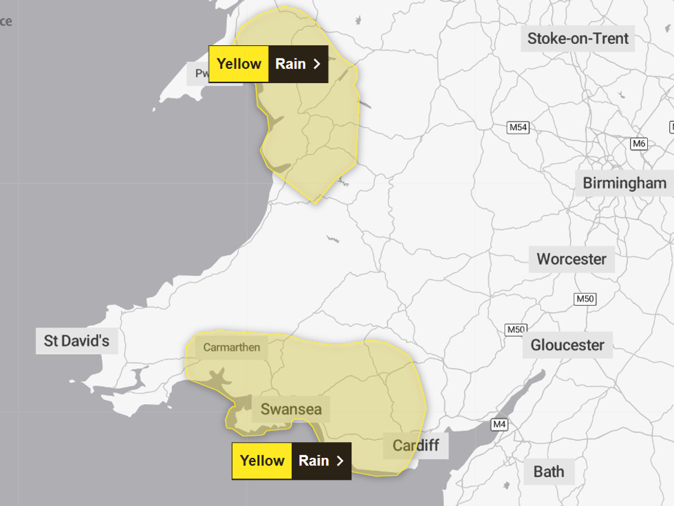
Yellow weather warnings are in place in Wales until 11pm tonight
|MET OFFICE
But windswept Britons must brave another couple of wet and windy days as the Atlantic hurls "low pressure after low pressure", he warned.
"Western and northern parts will see the heaviest downpours with more than an inch possible over higher ground", he added.
He said: “Wind and rain remain the theme for this week as low pressure after low pressure turn up across the UK.
“On Wednesday, fronts will bring a swathe of heavy rain across the UK, with persistent wet weather, heaviest across western parts.
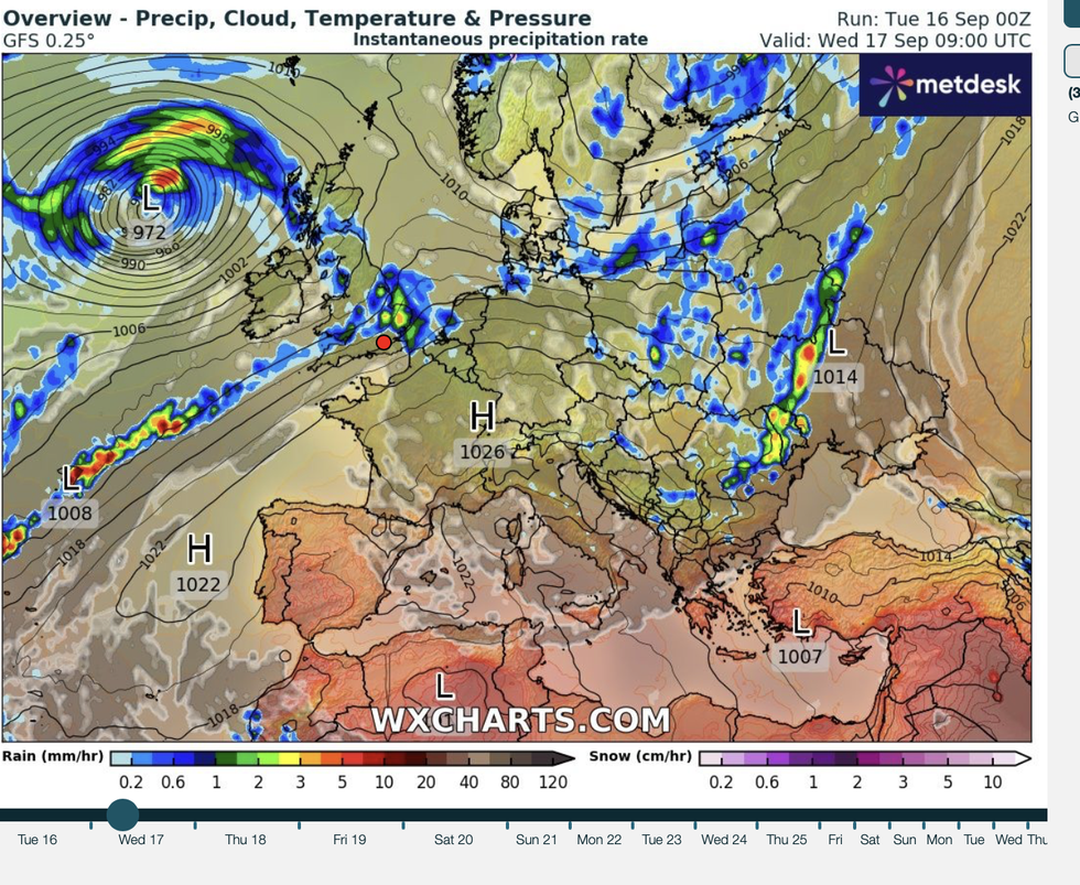
Western and northern parts will see the heaviest downpours with more than an inch possible over higher ground
|WXCHARTS
“The low sticks around for some time, and on Thursday, there are winds pushing across northern Scotland, while it turns less windy further south.”
Bands of rain were forecast to sweep in from the west last night and continue to drench Britain into Thursday.
Heavy downpours peppered with thundery outbreaks will dump torrents of rain across parts of the north.
Jim Dale, meteorologist for British Weather Services and co-author of ‘Surviving Extreme Weather’, said: “Low pressure will continue to bring heavy downpours through the start of the week, and there could be some flooding issues, although they are unlikely to cause major disruption.
“With these showers, there will be a risk of thunder as there will be energy in the atmosphere as temperatures rise.
“Towards the end of the week, and into next week, there is a chance that we could see temperatures rise into the 20Cs.”
Drenching forecasts have triggered bookies to slash the odds on a record wet September.
Coral’s John Hill said: “With heavy rain and set to hit the UK over the next few days, we have slashed the odds on this month being a washout.”