


A huge storm brewing off the east coast of America will hurtle towards Britain to unleash a weekend of torrential rain, wind, thunder and hail.
Ferocious jet stream winds will whip up a deep cyclonic low-pressure system churning the Atlantic.
While no name has been issued by the Met Office, this weekend could bring the first autumn storm of the year – Amy.
Government forecasters warn those heading out at the weekend to keep an eye on the forecasts as the system strengthens.
Met Office meteorologist Alex Burkill said: “On the other side of the Atlantic there is an area of low pressure developing, and as this pushes eastwards across the ocean and crosses the jet stream, which is the driving force for pushing it towards us.
“As it comes towards the UK and crosses the jet stream, it could be a particularly deep area of low pressure that arrives as we go through the second half of the weekend.
“Saturday could be a largely fine day, but if that deep low comes off and pushes in then things are set to turn very wet and windy as we go into Sunday.”

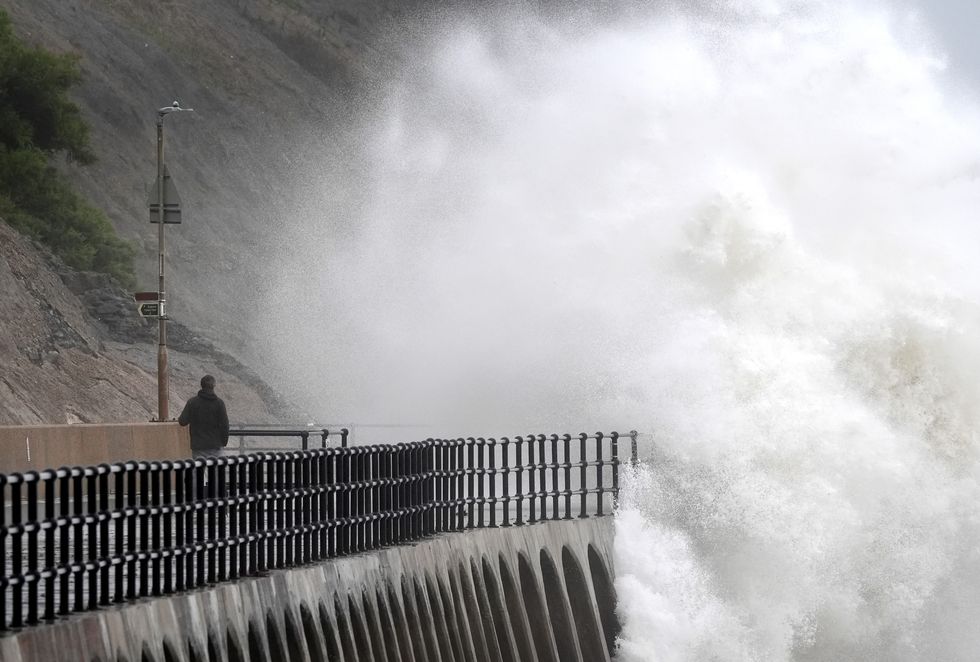
Storms threaten to wreak havoc across the UK
|PA
The storm follows a pattern typical of autumn storms, hitching a ride on the jet stream before sucking strength from its powerful winds.
Depending on how it interacts with the jet, it could strengthen violently in a process called ‘explosive cyclogenesis’.
This was the force behind major autumn storms including 2022’s Storm Eunice, 2024’s Storm Bert, and the Great Storm of 1987.
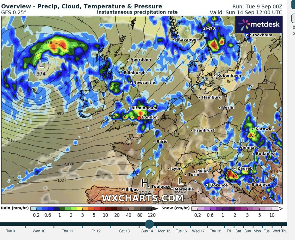
WXCharts is warning a storm could hit Britain very soon
|WXCHARTS
Regardless of whether it undergoes explosive cyclogenesis, the storm threatens a weekend whacking.
Jim Dale, meteorologist for British Weather Services and co-author of ‘Surviving Extreme Weather’, said: “Low pressure will be in control through the end of the week, and with energy still in the atmosphere, there is a strong jet stream and this feeds into these storms.
“There will be a risk of thunder and some heavy downpours, and where these happen, flooding is likely to be an issue.
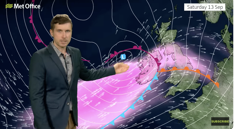
Alex Burkill warns of a deep storm system approaching
|MET OFFICE
“At this time of year, the strong jet and its impact on low pressure coming in from the Atlantic is not unusual, as there is a temperature contrast when cooler air moves in that drives the jet stream.”
After the mild start to the week, temperatures will widely drop as cool winds come in from the west.
Sunshine and showers will turn to heavier downpours ahead of the weekend, according to the Met Office.
The storm has not yet been named by the Met Office
| PABurkill said: “Low pressure is firmly in control as we go through the end of the week, and a front makes its way eastwards across the whole country into Thursday.
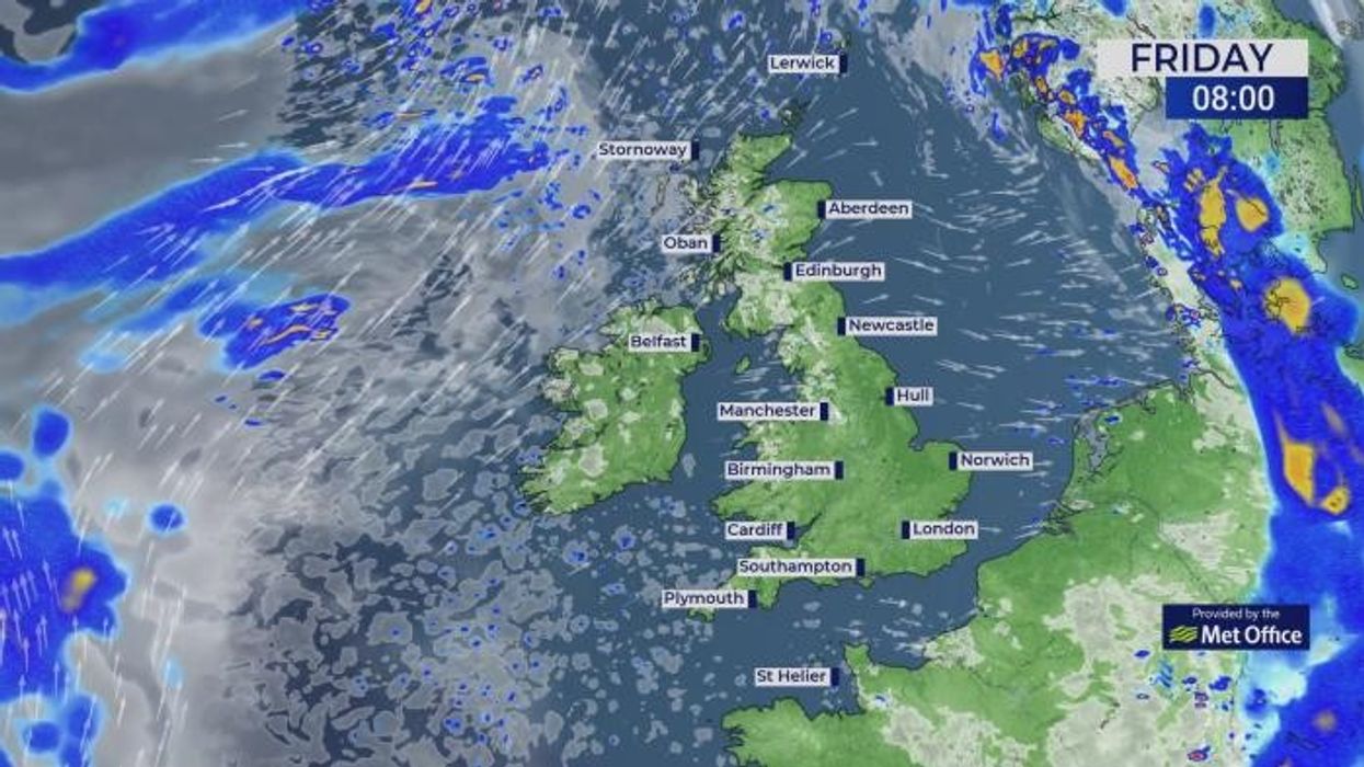
“It is more of a showery picture as we go through Thursday with showers piling in from the west because of low pressure towards the northwest, and the showers could be heavy and thundery with hail and some coastal gales.
“Friday is still heavily under the influence of low pressure to the northwest of the UK, and we will have a blustery day with more showers coming in from the west.”