


A mid-week storm laden with warm air in from the Continent will usher a boost of late summer joy.
Temperatures in parts of Britain will soar through the end of September with the arrival of a 25C tropical plume.
It will follow a wet and windy blast this week as two storms unleash torrential rain, wind, hail and thunder.
But a low-pressure cyclone skimming northern Britain on Wednesday will drag in a blanket of balmy southerlies.
Jim Dale, meteorologist for British Weather Services, said: “After Wednesday, we are starting to get a bit warmer as we draw in southerly winds from another system coming through to the north.
“We could see temperatures in the 20CS in parts of the country by next week, as we see a change to a spell of settled warmer weather.
“Then, we the low-pressure systems that have dominated the weather for a while will slow down a bit, and this could possibly come with a return to high pressure building.”
Unsettled weather through the middle of the week will be driven by a cyclonic low driven into Britian on the jet stream.
LATEST DEVELOPMENTS:
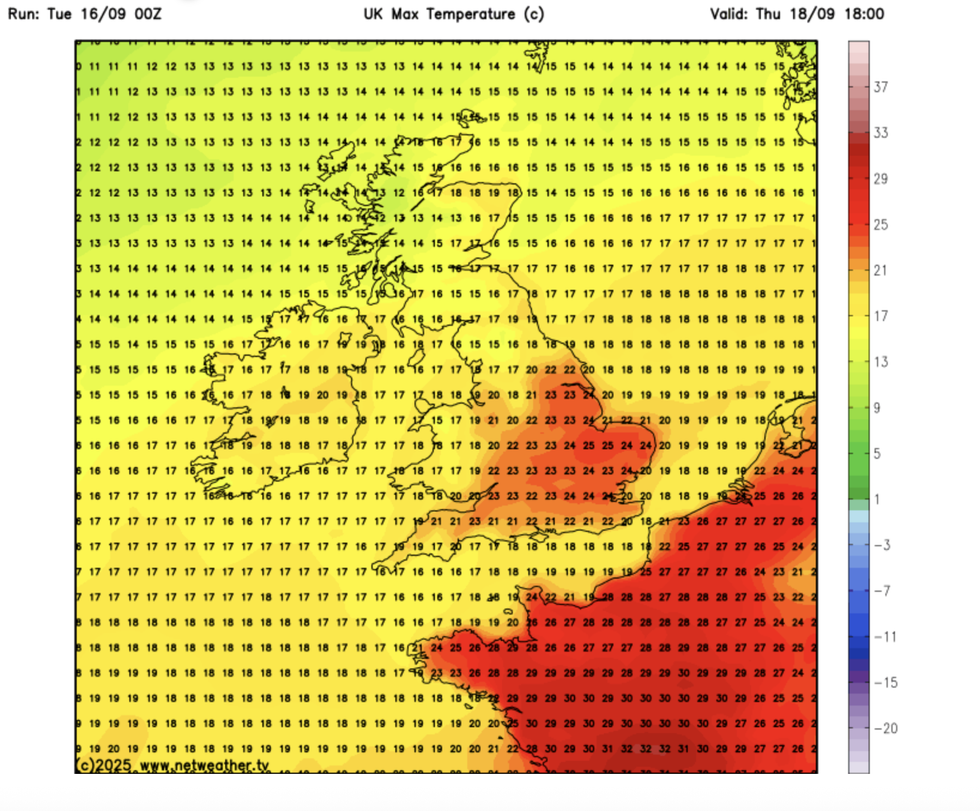
Temperatures could reach as high as 25C in the east of England
|NETWEATHER
Rather than zipping quickly across the country, it will hover over the tip of Scotland bringing most of the wind and rain to northern Britain.
As winds spiral around its low-pressure core, warm air will be swept in plunging southern Britain into summer-like temperatures.
Dale said: “This is another fat, flabby low that sits to the north of the country, and it is here that we may see some more unsettled conditions through the middle of the week.
“To the south, warmer air will start to come in from the Continent, and this is what is going to drive the higher temperatures.”
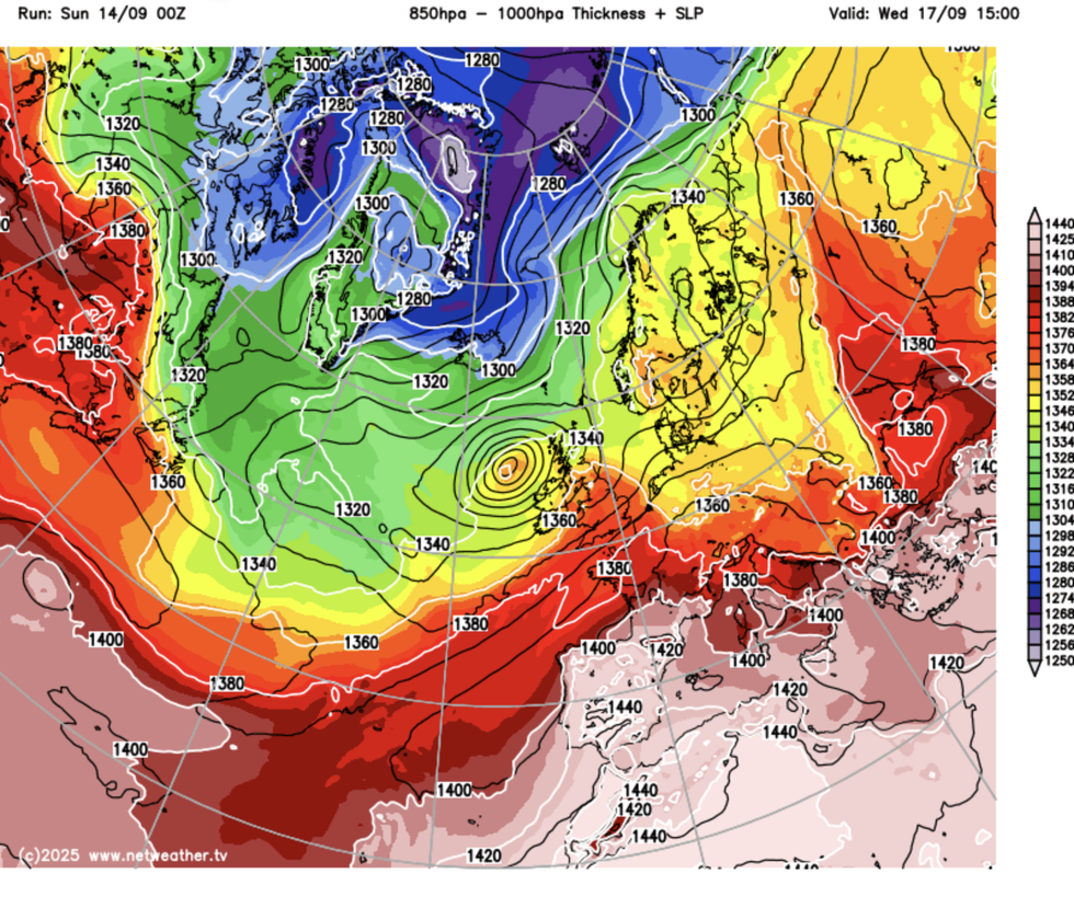
As winds spiral around its low-pressure core, warm air will be swept in plunging southern Britain into summer-like temperatures
|NETWEATHER
High pressure, which drives calm and often warm weather, is also on the month-end radar for Government forecasters.
Met Office meteorologist Honor Criswick said: “High pressure starts to creep back in as we head later into September, although we can also see low pressure largely dominating.
“But it is now possible that towards the end of September we could see high pressure building through.
“It is unlikely to be a dominant area of high pressure, but just something slightly less unsettled.”
Meanwhile, Britons are taking cover for the next spell of wind and rain as stormy weather heads in from the west.
A brief respite today will give way to wind and rain later today and through the middle of the week, the Met Office warned.
Meteorologist Kathryn Chalk said: “There will be some bright skies on Tuesday, especially for the south of England and across much of Scotland.
“There will be a focus for showers, especially across northern parts of England with a few showers bubbling up for Wales.
“Otherwise, it is a quiet day compared to recent days, but the sunshine will turn increasingly hazy from the west as we have the next area of wet and windy weather arriving later.
“Temperatures will range from around 16C and possibly 19C in the south.”
Weather models show temperatures at the end of this week hitting the low-20Cs, with southern Britain likely to hit 25C.