


Britain is back on Arctic-assault alert amid warnings to brace for the return of the ‘Troll from Trondheim’.
Mild, spring-like temperatures are about to give way to an imminent -10C Scandinavian snow blast.
A ‘major change’ back to winter has prompted government forecasters to issue a week-long raft of severe weather alerts.
Temperatures will nosedive through the coming days before the weekend brings the risk of widespread snow.
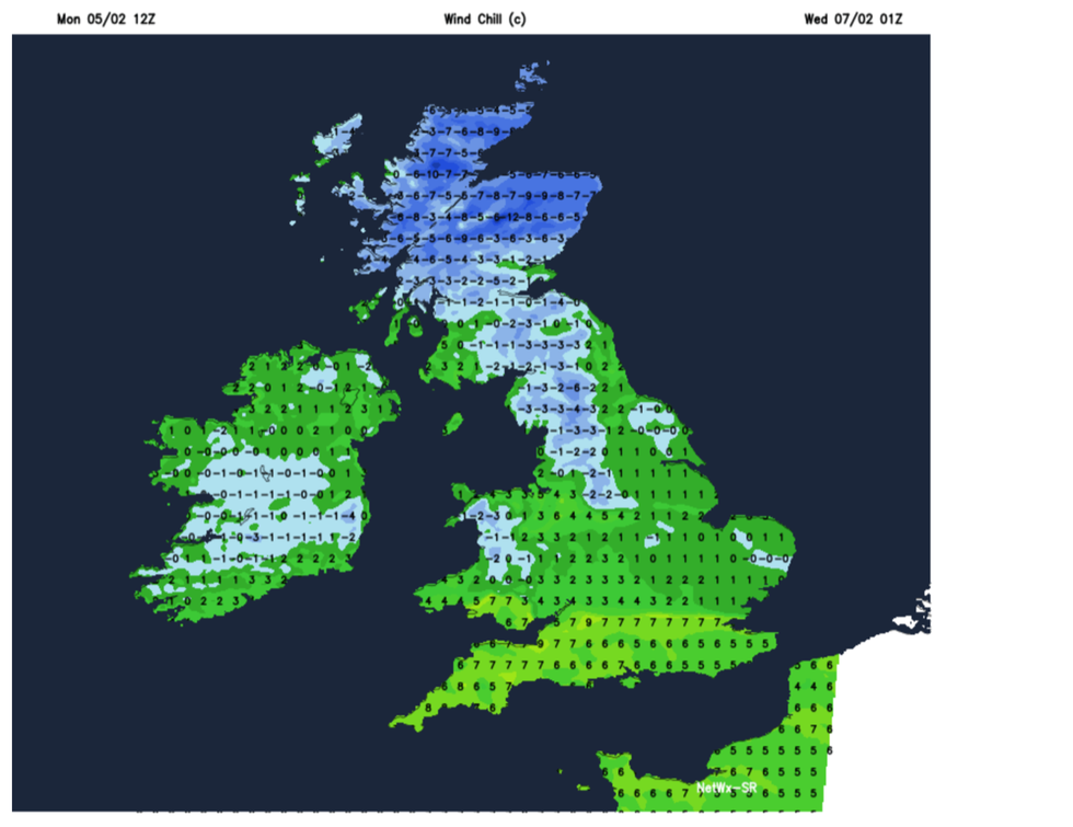
Temperatures are set to drop to as low as -10C
|WXHCARTS
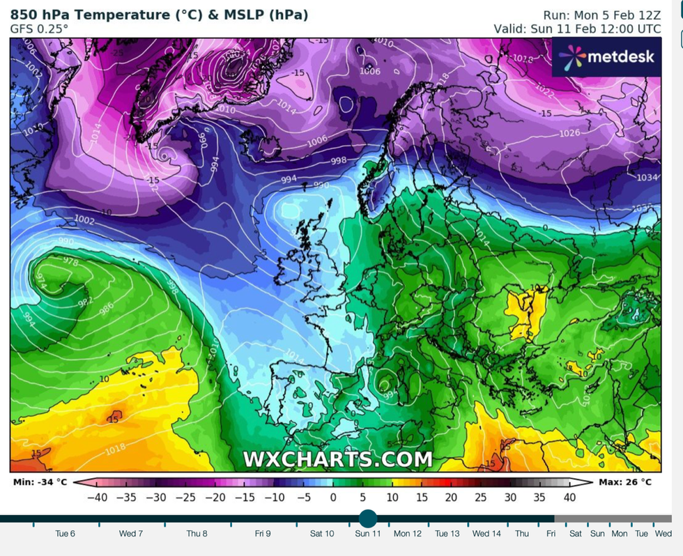
Bitter winds will sweep in from Scandinavia raising the chilly spectre of last winter’s ‘Troll from Trondheim’.
Jim Dale, meteorologist for British Weather Services, said: “We are about to see a major change from the mild weather.
“Cold air will push in this week, and at the weekend we could see temperatures of -10C in Scotland with a more widespread risk of frost, and the risk of snow further south, perhaps to Wales and northern England.
“Rather than a ‘Beast from the East’, this is similar to last winter’s ‘Troll from Trondheim’, coming in from the north and Scandinavia where they have endured an absolute beast this winter.
“The troll will be well-fed and very strong when it arrives.”
The Highlands and hills of Scotland will be first in the firing line for snow this week, he said.
Towards the middle of the month, snow could hit most of the country, sparing only the far south and the southeast, he warned.
LATEST DEVELOPMENTS:
Bitter winds will sweep in from Scandinavia
|WXCHARTS
“People should be prepared for disruption,’ he said.
“There is a 100 per cent chance of heavy snow over Scotland, with only East Anglia, the southeast and the southwest avoiding snow with only a 10-per cent chance.
“From the weekend onwards, this is when the cold air really pushes in and brings the wider risk of snow.”
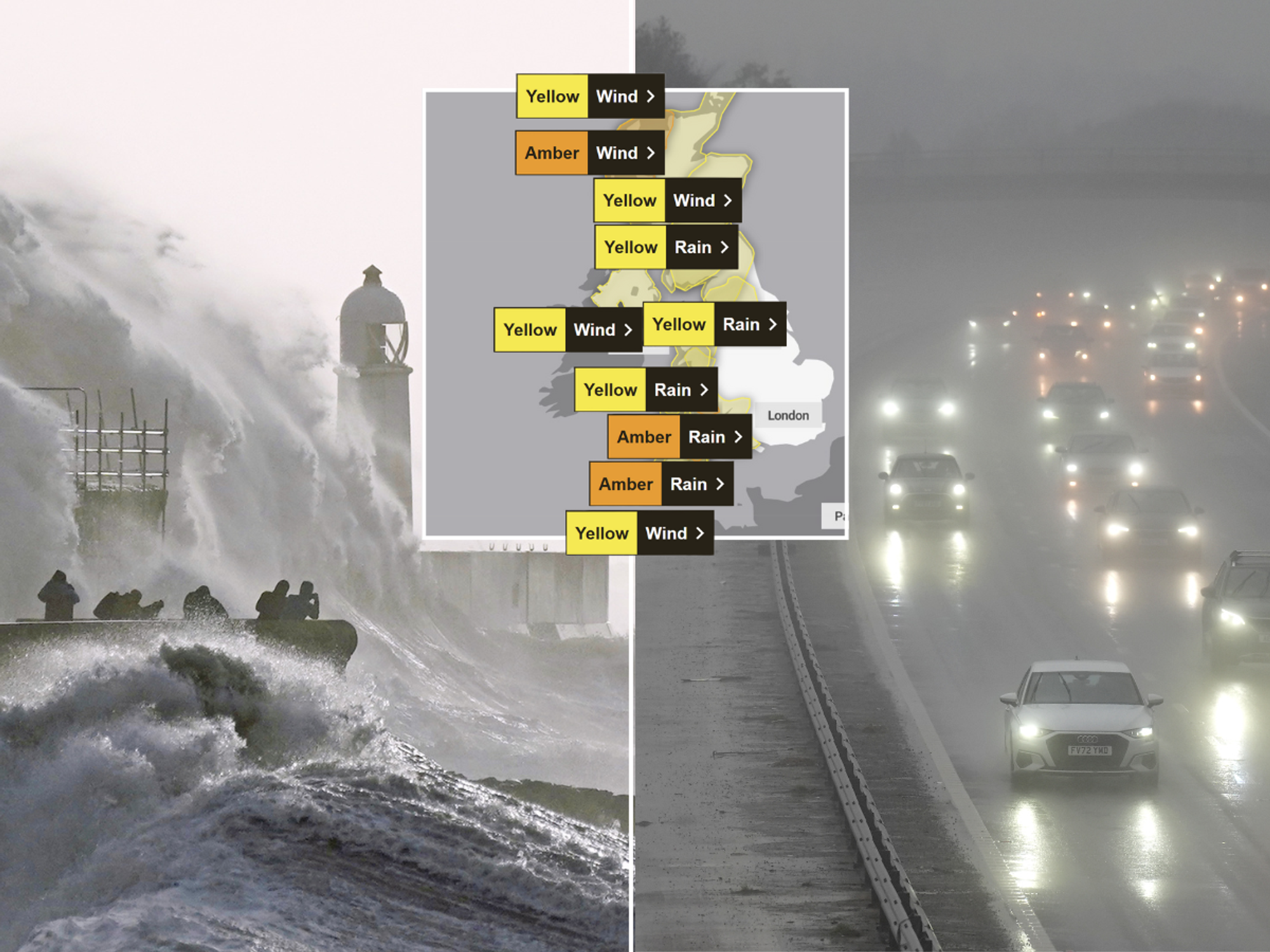
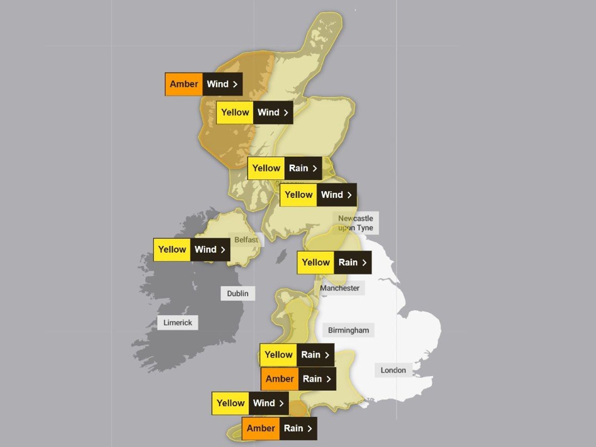
A Met Office warning for up to eight inches of snow on Thursday is in force across the East Midlands, the east of England, north-east England, the northwest, Wales, the West Midlands and Yorkshire and the Humber.
Government meteorologists warn of disruption to travel, power cuts, mobile phone outages and the risk of rural regions being cut off.
The forecast may change through the week, with more places being impacted by the winter blast, according to the Met Office.
Met Office deputy chief meteorologist Chris Almond said: “There’s an increased signal for wintry hazards as we move through the week as cold air from the north moves over the UK.
“It’s from Thursday that the snow risk becomes more potentially impactful, as mild air attempts to move back in from the south, bumping into the cold air and increasing the chance of snow developing on the leading edge.
“The initial snow risk looks highest in northern England and Wales from Thursday.”
The mercury will widely nosedive to freezing or just above this week while bitter winds across Scotland will make it feel close to -12C.
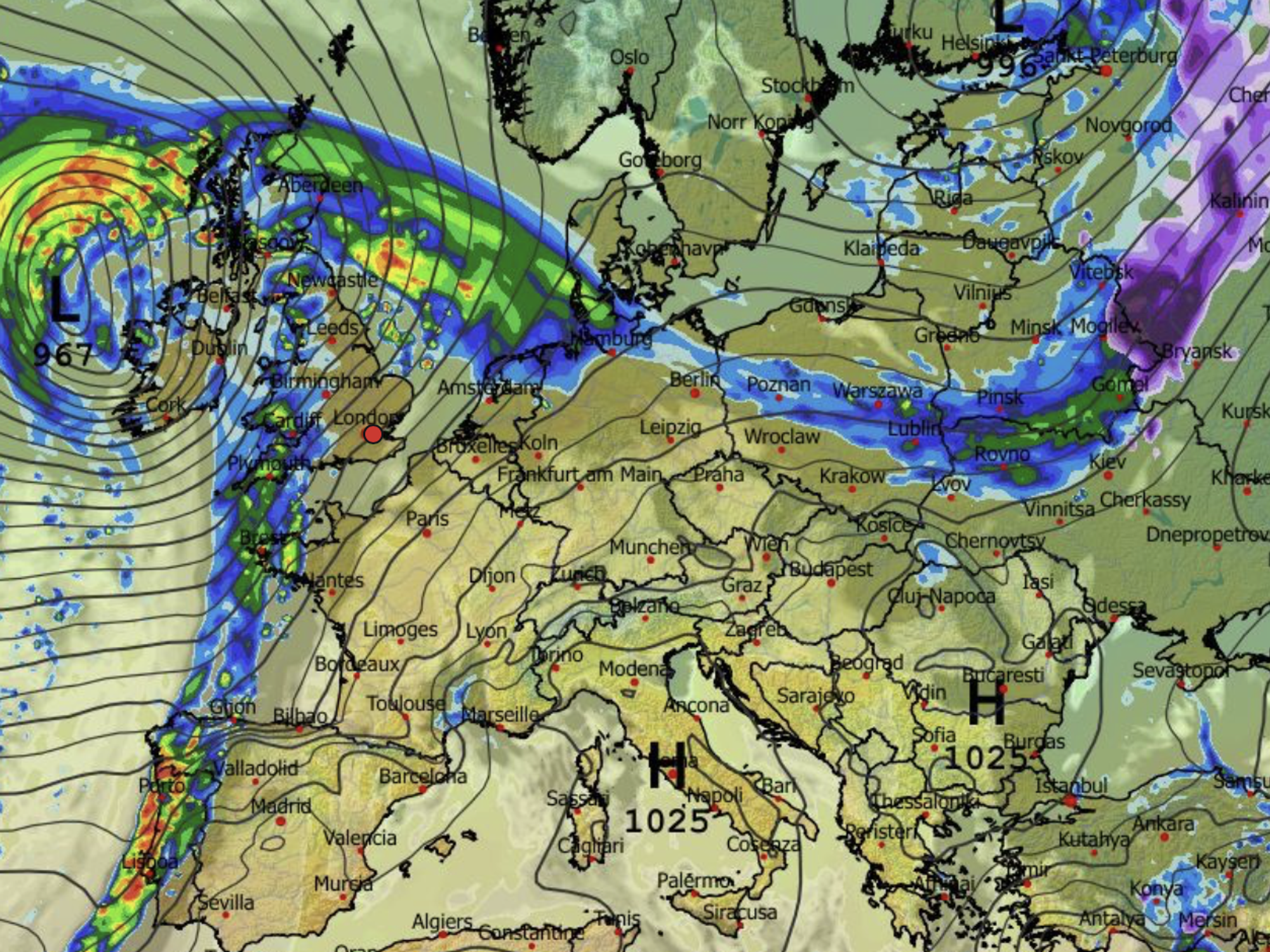
A low-pressure system from the Atlantic will clash with cold air over the UK later this week to bring the risk of widespread snow, according to Exacta Weather’s James Madden.
He said: “It will spread northwards throughout Thursday and leave a blanket of snow across large parts of northern England, Scotland, and some central regions to begin with.
“Question marks still surround this second snow event, and whether or not this will impact areas farther south.”