


Storm Bram will smash Britain with another 24 hours of torrential downpours amid warnings for ‘imminent’ dangerous flooding.
A raft of alerts for torrential rain and 90mph gales is in force through the next 24 hours including an amber wind warning for Scotland.
Clashing weather patterns will slowly steer Bram across the country, with another two days of rainfall forecast in the tail of the storm.
Scotland and northern England face the strongest winds although it is persistent rain through the week which poses the greatest danger.
TRENDING
Stories
Videos
Your Say
Met Office chief forecaster, Dan Suri, said: “Storm Bram will bring a very wet and windy spell of weather, with very strong winds and further heavy rain which falling over saturated ground, could cause flooding impacts.
“Within the Amber wind warning over northwest Scotland, gusts of up to 90mph could be recorded.
“Rain is an additional impact from Storm Bram, with the possibility of 100mm [four inches] over higher ground in the south of Wales and parts of Devon.”
Violent gales will whip up mountainous waves sparking warnings to avoid coastal areas.
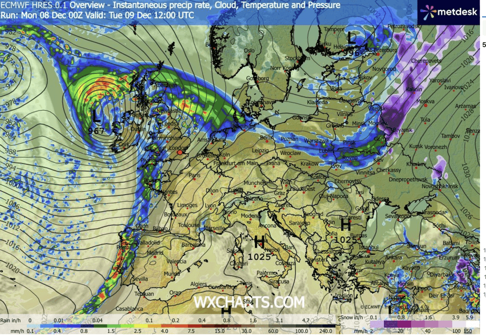 |
| WX CHARTS
Bram’s assault will be driven by a battle in the Atlantic between a ‘cold plunge’ to the north and southerly tropical winds.
Met Office meteorologist Tom Morgan said: “We have a cold Arctic plunge of air moving south across the Atlantic meeting warmer sub-tropical air and that temperature contrast is generating a strong jet stream.
“It is the jet stream that is bringing in areas of low pressure across the UK, and that is going to be the case over the next few days.
“One area of low pressure is going to potentially rapidly deepen into Tuesday, so we have concerns about how much rain we will see particularly across Wales and southwestern England.
STORM BRAM LATEST
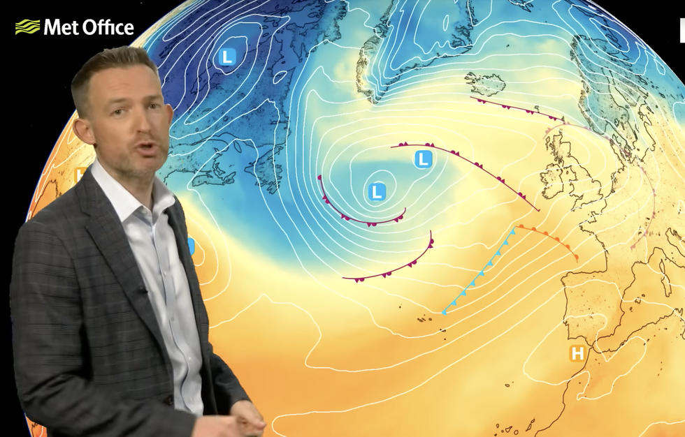
Storm Bram will strike Britain
|MET OFFICE
“But there will also be some very strong winds on the southern side of this area of low pressure, and we could see some damage in parts.”
Up to four inches of rain is forecast in parts of the country, with western and northern regions in the firing line for the worst of the onslaught.
These regions will turn drier through the day, as the focus for rainfall moves across Britain.
Met Office meteorologist Jonathan Vautrey said: “Higher ground sites could see 60 to 80mm of rain, and with saturated ground, that could cause some flooding and disruption.
“But the rain will be arriving through the day, and the winds will be picking up before it turns a little drier and brighter from the west during the second half of the day.”
Huge waves whipped up around northern coasts threaten disruption to ferry and travel services, he warned.
Government forecasters say rain will ease towards the end of the week, although rivers and water tables will be at breaking point.
A Met Office spokesperson said: “Storm Bram will slowly pull away northwards from Britain during Wednesday.
“In its wake, Wednesday will be a windy day, especially in the north, with some showers, mainly in the west as well as some more persistent rain in the far north, at least at first.”
Jim Dale, meteorologist for British Weather Services and co-author of ‘Surviving Extreme Weather’, added: “The main risk is from flooding, and this will be most likely to the west.
“The outlook for the week is unsettled, with virtually no sign of snow or cold.”