


Snow is set to his the UK as the Met Office has warned of disruption with temperatures set to plummet.
The Met Office said cold air from the north will drop temperatures for many this week, with an increased chance of wintry hazards and a warning for snow issued for some.
A yellow warning for snow has been issued stretching from the Scottish border to Hereford. The warning is in force from 3am on Thursday morning and is expected to last until Friday morning.
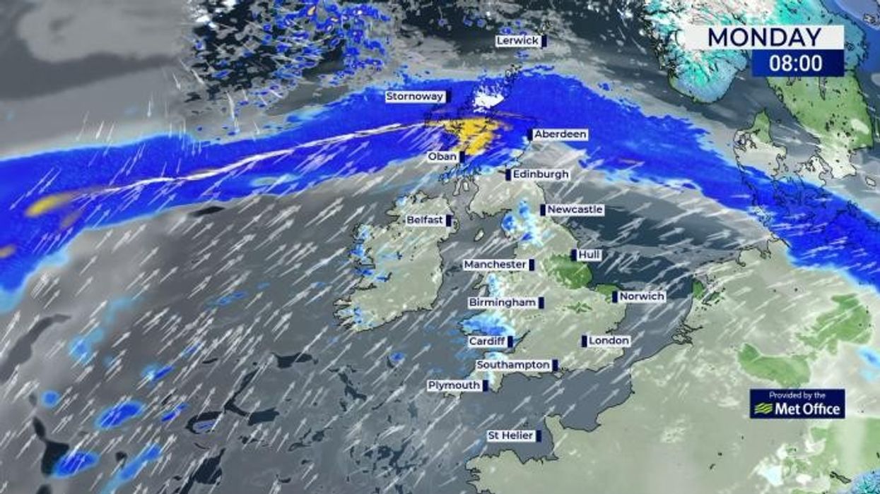
There have also been yellow warnings for rain and ice issued for the Scottish highlands on Monday and Tuesday too.

The snow is expected to hit on Thursday
|WXCharts
Met Office deputy chief meteorologist Chris Almond said: "While the early part of this week will see some rain, at times heavy, gradually sinking southwards, there’s an increased signal for wintry hazards as we move through the week as cold air from the north moves over the UK.
"It’s from Thursday that the snow risk becomes more potentially impactful, as mild air attempts to move back in from the south, bumping into the cold air and increasing the chance of snow developing on the leading edge.
"While there are still lots of details to work out, the initial snow risk looks highest in northern England and Wales from Thursday. 1-2cm is possible to low levels, with 10-20cm possible over the highest ground within the warning area.
"This snow will likely gradually transition to sleet and rain later on from the south."
LATEST DEVELOPMENTS
- Asylum seeker who piloted boat carrying more than 70 migrants jailed after woman fell overboard and died
- Britain braced for clash with France and Belgium as UK demands EU stop importing from Russia
- Royal Navy vessel pulled out of lead role in 'largest Nato exercise since Cold War' due to 'rusty' shaft
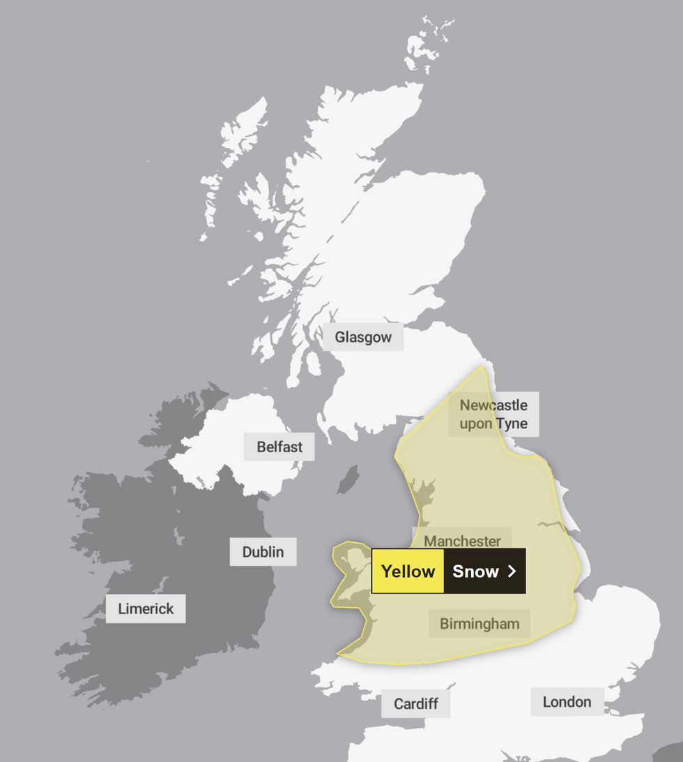
The yellow weather warning has been issued for the north of England and the Midlands
|Met Office
The Met Office has warned that weather warnings are set to be amended or issued as the week progresses.
A spokesperson added: "Although there’s still some uncertainty on the positioning of weather fronts from Thursday and the exact position of any snow, the trend further ahead is for the colder conditions with more-scattered wintry showers to spread south."
This current weather warning sees a yellow warning for ice across the far north of Scotland, including Caithness, the Orkneys and Shetland Islands.
The warning for ice is currently in place until 4am tomorrow.

There could be snowy scenes in rural areas later this week
|PA
There have also been warnings of potential travel disruptions following the 'wall of snow' set to hit the Midlands and North of England.
The forecaster said there was a small chance of power cuts and rural communities being cut off in the included areas. It added that delayed or cancelled rail and air travel was also likely.
Looking into the weekend and the start of next week, the Met Office forecast said: "Across the north [it will be] cold throughout with snow showers tending to focus on northeastern areas while for the far south the period may start of with some rain and near average temperatures, before the cold air reaches here by the start of next week.
"[It will be] windy at times, especially so in some eastern areas where a notably wind chill is expected. Temperatures [are] ranging from rather mild in the south at first, to cold, perhaps very cold in the north."