


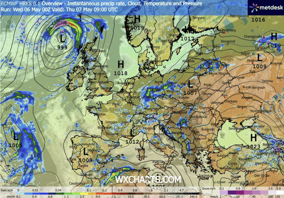
Britain’s weather is about to make another U-turn as sub-zero temperatures, frost and snow give way to a thundery deluge, Met Office officials have warned.
After the UK shivered in its coldest May night for five years, when temperatures in the Highlands dropped below -6C on Wednesday morning, forecasters said shifting weather patterns threaten the prospect of gales and heavy downpours.
Polar winds will retreat to the north as cyclonic low-pressure systems hurtle in from the southwest.
A brief calm before the storm through the next 48 hours will give way to a turbulent weekend, experts warn.
Met Office meteorologist Tom Morgan said: “As we go towards Friday and into the weekend, we are potentially going to see a change in the weather.
“We have a large area of low pressure sitting to the west of Iberia, and that is going to drift towards the UK, and that is going to strengthen the easterly winds.
“So, it is going to turn quite a bit windier, particularly across England and Wales, as we go into the weekend and there will also be an increasing chance of heavy showers and perhaps even some thunderstorms.”
Polar winds pushed thermometers in parts this week to their lowest since 2021, with Altnaharra in Scotland plunging to -6.1C yesterday.
Britain’s weather is about to make another U-turn
|WXCHARTS
Temperatures mid-week in parts of the country were well below average for May, with only the southeast clinging on to the warmth.
The cold snap is forecast to thaw through the next couple of days, although the risk of frost remains in exposed regions.
Met Office meteorologist Alex Burkill said: “We end up with a northwest-southeast split, with the cloudiest and the wettest weather towards the northwest and further east it is drier.
“There could be a touch of frost in prone spots, and we are under the influence of low pressure to the northwest.
LATEST DEVELOPMENTS
“Temperatures should be picking up a little bit, and there is a warming trend as we go through this week.”
However, after a brief calm spell, winds will pick up and low pressure to the north of the country will turn on the taps.
Mr Burkill said: “We see things quietening down a little bit for a short period of time, and there is wetter weather towards the south that is set to push its way in as we go towards the weekend.
“It will be cloudy and blustery towards the northwest, and there will be more outbreaks of rain for western areas.”
Heavy rain in regions that have seen little so far this year will arrive with the risk of flooding.
March was one of the driest on record in parts of the country, with much of April following suit.
Showers will move in from the south ahead of the weekend, with a soggy outlook predicted into mid-May.
Jim Dale, meteorologist for British Weather Services and co-author of ‘Surviving Extreme Weather’, said: “We will start to see showers and heavier rain as we go into the weekend, and this going to be the theme through the next week or so. Where rain is heaviest, after a long period of dry weather, there will be a risk of flooding.”
Our Standards: The GB News Editorial Charter