


Devastating Hurricane Melissa could be about to take a storm-stirring swipe at Britain.
Jamaica, Cuba, the Bahamas and later this week, Bermuda, are reeling from the Category-5 monster, one of the biggest to hit the region this century.
Hurricane-track models of the storm and its remains show the ‘cone’, the expected onward path, directly hitting the UK.
While Britain is unable to experience a full-blown hurricane, their dying embers can become swept up in our weather patterns.
Knock-on effects from Melissa are expected this weekend and into the start of next week.
Jim Dale, meteorologist for British Weather Services, said: “While the precise direction of travel is still uncertain, the ashes of Melissa are likely to bring something in some form or another to the UK.
“The hurricane will have died at this stage, but we often see their remains interacting with weather patterns in the north Atlantic.
“It can do this in various ways, from bringing unsettled weather to allowing high pressure to build, driving calmer weather.”
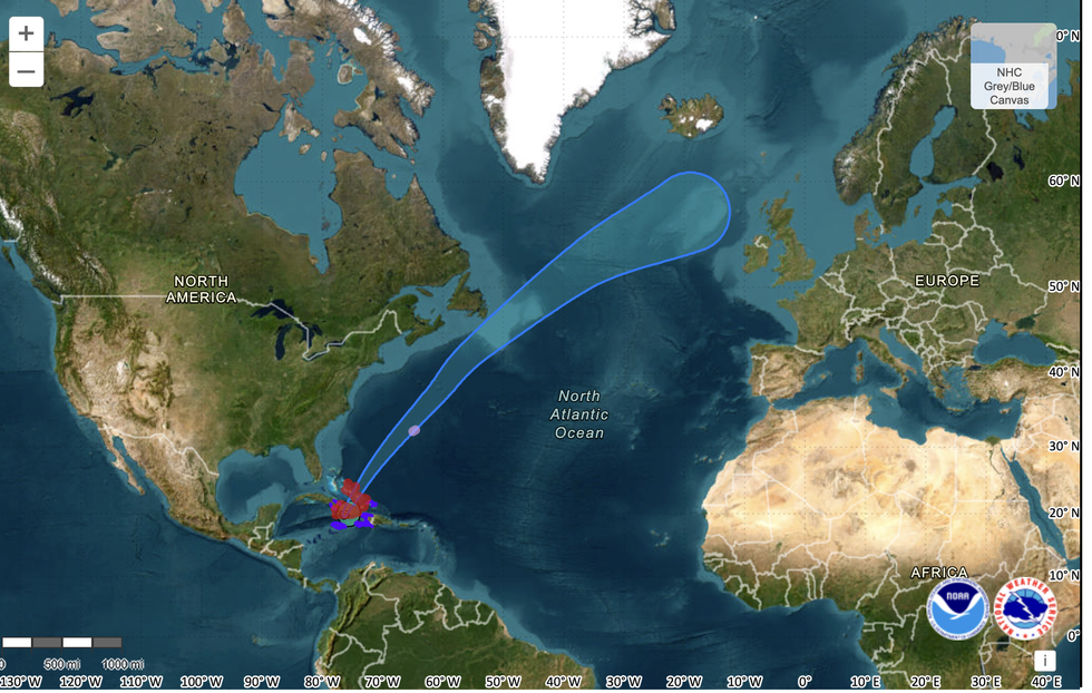
The path of Storm Melissa
|National Oceanic and Atmospheric Administration
The 185mph mega storm smashed Jamaica on Tuesday night before moving north wards through the Atlantic Basin.
Dubbed the ‘Storm of the Century’, Melissa has been compared in strength, size and impact to 2005’s Katrina and Wilma, and even the strongest Atlantic ever – 1980’s Allen.
Hurricanes never reach the UK intact, instead the energy wrapped into their remains can jolt the jet stream and feed into local low-pressure storms.
A Met Office spokesperson said: “Hurricanes cannot form at the latitudes of the UK as they require much higher sea surface temperatures to develop than exist close to the UK.
LATEST DEVELOPMENTS
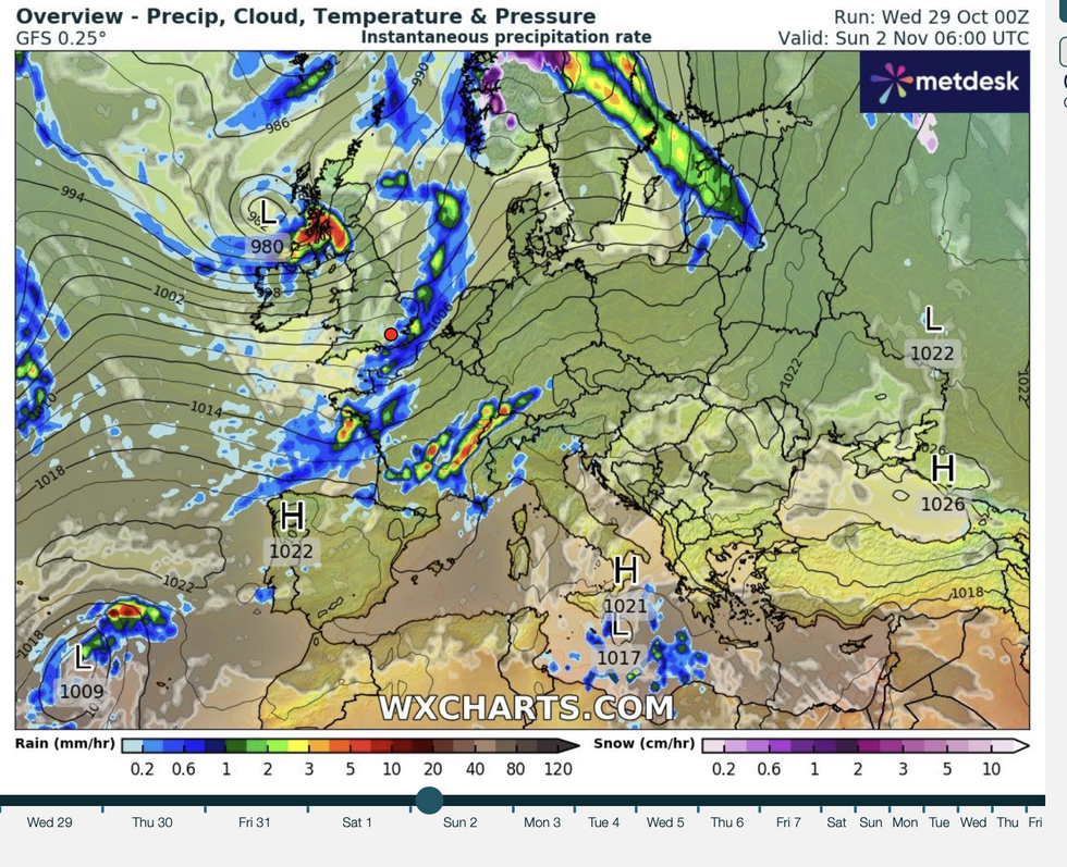
The UK is sometimes affected by extratopical storms
|WX CHARTS
“However, the UK is sometimes affected by extratropical storms as they move to higher latitudes, such as ex-Hurricane Ophelia in 2017.”
Ex-hurricanes affect the UK in various ways, from whipping up storms do pulling balmy blasts in from the tropical south.
Ex-Melissa’s interaction with the jet stream is unlikely to see it strengthening into a significant storm.
Instead, it is more likely to bring some wet and windy weather into parts of the country later this weekend.
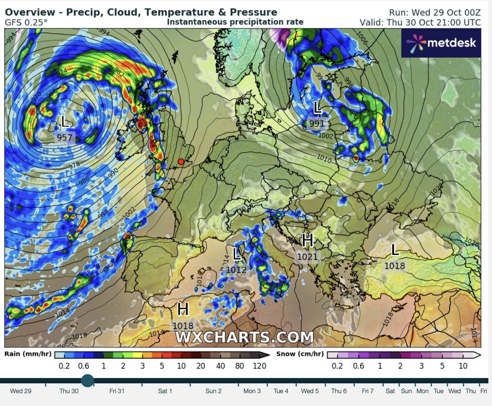
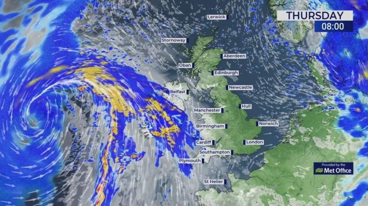
Britons can expect some wet and windy weather
|WX CHARTS
Met Office meteorologist Honor Criswick said: “Melissa is fairly slow-moving at the moment, and as it drifts northwards it moves into colder air, and the sea surface temperatures are not as warm.
“There are a fair few models pushing it into parts of the UK, although we don’t get hurricanes in the UK, but we can get ex-hurricanes, and they can still bring some wet and windy weather.
“It doesn’t get picked up by the jet stream until we get to the weekend, but there is still a low tracking across parts of the northwest.
“It could potentially bring us some wet and windy weather.”
Meanwhile, Britain is facing an unsettled end to the month and a spookily wet Halloween.
Met Office meteorologist Clare Nasir said: “More wet and windy weather moves in from the Atlantic, and so the weather remains mobile and lively with gales from time to time, outbreaks of rain, but a little sunshine, as well.
“Winds will be a feature of the weather into Friday, with the risk of gales, and into the weekend the weather remains fairly mobile.”