


Britain’s yo-yo weather will bounce back to balmy this week as thermometer pendulums swing to spring-like highs.
A shift in the jet stream will push the mercury out of the sub-zeros and into the upper teens.
As the UK wipes its brow from a brush with Storm Benjamin followed by a weekend chill, incoming is a sultry mild blast.
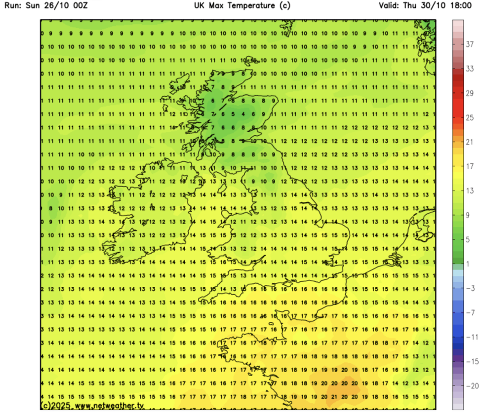
Southern Britain could see highs of 15C and 16C over the coming days, as shocked meteorologists announce a "highly unusual" autumnal glow.
British Weather Services’ Jim Dale said: “We are getting to the end of October, and parts of southern England are probably going to see 16C this week.
“This is highly unusual at a time of year when we should be seeing widespread frosts and temperatures much, much lower.
“Southerly winds from the Continent will bring a very mild period through the week.”
The mild snap will follow a chilly weekend which brought the first frosts of the season and a dusting of snow over the hills.
Temperatures are on the rise
|NETWEATHER
A deep cyclonic low-pressure storm skimming the south brought Storm Benjamin’s winds to English Channel coasts.
This chased the heels of a two-week gloom, wedged over Britain by a giant high-pressure anticyclone.
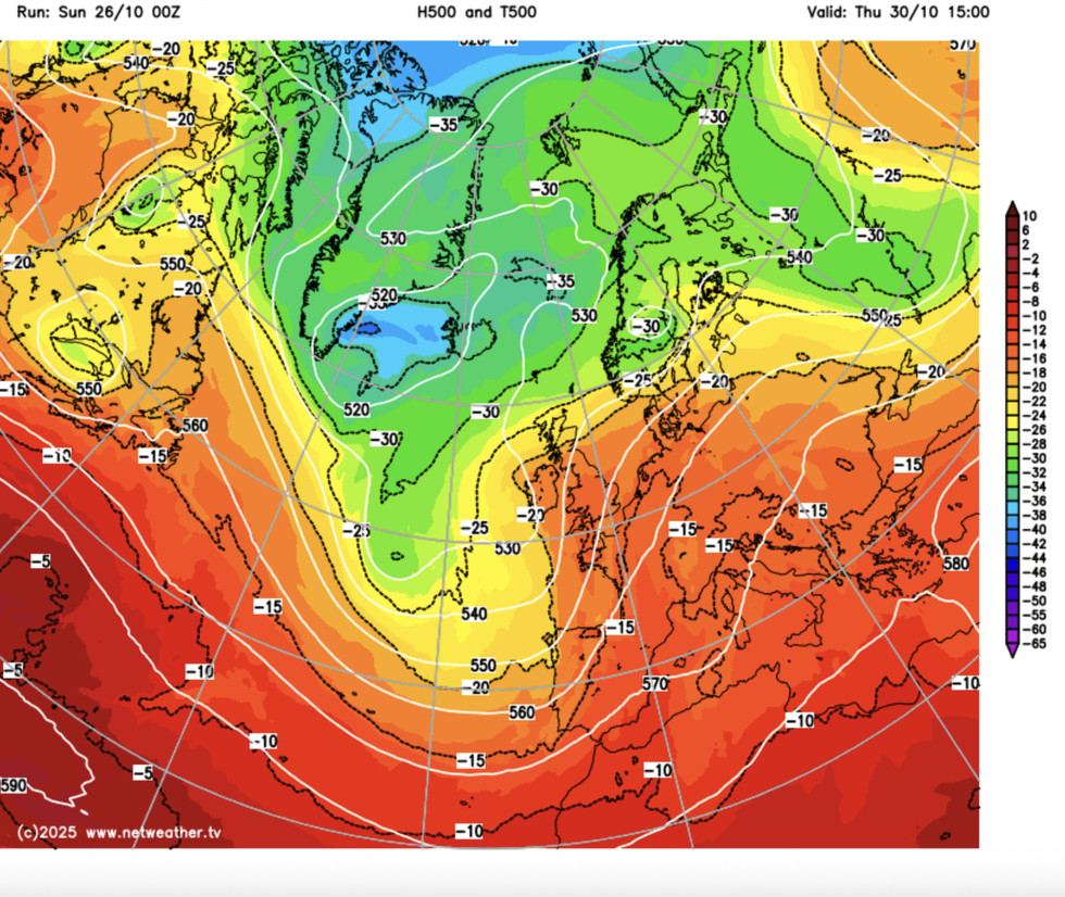
The weather this week is once again on the turn, with some wind and rain around before warm gusts enter from the south.
Met Office meteorologist Alex Burkill said: “As we head towards the middle of the week, our model shows low pressure towards the west and higher pressure toward the south.
LATEST DEVELOPMENTS
The weather in Britain is set for another dramatic turn
|NETWEATHER
“Other models have high pressure more amplified, and that suggests we could have some largely fine drier weather.
“By the end of the week, it looks like there will be low pressure nearby, and we will be dragging in our air from the south, so things could warm up and it will be milder.”
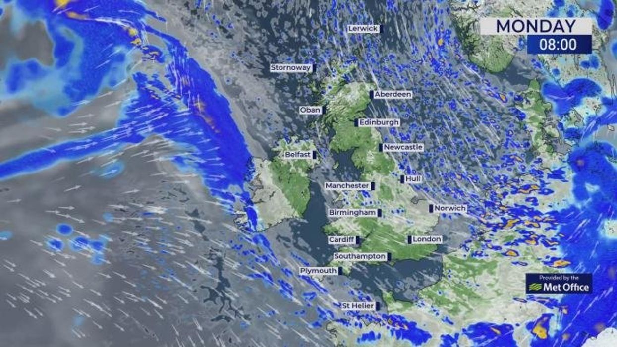
Low pressure shifting to the east on Monday will bring a spell of unsettled weather to parts of the country.
It will keep temperatures down for the next couple of days before the mercury bubbles into the teens.
A Met Office spokesperson said: “As high-pressure builds, there is the potential for some drier and brighter weather next week, although rain will return at times, especially in the northwest.
“For those planning outdoor activities such as pumpkin picking or Halloween celebrations, it will be important to wrap up warm and secure any decorations, as it will remain chilly and breezy.”
But, by the weekend, winter coats, scarves and gloves should be back in the wardrobe.
Burkill said: “There will be some wet weather around, but it doesn’t look particularly impactful through the early part of the week, and still a bit on the chilly side.
“Then, during the middle of the week there is a transition to something a bit quieter, before there is more changeable weather waiting in the west as we go from Thursday and into Friday.
“So, there will be some rain and some stronger winds but also some drier weather, and towards the middle of the week, the weather looks a little bit calmer, and temperatures are set to rise.”