


A balmy blast with a stormy sting in the tail will put Britain in the crosshairs of three weather cyclones.
As temperatures through the coming days waft into the mid-to high teens, waiting in the wings is a conveyor belt of wind and rain.
Britons will enjoy warmer gusts from the south as the risk grows of mid-autumn turning "increasingly unsettled".
Jim Dale, meteorologist for British Weather Services, said: “There are three areas of low pressure heading towards the UK over the next week or so.
“The first, just after mid-week, doesn’t look too bad, then there are two more with the third after the weekend looking the worst.
“Worst affected will be the west and the northwest, with the heaviest rain and gusts.”
Higher temperatures will give "cyclonic" low-pressure systems an extra boost as they barrel in, he warned.
Western coasts face the worst of the weather, although a slight gear change of the jet stream could unleash a more widespread hammering, he added.
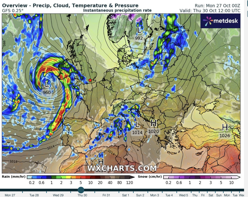
Western coasts face the worst of the weather, although a slight gear change of the jet stream could unleash a more widespread hammering
|WXCHARTS
He said: “This is something we are going to be watching over the next few days as these cyclonic patterns come towards the UK.
“They are coming from the south, and with higher temperatures, they will arrive with more energy.
“They are most likely to skim up the western coast, but with a slight change in direction, more of the country could see some action.”
Temperatures over the coming days are expected to hit the mid-teens thanks to northerly winds giving way to southerlies.
LATEST DEVELOPMENTS
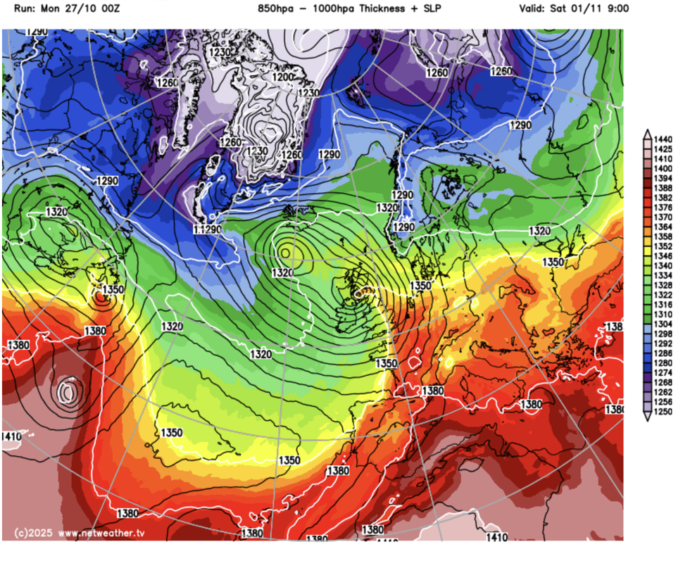
Calmer spells will be shaken by low-pressure from the west painting mixed picture
|NETWEATHER
Southern Britain could hit 16C by Wednesday, while much of the country hovers above average for almost winter.
Calmer spells will be shaken by low-pressure from the west painting mixed picture for Halloween.
Met Office meteorologist Alex Burkill said: “There is quite a mobile set up to start the week, and there will be more changeable weather at times, but the middle of the week looks drier and calmer.
“There are strong signs that we are going to see temperatures really rising as we go through the back end of the week and head towards Halloween.
“During the middle part of the week, we will get a southerly flow and that is going to lead to our temperatures rising.”
The mild spell will follow a chilly weekend which saw temperatures to the north drop below freezing.
Parts of the country will be quicker to recover with Scotland and northern England catching up at the weekend.
Met Office meteorologist Marco Petagna said: “We start the week with a pretty unsettled note, with a keen north to north-westerly wind.
“Temperatures will be on the chilly side, particularly across the north of the UK, and there could be some snow across the high ground of Scotland, and temperatures in the north low enough for a touch of frost.
“Low pressure will stay in charge, with the best of the sunshine towards southern parts of England and Wales.
“There could even be some further snow to come across the highest ground of Scotland."