


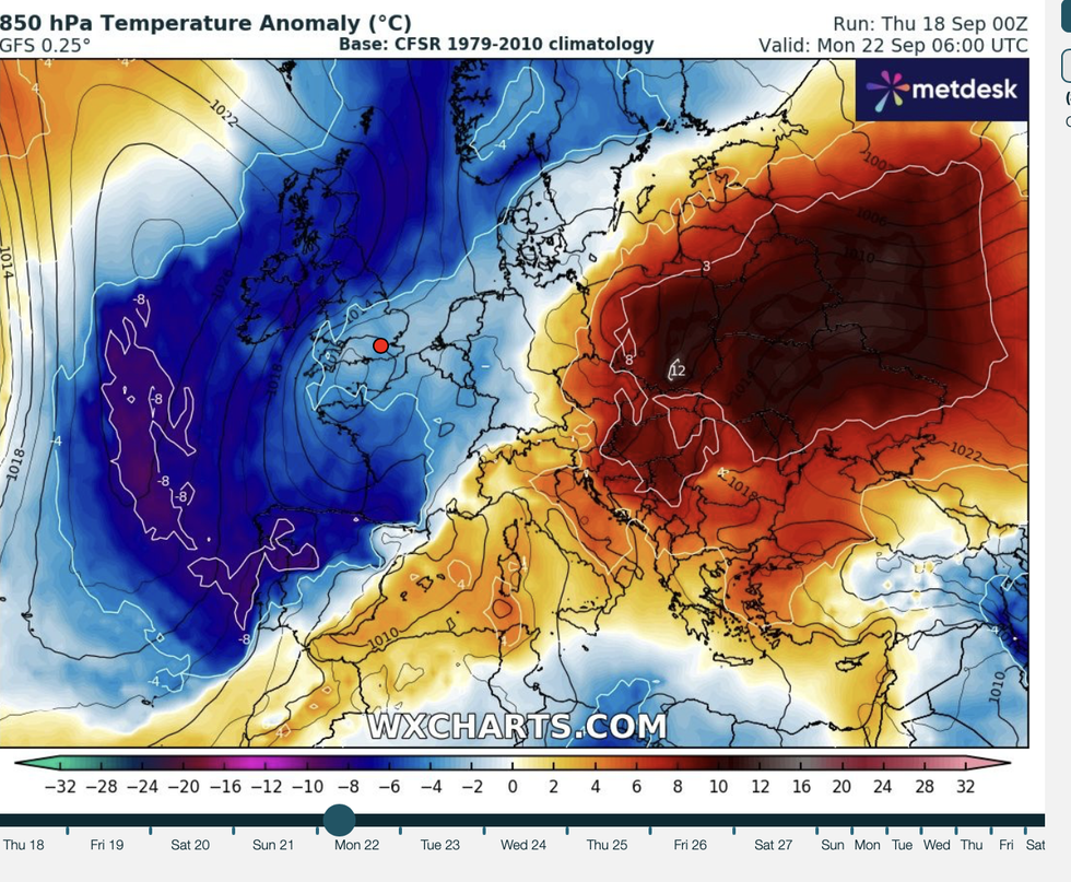
A Scandinavian ice-dome is set to plummet temperatures from a 26C heat into thick autumn fog, frost and a dusting of snow.
A major U-turn next week will see southerly winds give way to chilly gusts from the Arctic circle.
Steering the chill will be a huge high-pressure "anticyclone" descending across the country.
Much like a summer "heat dome", high pressure that dominates later in the year swaps roles instead cranking down the thermostat.
Met Office meteorologist Alex Deakin said: “As the jet stream shifts to the north, high pressure is allowed to build in, certainly across northern areas for the early part of next week.
“There is quite a strong signal for the Scandinavian high taking over through the early to middle part of next week.
“On Wednesday and Thursday, the most likely scenario is for the high to be sitting to the north, a true Scandinavian high.
“With high pressure sitting to the north of the UK, there will be much drier conditions here, and this means that it will bring something a little bit cooler in but also a bit drier.”
LATEST DEVELOPMENTS:
Temperatures are set to plunge in just days
|WXCHARTS
Chilly mornings could arrive with a touch of frost with falling overnight temperatures driving mist and fog, he said.
The arrival of high pressure will follow another couple of days of wet and windy weather as stormy lows head in from the Atlantic, he added.
He said: “In the short term we are going to see some wet and some warm weather shifting to something a bit drier and a bit colder.
“The jet stream is in a mobile position, sending weather systems our way quite rapidly with wet and windy weather whizzing through.
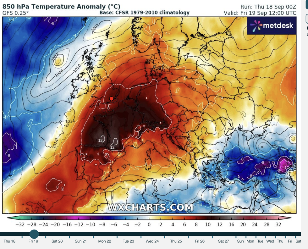
A 26C heat blast is set to hit parts of Britain today
|WXCHARTS
“Next week, the jet takes a more amplified position, with the jet doubling back on itself and generating a cut-off low pressure system, so we will see further wet weather over the next few days.
“With light winds, at this time of year, under high pressure, there is an increased chance of seeing mist and fog in the mornings.”
Weather models for the start of next week show Scotland may see the first dusting of snow.
In the meantime, temperatures across the south in the high 20Cs will be driven by cyclonic systems spinning over Britain.
They will be boosted by a strengthening jet stream and warm ocean temperatures after the summer heatwave.
Dale said: “There is a lot of energy in the sea around the UK, and this is going to feed into storms as they come across the Atlantic.
“As these move to the north of the country, they will pull in warm air from the south, and we could see temperatures in the mid- to high-20Cs.”
A dipped ‘trough’ in the jet stream will plunge over Britain adding to the wet and windy weekend outlook.
Met Office meteorologist Aidan McGivern said: The south and the southeast will stay drier with the strongest winds across northern Scotland.
“The trough of the jet stream is going to slowly push across the UK during the weekend and start of next week potentially brining some heavy showers.
“However, the net impact is that we have a big ridge of the jet stream to the west of the UK and high pressure building, and that ultimately is likely to cross the UK as we go through next week, and that could be the end to the very wet weather and bring a drier end to September.”