


The Met Office has announced a yellow weather warning for heavy rainfall across large parts of the UK this weekend, raising concerns about potential flooding and widespread disruption.
The alert takes effect from 9am on Saturday and continues until 6am on Sunday, covering regions throughout Scotland, Wales, Northern England and the North East.
Forecasters predict between 20-40mm of rainfall across affected areas, though some locations could experience between 75-100mm during the warning period.
The heaviest downpours are expected during the later stages of Saturday.
Strong gusty winds and possible thunderstorms will accompany the rainfall from mid-Saturday, creating additional hazards.
The combination of intense precipitation and winds significantly increases disruption risks across transport networks and essential services.
Multiple regions face severe weather impacts, with Scotland's central belt including Glasgow and Edinburgh under alert alongside the Borders region.
Wales will see the warning affect ten counties including Carmarthenshire, Ceredigion, Conwy, Denbighshire, Flintshire, Gwynedd, Anglesey, Pembrokeshire, Powys and Wrexham.
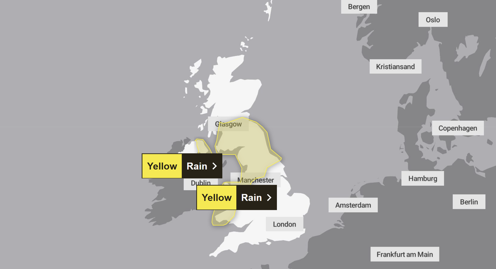
The yellow weather alert has been issued for large parts of the UK
|MET OFFICE
TRENDING
Stories
Videos
Your Say
Northern England faces comprehensive coverage, with the North East entirely affected.
The warning extends to Yorkshire and Humber, while northwest England includes Chester, Ellesmere Port, Neston, Frodsham, Helsby, Runcorn and Widnes.
Scottish areas specifically mentioned include West Dunbartonshire, Strathclyde, Central, Tayside, Fife, Edinburgh, East Lothian, Midlothian, West Lothian, Falkirk and the Scottish Borders.
Higher ground in Scotland may see precipitation falling as snow rather than rain. The most intense rainfall is anticipated to occur during Saturday's later hours, with conditions gradually improving by Sunday morning.
LATEST DEVELOPMENTS
- UK weather: Two-day monsoon deluge threatens flooding in parts of Britain as the Met Office issues yellow warning for rain
- UK weather: Tornadoes could strike across 357-mile zone as Met Office wind warning comes into force in just hours
- UK weather: Cyclonic storm system to barrel through Britain as warnings in place for flying debris and damage to buildings
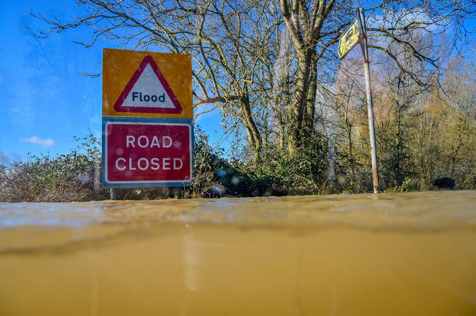
There could be areas of flooding in rural areas near riverbanks
|PA
Shropshire currently faces immediate flood concerns, with the Environment Agency issuing alerts for the Severn Vyrnwy confluence following recent heavy rainfall.
Rivers are rising rapidly, threatening low-lying areas and farmland throughout Wednesday afternoon.
The agency expects the river to reach between 3.2m and 3.6m at Llanymynech and 1.5m to 2m at Cae Howel.
Affected locations include the Welsh border at Llawnt through to Shrawardine near Shrewsbury, plus Llanymynech, Maesbrook and Melverley.
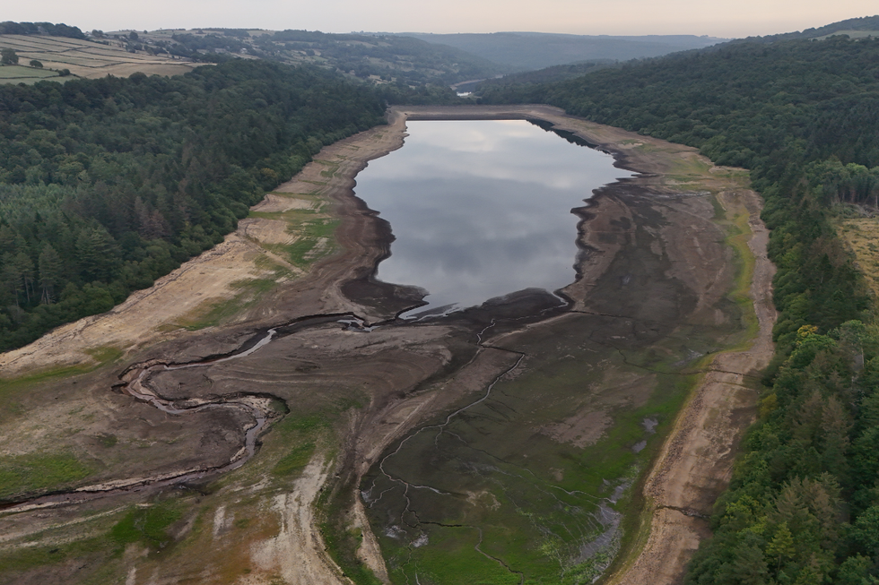
Low water levels have caused issues at Broomhead Reservoir in South Yorkshire
|PA
Despite recent precipitation, England continues experiencing drought conditions following the driest January-to-August period since 1976.
Reservoir levels remain critically low at 56.1 per cent capacity compared to the typical 82.8 per cent for September.
Chairman of the Environment Agency Alan Lovell said: "While we have seen some recent rain, it is nowhere near enough to reverse the impact of the last seven months, which have been the driest since 1976.
"We are calling on everyone to continue to take simple steps to reduce their water use and are grateful to people for following the restrictions imposed by water companies."
The Met Office advises residents in flood-prone areas to develop contingency plans and assemble emergency supplies.
Essential items include torches, batteries, mobile phone power banks and other necessities to manage potential power outages.
Authorities warn of a small possibility that fast-moving or deep floodwater could pose life-threatening dangers.
Property flooding remains a risk, potentially causing structural damage to homes and commercial buildings.
Transport networks face significant disruption prospects, with possible delays or cancellations affecting train and bus services.
Road users should expect hazardous driving conditions due to surface water and spray, with some routes potentially becoming impassable.