


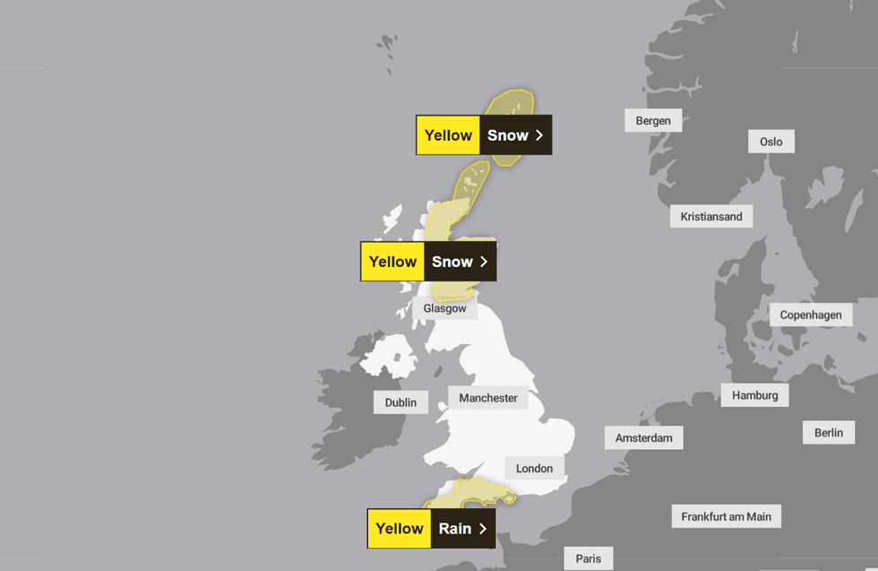
The Met office has issued a number of yellow weather warnings across the UK for the next three days.
Covering southwest England and north Scotland, the warnings alert of heavy rainfall and snow in the regions respectively.
Today’s yellow warning for southwest England anticipates significant rainfall, which may lead to flooding, power cuts, difficult driving conditions and travel disruption.
GB News Weather Correspondent, Nathan Rao, said: “A further two inches of rain from today will drench the southwest, already submerged after a triple-whammy assault from [Storms] Goretti, Ingrid and Chandra.
TRENDING
Stories
Videos
Your Say
“The weekend respite will give way to yet another deluge as the fired-up jet stream lobs rain-laden low-pressure storms into the UK.”
Rain is expected to become heavier overnight, gradually clearing over Tuesday, but may persist in the northeast of the warning area until tomorrow evening.
Southern England saw 74 per cent more rainfall than usual in the month of January, with Cornwall experiencing its wettest on record.
Due to this, persistent rainfall over the next few days might cause flooding due to an already water-saturated ground.
The yellow warnings will be in place from today until Wednesday
|MET OFFICE
The Met Office has warned there is a “small chance” of potential “danger to life” if flooding occurs.
The warning also states: “There is a small chance that some communities will become cut off by flooded roads.”
Homeowners should check if their property is at risk of flooding and prepare accordingly, the Met Office advises.
The yellow weather warning, in place from 6pm tonight until 9pm tomorrow, is classified as very-low likelihood, but medium impact.
LATEST DEVELOPMENTS
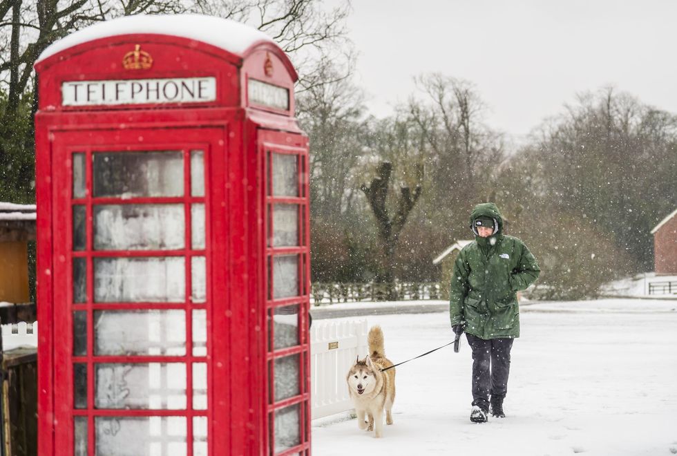
For north Scotland, rain turning into sleet, then snow is expected to hit through Tuesday into Wednesday, along with strong winds
|PA
For north Scotland, rain turning into sleet, then snow is expected to hit through Tuesday into Wednesday, along with strong winds.
The Met Office warns of longer journey times for road, bus and trains, advising travellers to check timetables before leaving the house.
According to the Met Office alert, blizzard-like weather may occur in some areas.
The warning states: “By Wednesday accumulations of 1-3 cm [of snow] are expected above 100 metres, with perhaps up to 5 cm in some places.
“For ground above 200 metres, accumulations of 10 cm are expected with some places locally seeing up to 20 cm.”
The warning, due to last from midnight tonight to 3pm Wednesday, has been classified as medium likelihood, but low impact.
Drivers should check conditions before travelling, giving extra time to journeys and being wary of road closures, advises the national forecaster.
The Met Office also states weather warnings are subject to change, so those in impacted areas should continue to monitor the weather.
Relatively dry, cloudy weather, with some light showers is expected for the rest of the country.
However, the UK might see a repeat of January’s wet weather due to incoming Atlantic storms.
Rao said: “Early signs show shifting high pressure to the north after the weekend may bring a calmer interlude.
“But in close pursuit will be the next bout of Atlantic storms, with wet weather threatening to hold out through the rest of February.
“Dominant, stormy low-pressure will stay in charge for the next 10 days at least, according to long-range experts.”