


Britain faces flood hell through the rest of winter as the Atlantic gates open to another week of relentless downpours.
While signs have emerged of drier weather from next week, it will be brief with the rest of the month threatening a "repeat of January".
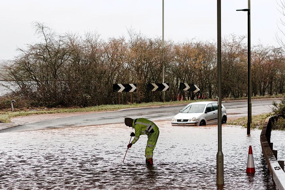
A further two inches of rain from today will drench the southwest, already submerged after a triple-whammy assault from Goretti, Ingrid and Chandra.
The weekend respite will give way to yet another deluge as the fired-up jet stream lobs rain-laden low-pressure storms into the UK.
TRENDING
Stories
Videos
Your Say
Government forecasters have taken the unusual step of issuing warnings below the standard threat threshold as the region teeters on the brink of flood disaster.
Met Office meteorologist Alex Burkill said: “There is more persistent rain into the start of the week, and we could see 20mm, 30mm, 40mm or 50mm of rain building up from Monday into Tuesday.
“We ordinarily wouldn’t be issuing a rain warning for these kind of totals, but because of the flooding we saw earlier, and because the ground is so saturated, we are likely to see some more issues because of this wet weather coming through.”
Stormy low-pressure systems driving in on jet stream winds continue to plough the country with bands of persistent rain.
Wet weather is threatening to hold out through the rest of February
|GETTY
Early signs show shifting high pressure to the north after the weekend may bring a calmer interlude.
But in close pursuit will be the next bout of Atlantic storms, with wet weather threatening to hold out through the rest of February.
Mr Burkill said: “There are signs that high pressure will back away from Scandinavia towards Greenland, and that could shift the pressure set up further south, and that means that we are more likely next week to see our low-pressure systems travelling a little bit further south and affecting the UK a little bit less.
“But it doesn’t look like it is going to last very long, because it looks likely that we would see the repeat of what we have seen through much of January.”
LATEST DEVELOPMENTS
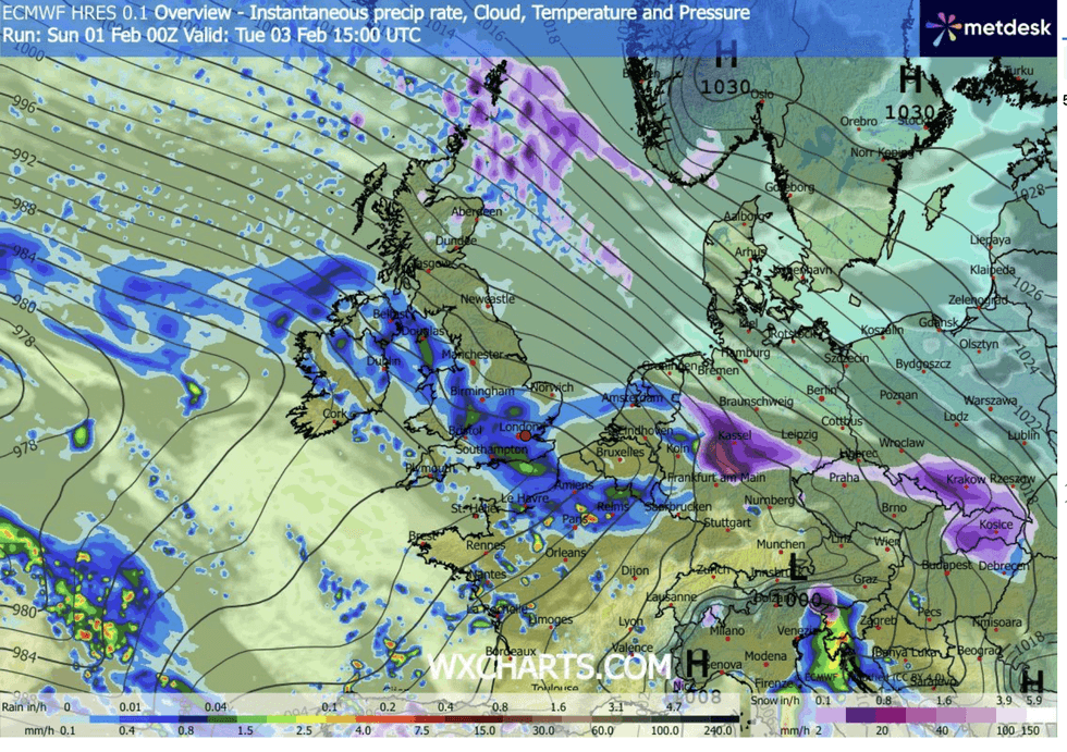
Regions most at risk through the coming days will be the southwest, Wales, and parts of Scotland
|WXCHARTS
Regions most at risk through the coming days will be the southwest, Wales, and parts of Scotland.
Dominant, stormy low pressure will stay in charge for the next 10 days at least, according to long-range experts.
Jim Dale, meteorologist for British Weather Services and co-author of ‘Surviving Extreme Weather’, said: “There is going to be little to no change for the next week at least, with the theme being more wet weather coming in from the Atlantic.
“Most at risk will be southern regions, although there will be a risk further north, particularly in parts of Scotland.
“This is the effect of high pressure over Scandinavia pushing low pressure further south, bringing bands of rain through the UK.”
Rain warnings are in force in the West Country through today and tomorrow, where the risk remains of flooding and disruption.
A Met Office spokesman said: “While there is some uncertainty, outbreaks of rain may become persistent on Monday, especially later in the day and overnight, before gradually easing and clearing into Tuesday.
“Given saturated ground following recent rain, there is a chance this may lead to some flooding and disruption in places.”
Our Standards: The GB News Editorial Charter