
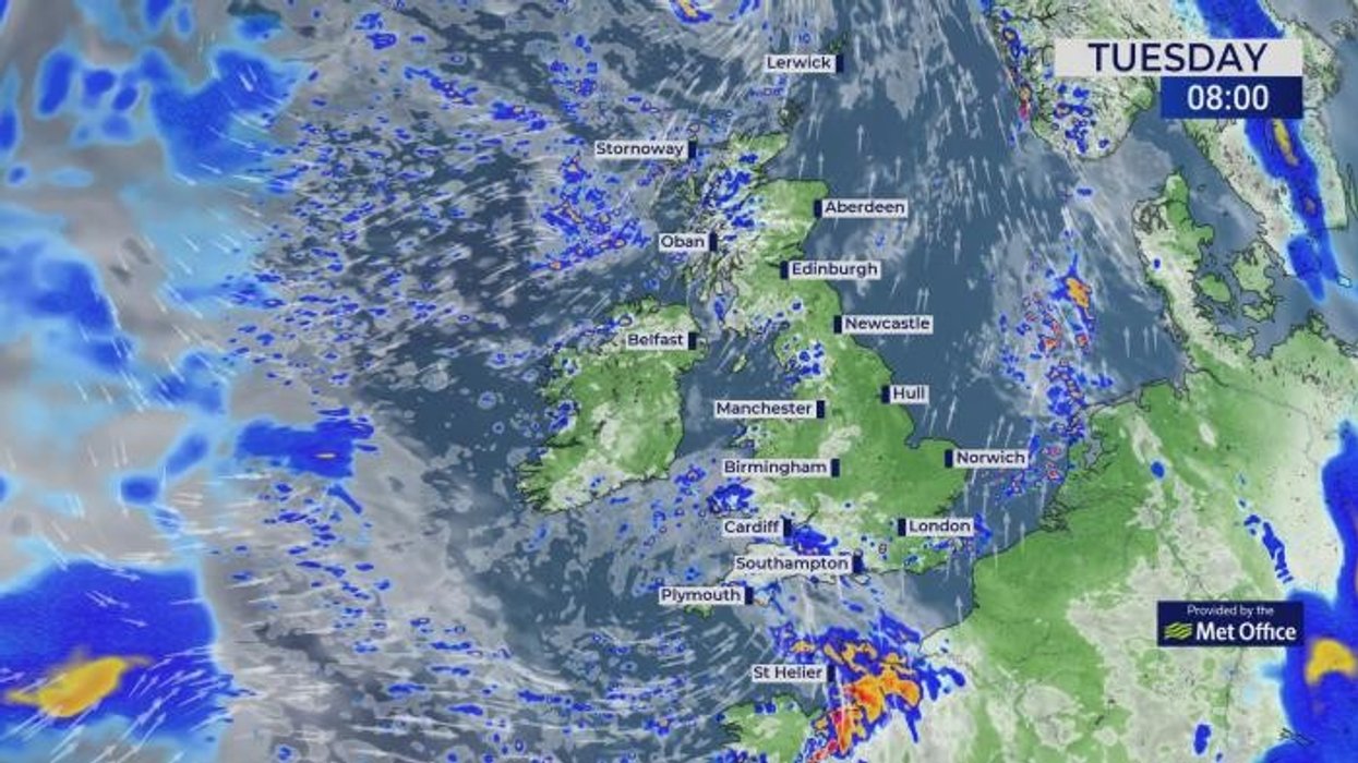


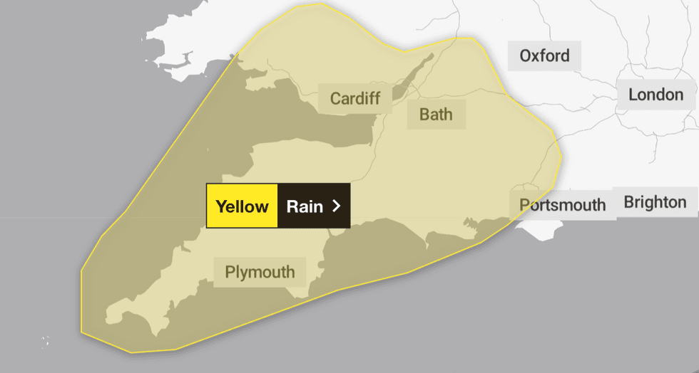
The Met Office has issued a yellow weather warning for rain as Britons are urged to prepare for heavy showers and thunderstorms.
The warning is in place from midnight until 2pm tomorrow.
Areas affected include London and the South East, South West and Wales.
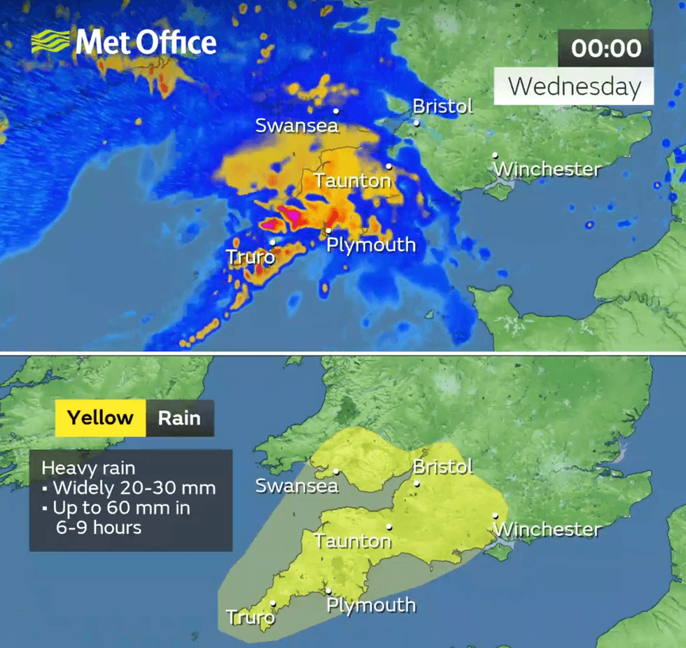
Some places could see 40-66mm of rainfall within a period of six to nine hours.
The Met Office stated: "Heavy rain and strong winds will move northeast through the first part of Wednesday, followed by heavy showers and some thunderstorms, these becoming more isolated through the afternoon."
The forecaster said homes and businesses could flood in the areas covered by the warning.
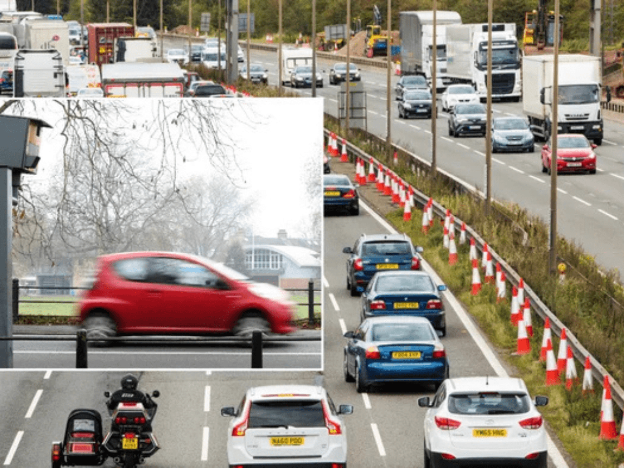
Motorists have been warned that flooding on roads could make journey times longer.
Bus and train services could also be impacted.
LATEST DEVELOPMENTS:
The Met Office has issued a yellow weather warning for rain
|MET OFFICE
Forecaster Met4Cast said there could potentially be a "few brief tornados" in some parts of the country.
"Low pressure drifting north and an associated cold front will drive heavy showers northeastwards across England & Wales on Wednesday," Met4Cast wrote to X.
It added: "The primarily severe risk is large hail and strong wind gusts particularly across the southeast Midlands, East Anglia and extending into parts of southeast England, however given low cloud bases and moderate low level shear (LLS) there is the potential for a few brief tornadoes."
The wet weather follows Britain's hottest summer since records began.
The weather warning will be in place for 14 hours from midnight
|MET OFFICE/X
Met Office data released yesterday suggested temperatures averaged around 16.10C throughout June, July and August.
The provisional figure surpasses the previous record of 15.76C from 2018, marking another milestone in the nation's warming climate.
The unprecedented heat followed what was the UK's warmest spring on record, creating months of sustained high temperatures across the country.
Here is a full list of the areas affected by the latest Met Office weather warning:
London & South East England
- Hampshire
- Southampton
- West Berkshire
South West England
- Bath and North East Somerset
- Bournemouth Christchurch and Poole
- Bristol
- Cornwall
- Devon
- Dorset
- Gloucestershire
- North Somerset
- Plymouth
- Somerset
- South Gloucestershire
- Swindon
- Torbay
- Wiltshire
Wales
- Blaenau Gwent
- Bridgend
- Caerphilly
- Cardiff
- Carmarthenshire
- Merthyr Tydfil
- Monmouthshire
- Neath Port Talbot
- Newport
- Powys
- Rhondda Cynon Taf
- Swansea
- Torfaen
- Vale of Glamorgan