


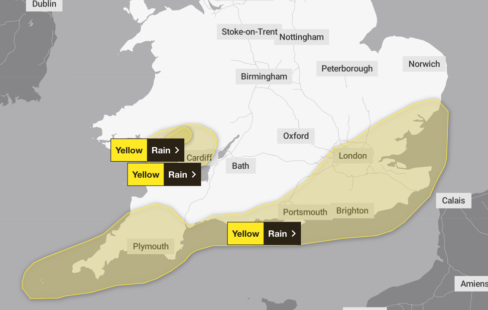
The Met Office has issued yellow weather warnings covering several parts of the country as Britons brace for heavy rain.
Parts of the East of England, London and the South East, the South West and Wales are affected, with the warning coming into affect in these areas from 10pm today until 12pm tomorrow.
The forecaster has warned of heavy showers, with 50-70mm of rainfall possible in a few hours in some areas.
This could result in flooding in these areas, the Met Office said.
The showers could be accompanied by thunder, though this will likely be near to coasts.
The wet weather could lead to travel disruption, including on the roads and to public transport, with bus and train journeys likely to take longer.
The Met Office said: "Heavy showers, perhaps merging into longer spells of heavy rain at times, are likely to reach southwest England and south Wales Thursday night, before pushing quickly east to affect other parts of southern and southeastern England into Friday morning."
LATEST DEVELOPMENTS:
- UK weather: 'Polar Maritime airmass' triggers heavy rain as Hurricane Erin threatens 'false autumn' washout
- UK weather: Britain to be bashed by deluge of electrical thunderstorms as bank holiday heat clears
- Archaeology breakthrough: Long-lost English monasteries revealed below ground after dry summer weather
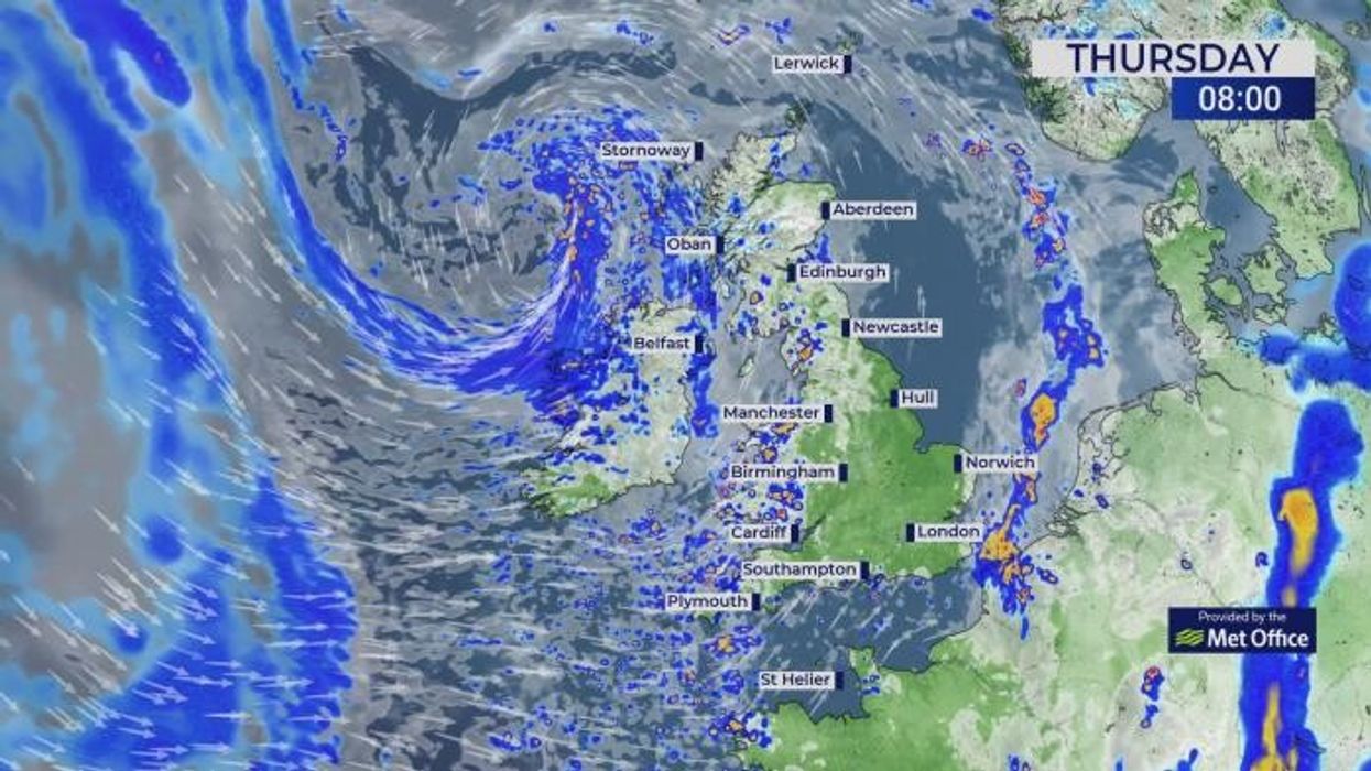
Several parts of the UK are covered by the weather warnings
|MET OFFICE
Another yellow weather warning for rain was already in place for parts of Wales, including Swansea and Bridgend, from 8am today, ending at 4pm.
Wet and windy conditions are sweeping across Britain as the meteorological summer reaches its end.
The Met Office has predicted strong winds and heavy rain will hit many parts of the country on Saturday.
Deputy Chief Meteorologist, David Oliver, said: “A deep area of low pressure will develop close to the UK on Saturday and track northeast over the weekend, bringing wet and windy weather for many.
“While the exact track and depth of the system is still a little uncertain, at present it looks likely that we’ll see gusts in excess of 50mph in some areas during Saturday and Sunday, especially across coasts, headlands and high ground.
"In addition to these gusty winds, 10-20mm of rain is likely across many regions, with higher totals over hills in western areas.”
The unsettled weather marks the remains of Hurricane Erin which hurtled across the Atlantic and died in the cold waters of the North Atlantic.
Here is a full list of all the areas affected by the latest yellow weather warning:
East of England
- Essex
- Hertfordshire
- Southend-on-Sea
- Suffolk
- Thurrock
London & South East England
- Bracknell Forest
- Brighton and Hove
- Buckinghamshire
- East Sussex
- Greater London
- Hampshire
- Isle of Wight
- Kent
- Medway
- Portsmouth
- Slough
- Southampton
- Surrey
- West Sussex
- Windsor and Maidenhead
- Wokingham
South West England
- Bournemouth Christchurch and Poole
- Cornwall
- Devon
- Dorset
- Isles of Scilly
- Plymouth
- Torbay
Wales
- Blaenau Gwent
- Bridgend
- Caerphilly
- Cardiff
- Carmarthenshire
- Merthyr Tydfil
- Monmouthshire
- Neath Port Talbot
- Newport
- Powys
- Rhondda Cynon Taf
- Swansea
- Torfaen
- Vale of Glamorgan