


A cyclonic strike threatening a rain-drenched start to autumn will also usher a last gasp of summer warmth.
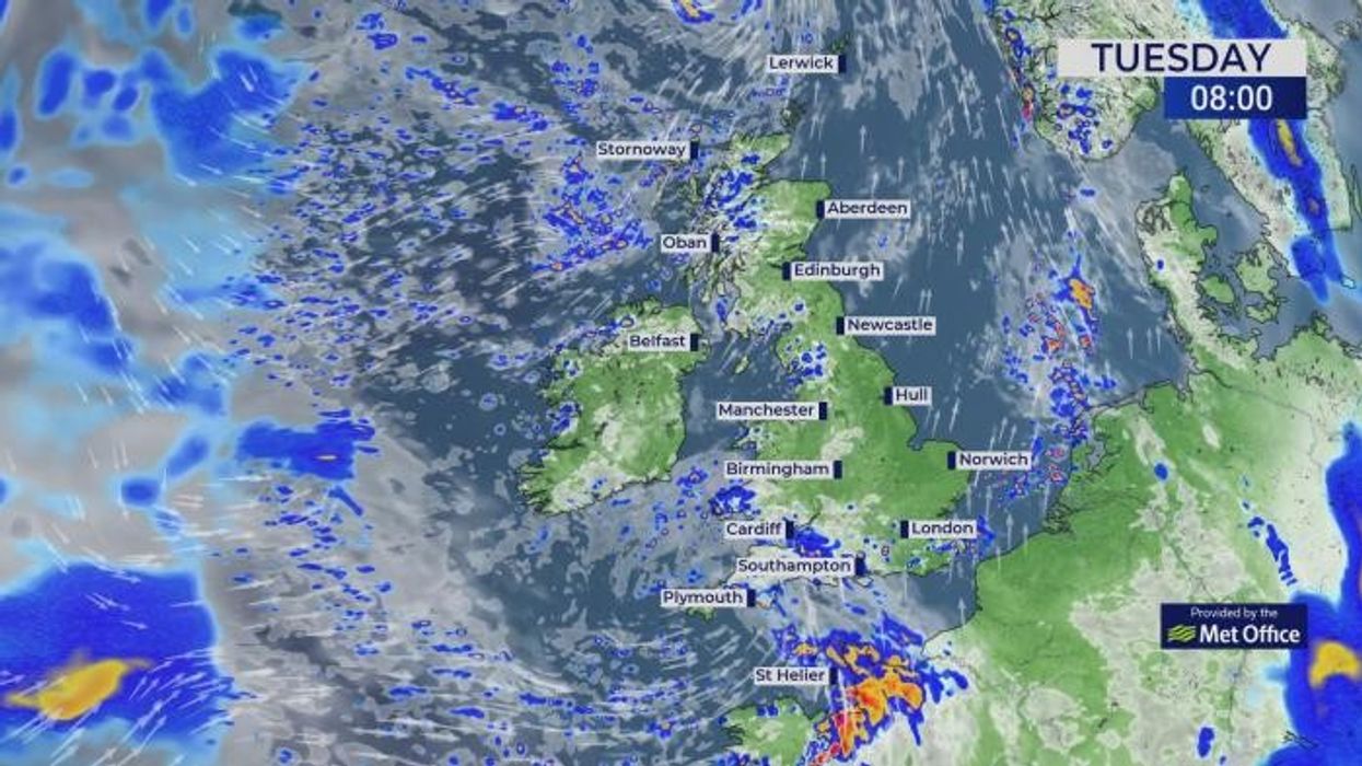
Low-pressure storm systems lined up off the west coast this week will drag bands of heavy rain across Britain.
But while western regions take cover for the deluge, the other side of the country will watch the mercury rise.
Temperatures across eastern counties through this week are poised to nudge back into the mid-20Cs.
A cyclonic strike threatening a rain-drenched start to autumn will also usher a last gasp of summer warmth
|WXCHARTS
Jim Dale, meteorologist for British Weather Services, said: “It is going to feel quite warm in the east of the country through the next week, with temperatures of 23C or 24C likely in parts.
“Low pressure from the west as it approaches will drag in warmer air from the south, although western parts of Britain will face the brunt of the unsettled weather.
“The Atlantic is waking up as we go into the start of autumn, and that will bring the risk of potentially disruptive unsettled weather.”
The change from weeks of rainless skies will be driven by high pressure giving way to "cyclonic" low pressure from the Atlantic.
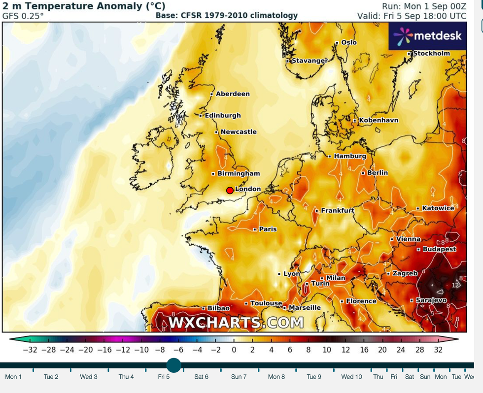
Temperatures across eastern counties through this week are poised to nudge back into the mid-20Cs
|WXCHARTS
A shift in position of the jet stream will steer unsettled lows across the Atlantic, strengthening them on the way.
A nationwide split through the coming days will put western coasts in the firing line for heavy rain and potentially strong winds.
Dale added: “There are some strong weather fronts coming in from the west, and primarily these will affect the west of the country.
“Ordinarily, these would be quite weak at this time of year, but with sea temperatures unusually high, there will be a lot of energy to give to these systems.
“There is a growing risk of potentially stormy weather during the middle of the week.”
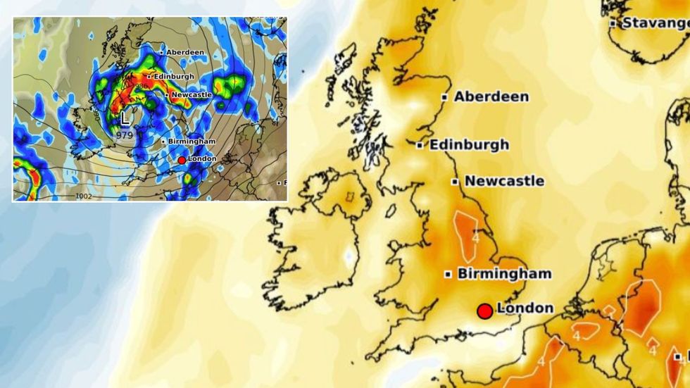
Weather models reveal a deep low-pressure system sweeping eastwards through the middle of the week.
As the Met Office reveals its annual list of autumn storm names, experts are tentatively watching for the emergence of the first named tempest – Amy.
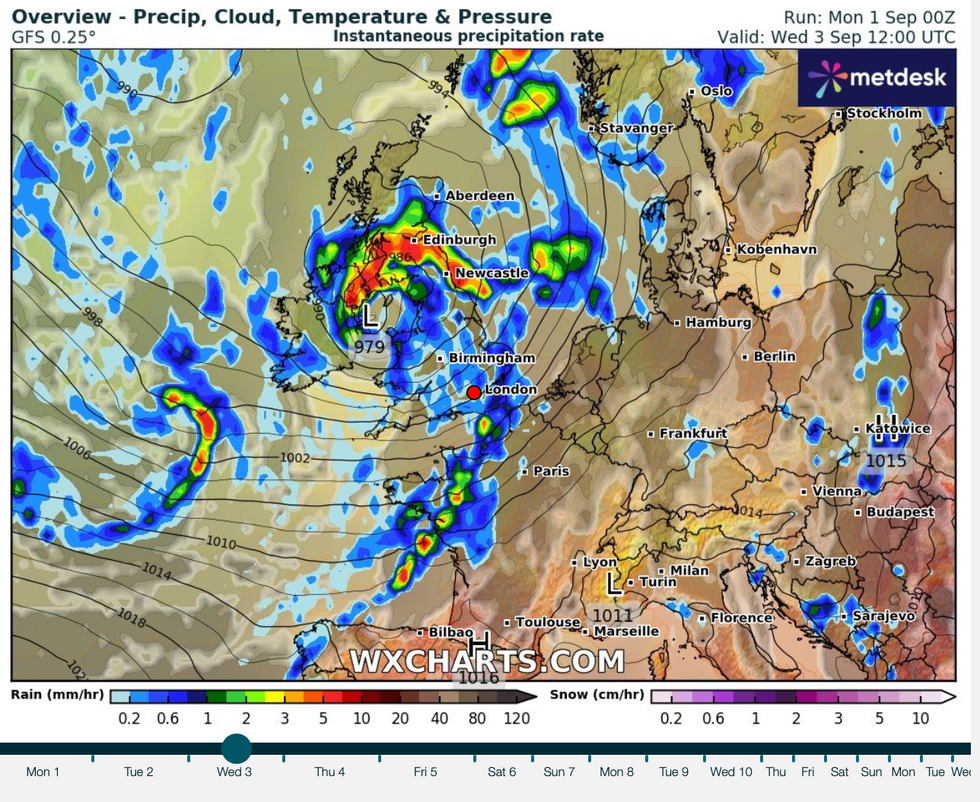
Weather models reveal a deep low-pressure system sweeping eastwards through the middle of the week
|WXCHARTS
With the wind and rain, Britons are also warned to take cover for thunderstorms and the risk of hail.
A Met Office spokesman said: “Changeable weather conditions are expected across the UK from Friday, with low pressure systems tending to dominate the pattern, and this means showers or longer spells of rain will affect much of the UK.
“Some heavy rain or showers are expected in places, most often in the west with thunderstorms and hail also possible.
“There could be some spells of strong winds if any deep areas of low pressure form in the vicinity of the UK.”