


Britain’s mini-heatwave will erupt in a thundery deluge as the nation braces for another weekend storm.
Near-record April temperatures of 26.6C will tumble below average in parts as bands of rain sweep in from the Atlantic.
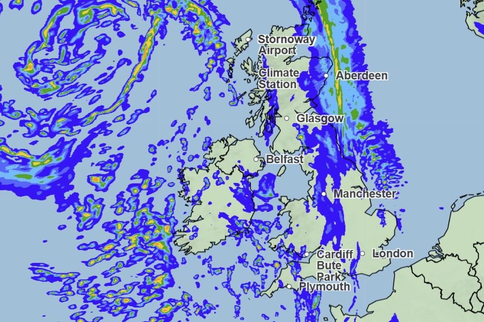
Western regions are in the firing line for the worst of the unsettled weather as the southeast holds on to another day of warmth.
It follows Storm Dave’s Easter downpours, although a more northerly path of the system will spare Britain a similar assault.
TRENDING
Stories
Videos
Your Say
Met Office meteorologist Annie Shuttleworth said: “There is a change on the way from Thursday; not only colder air but unsettled air is coming in, so there will be an increase in rain, colder nights, and windy days.
“At the weekend, an area of low pressure develops to the southwest of the UK, and there is the potential for a fairly windy spell, but nothing like we saw with Storm Dave.
“But there is a more unsettled turn to the end of the week with a showery, cooler setup to come.”
Similar to Storm Dave, low pressure will join forces with the jet stream to strengthen as it heads towards the UK.
 |
| MET OFFICE
The jet stream is unusually strong after being fired up by a cold snap over North America.
The storm will pass to the north of Scotland ahead of the weekend, sweeping chilly winds in from Greenland.
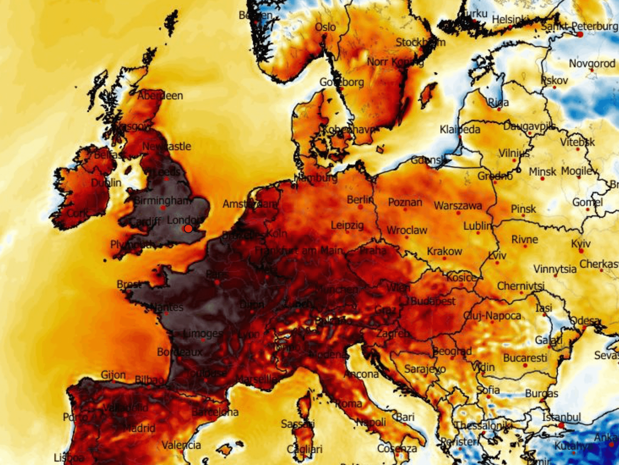
It follows the hottest day of the year so far, with temperatures hitting 26.6C at Kew Gardens, London, yesterday.
Met Office meteorologist Liam Eslick said: “It is going to start to turn a little bit more unsettled by the back end of the week.
LATEST DEVELOPMENTS
“We are keeping our eye on a low-pressure system that is interacting with the jet stream as it moves across the Atlantic.
“As it moves from the southern half to the northern half, it will deepen rapidly and it will intensify the winds, but the position and the timing of the low is uncertain.
“It looks like it will stay to the north west of the UK, and it looks like it will turn wet and windy across the western half, so Northern Ireland and Wales and possibly the western half of Scotland is likely to see the influence of this low pressure.”
The U-turn will follow one of the warmest April spells on record as temperatures mid-week rocketed into the mid-20Cs.
Warm air from North Africa brought summer-like sunshine to swathes of the country as the mercury peaked yesterday.
Southeastern regions will hold on to the warmth today before the whole country turns cooler for the weekend.
Ms Shuttleworth said: “On Thursday, you really will notice the difference, with a close to 10C difference, but it could still be a warmer day in some southeastern areas with 25C once again.
“By Friday, the cold air is pushed in widely across the UK, with temperatures about average or a little bit below average for northwestern areas.
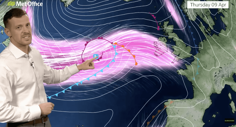
Liam Eslick warns the storm will be strengthened by the jet stream
|MET OFFICE
“It doesn’t look like a total washout but unsettled and cooler, with southeastern areas getting the best of any drier weather.”
Jim Dale, meteorologist for British Weather Services and co-author of ‘Surviving Extreme Weather’ added: “Temperatures are much lower this weekend with a plume of rain coming in from the west.
“But we could see high pressure return next week.”