


A 75C heat plume about to surge in from the tropics will sizzle Britain in an early taste of summer.
Temperatures will rocket from tomorrow as southerly winds pull in balmy gusts from North Africa.
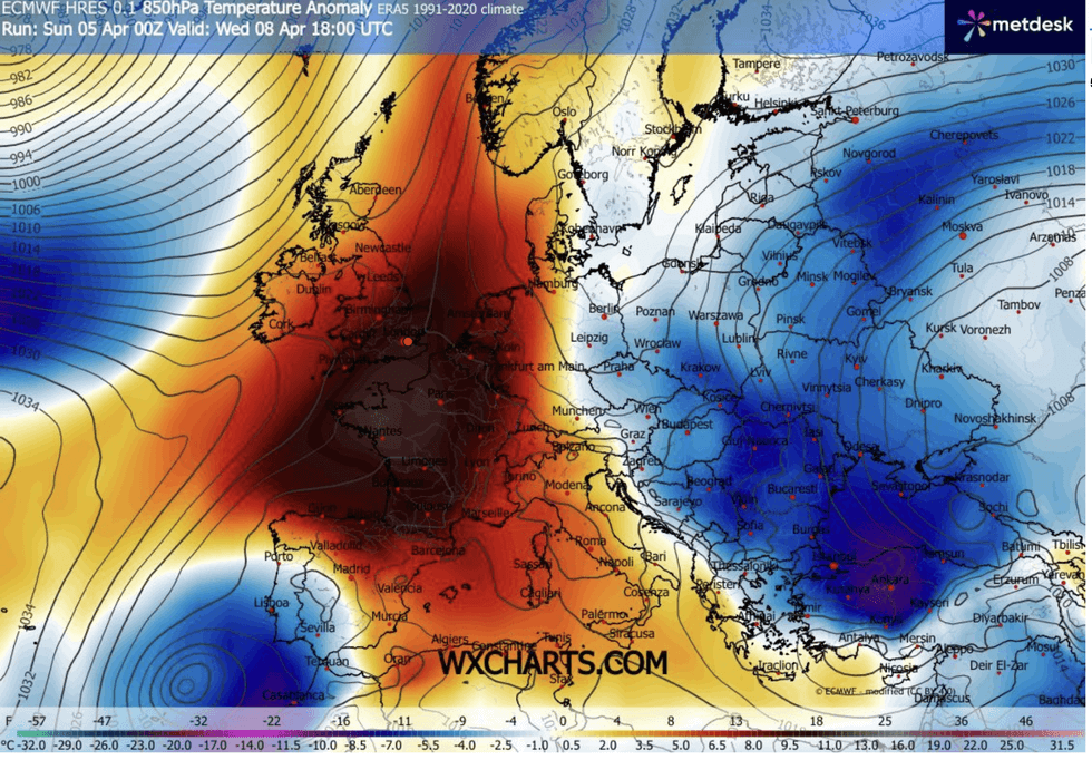
Southern Britain could nudge 25C by Wednesday, with the whole country thawing from the early April chill.
Met Office meteorologist Greg Dewhurst said: “Many of us will reach double figures, and as high pressure continues to build over the next few days, temperatures will continue to rise.
“On Tuesday and Wednesday, we could reach the low 20Cs, with 23C or 24C possible across central and southern parts of the UK , but it is turning fresher and more unsettled for all of us as we go towards Thursday.”
As Britain reels from Storm Dave’s Easter assault, experts say it is time to swap scarves and raincoats for t-shirts and shorts.
After a chilly start today, the mercury will creep up through the next 24 hours before peaking mid-week.
Southern regions will hit the high-teens and low 20Cs by tomorrow before Wednesday scrapes a possible 25C.
Southern regions will hit the high-teens and low-20Cs by tomorrow before Wednesday scrapes a possible 25C
|WXCHARTS
Chilly Polar winds swept in by Storm Dave will be shoved out by warm gusts coming in from Egypt.
Jim Dale, meteorologist for British Weather Services and co-author of ‘Surviving Extreme Weather’, said: “Wednesday is going to be the warmest day, and we will see temperatures in the low 20Cs, 25C may be optimistic, but it is not out of the question.
“We are seeing a change in wind direction, with this warm air originating from Egypt and Libya.
“So, this is going to feel like a proper spell of spring weather.”
LATEST DEVELOPMENTS
Temperatures will rocket from tomorrow as southerly winds pull in balmy gusts from North Africa
|NETWEATHER
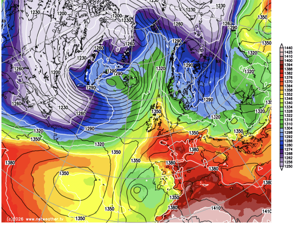
Britain’s weather is under the steer of the jet stream, supercharged by a cold spell hitting North America.
Unusually strong jet stream winds at the weekend were blamed for Storm Dave’s unusually strong April winds.
The jet stream will over the next 24 hours loop over the UK, allowing high pressure – the driver of calm, warm weather – to build close to Britain.
Mr Dewhurst said: “We will start to see high pressure building in from the south and that will build over the coming days and there is some very warm weather on the way for Tuesday into Wednesday.
“It is a chilly start to easter Monday, and while there will be plenty of sunshine, the cloud may be thick enough for one or two splashes of rain.
“But for many of us, it will be a dry day with plenty of spells of hazy sunshine, and winds coming in from the south, so temperatures will start to rise.”
Britons should make the most of the warmth, though, with temperatures to dip to the April average by the weekend.
A Met Office spokesperson said: “Temperatures are expected to ease back closer to seasonal averages after the early‑week mild spell, with no strong signal for either prolonged warmth or cold.
“There are tentative signs that higher pressure could begin to build later next week, potentially bringing more settled conditions, but confidence in this remains low at this stage.”