


Britons are about to bask in the warmest day of the year so far as tropical winds sweep in from the Middle East.
Unusually, temperatures nudging 25C will follow an easterly path, as an anticyclonic high builds over Russia and the Continent.
Wednesday is shaping up to be the warmest day of the year so far, with highs of 24C predicted in southern counties.
And Britons will be needing the suncream from today with clear, cloudless skies promising to deliver lashings of golden rays.
TRENDING
Stories
Videos
Your Say
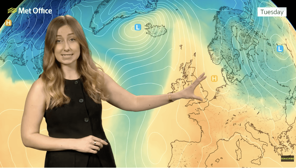
Met Office meteorologist Honor Criswick said: “Even though it will be a colder start on Tuesday, it will be a dry settled day, and with high pressure to the east, we start to see a southerly flow, and we bring up a fairly warm plume of air.
“So, not only will Tuesday be dry settled with sunshine, it is also going to be warmer.
“Most towns and cities will push into the high teens, but some isolated spots could see 22C to 23C.
“And if you are a fan of the warm weather, there is more on the way on Wednesday as we remain in the southerly flow with plenty of warm weather with temperatures, possibly reaching 24C.
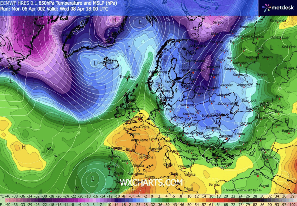
Britons will sizzle in 24C heat
|WX CHARTS
“So, it could be the warmest day of the year so far.”
Southern and eastern regions will enjoy the summer-like burst while rain dampens spirits to the west, she said.
She added: “Things are going to be feeling warmer from Tuesday and Wednesday with lots of warm sunshine around.”
“But, it is a different story in the west with cloud thickening up and rain pushing into Northern Ireland and western Scotland, and it is quite breezy here at times.”
LATEST DEVELOPMENTS
Soaring temperatures will be driven by a warm plume
|MET OFFICE
Soaring temperatures will be driven by a warm plume sweeping in from the south and the southeast.
Winds will spiral a huge region of high pressure to the east of Britain, sweeping warmth in from North Africa.
Summer warmth is commonly the product of the Azores High, to the west, which this week will give way to the easterly anticyclone.
Jim Dale, meteorologist for British Weather Services and co-author of ‘Surviving Extreme Weather’, said: “This warm plume is coming out of Egypt and Libya, so more from a southeasterly direction.
“It will feel much warmer on Tuesday, with Wednesday coming close to 23C or 24C in parts of the country.
“It is going to be a very pleasant couple of days and will feel like a proper spell of spring weather.”
Tomorrow is likely to see the mercury push past the 20.9C recorded in March in Worcester, he added.
He said: “Wednesday is looking like the warmest day of the year so far, and then it turns fresher towards the end of the week.
“Thursday will be pleasant, but then it turns more unsettled again by the weekend.”
A spokesperson for the Met Office added: “Temperatures are expected to ease back closer to seasonal averages after the early‑week mild spell, with no strong signal for either prolonged warmth or cold.
“There are tentative signs that higher pressure could begin to build later next week, potentially bringing more settled conditions, but confidence in this remains low at this stage.”