


Britons should make the most of one of the warmest April spells on record before the heavens unleash a thundery deluge.
Temperatures in southern Britain could hit 27C today, beating the 24.4C record for April 8th set in London, in 1894.
But change is afoot ahead of the weekend, as a sweeping cold front from the west to plummets the mercury.
With cooler winds will come electrical downpours loaded with thundery rain and lightning.
TRENDING
Stories
Videos
Your Say
Met Office meteorologist Liam Eslick said: “There is plenty of sunshine, and as we go into Wednesday, high pressure has influence over the UK, and we will cling onto clearer skies across the southern half of the UK.
“Temperatures are on the rise, and we are looking at 23C or 24C, and we could see a possible 25C or an isolated 26C by the back end of the afternoon.
“It is going to turn a bit wetter and cooler as we head towards Thursday afternoon, and temperatures will be down quite a few degrees with a number of showers, and some of these are likely to be heavy with even see the odd rumble of thunder or flash of lightning.”
The Met Office said 27C in an isolated spot in the south by late afternoon would not be out of the question.

Britons can expect to see temperatures rise to 26C in some parts
|WX CHARTS
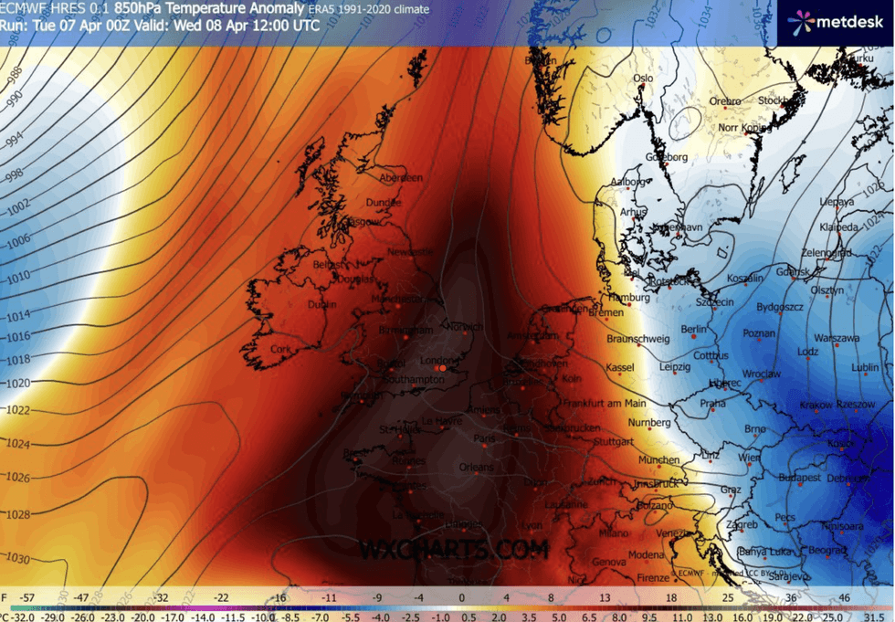
High pressure to the east of the UK will sweep a plume of warm air in from North Africa.
Temperatures are expected to peak today with widespread highs across southern Britain in the low-20Cs.
Northern and northwestern regions will be cooler with a greater chance of rain, but most of Britain will enjoy the warmest day of the year so far.
But high pressure will give way to low pressure ahead of the weekend, and the return of cooler showers.
LATEST DEVELOPMENTS

High pressure will give way to low pressure ahead of the weekend
|MET OFFICE
Jim Dale, meteorologist for British Weather Services and co-author of ‘Surviving Extreme Weather’, said: “The weather is going to change on Saturday with a plume of rain coming up from the southwest.
“It is also going to feel much cooler compared to midweek as a cold front comes through.
“But there are signs that high pressure will return next week.”
With higher temperatures today will come lashings of sunshine and clear skies as high pressure largely keeps cloud at bay.
Britain will experience a wet and windy spell
|WX CHARTS
Misty haze over western and northwestern regions will keep temperatures lower compared to eastern Britain.
Met Office meteorologist Honor Criswick said: “There is lots of sunshine around, any sunshine is turning hazier in the west with a build of cloud here, and this may be thick enough to bring some rain and drizzle.
“It’s a fairly brief warm spell, and later on Wednesday we are starting to introduce a couple of cold fronts bringing in a different air mass and colder conditions, and it will bring in some bands of rain and heavy showers.
|There may be quite a wet and windy spell to finish off the week.”