
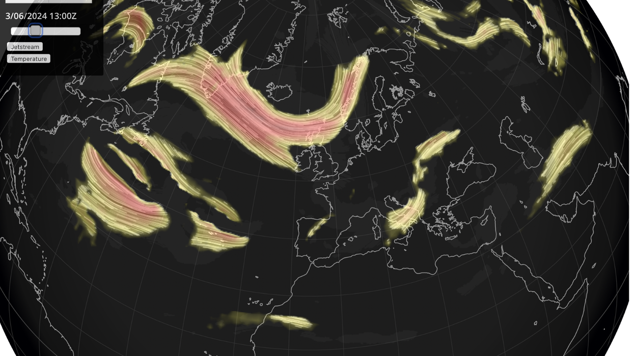


A ‘split jet stream’ astride a dome of ‘sinking air’ will open the doors to blue summer skies and sunshine.
Britain’s weather is about to take a major U-turn as drizzle and showers give way to a blast of warmth.
The jet stream will split, sending branches north and south of the UK as high pressure builds in between.
High pressure–the driver of summer sunshine–will force dry air groundward, stabilising the atmosphere and stopping the rain.
Met Office meteorologist Annie Shuttleworth said: “There is quite a strong signal that the main bulk of the jet stream dives to the south and bulks up to the north, so it splits and allows high pressure to build in across the UK.
“That high pressure moves in from the west, and by the weekend it is becoming much more dominant across the UK.
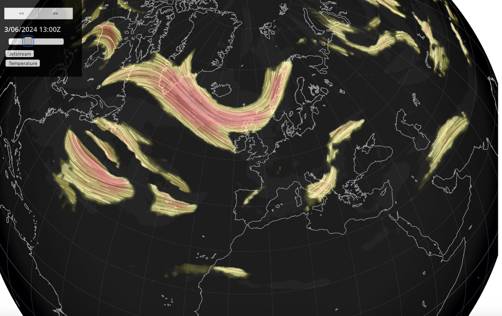 The jet stream will split, sending branches north and south of the UK as high pressure builds in between | NETWEATHER
“High pressure means sinking air, and that means you don’t get showers forming so easily because you need unstable air for showers, you need air to rise.
“When you get sinking air, that stops those showers from bubbling up and developing, it means dry weather, and it also can reduce cloud cover because of that sinking dry air so it means more sunshine is on the way.”
However, weather fronts nudging in from the north threaten a wetter picture across parts of Scotland, she warned.
She said: “The position of the high could allow for some systems to topple over the north of it and so we could still see some outbreaks of rain pushing into northern Scotland.
“There could still be some systems pushing across the high, so that doesn’t mean it’s necessarily going to be totally dry.”
Southern Britain will enjoy the best of the weather through the start of June with temperatures to rise into the mid-20Cs.
Much of Britain will enjoy a ‘pleasant start to summer’ before a greater risk of northerly showers on Tuesday.
However, high pressure will continue to creep in from the west bringing a largely dry and settled outlook.
Jim Dale, meteorologist for British Weather Services and co-author of ‘Surviving Extreme Weather’, said: “High pressure is starting to build, and it is going to bring a very pleasant start to summer for most of the country.
“Frontal systems do try to come in from the north, so there will be a risk of showers, mainly across Scotland and the north.
“It turns a bit more uncertain from Tuesday, when these systems seem to want to nudge past the high, but this is something that we will need to keep our eyes on.”
While it may be too soon for a ‘heatwave’, forecasters say temperatures will nudge slightly above average for the start of summer.
Exacta Weather’s James Madden said: “In essence, the on-cue arrival of high pressure in the coming days will be influential on bringing settled and warm to sometimes hot weather conditions throughout this weekend, and up until around the middle part of next week at the very least.
“Its position won't drive any extreme, very hot temperatures, but we can still expect to touch or exceed quite widely a warm 20C.”
Met Office meteorologist Alex Burkill added: “Next week, we are more likely to have higher-than-average pressure somewhere towards the west of the UK with lower-than-average pressure elsewhere across other parts of Europe.
“At the start of next week, high pressure to the west of the UK should lead to a largely fine picture.
“There is quite a bit of uncertainty as to where any low pressure would track, and it could come further south so we could see rain in some other parts, although high pressure is likely to dominate next week.”