


A plunge of cold air from Greenland will jolt the Atlantic jet stream bringing warmth and sunshine across Britain.
Temperatures will rise after the weekend as high pressure builds to the east of the UK drawing in mild, southerly gusts.
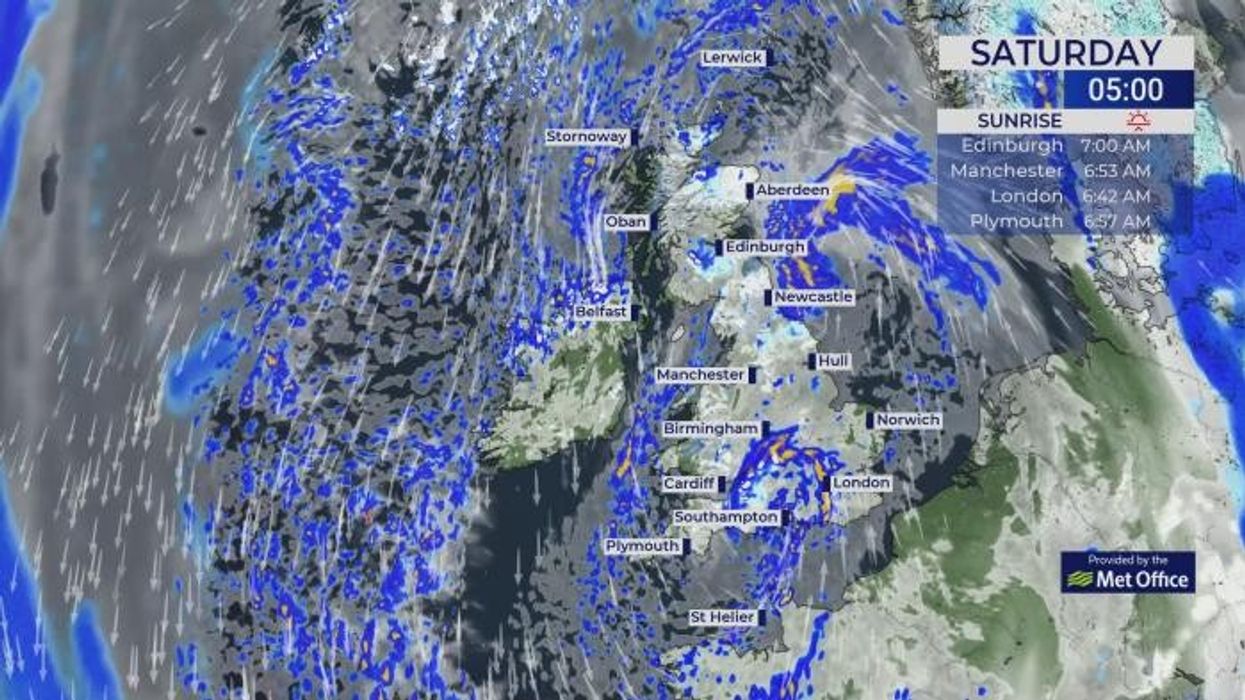
It will, however, follow a chilly weekend which could bring up to 10cm of snow to the hills of Wales and Scotland, forecasters warn.
But a ‘shift’ in the weather into March will deliver a boost of joy of Britons holding out for a sunny start to the meteorological spring.
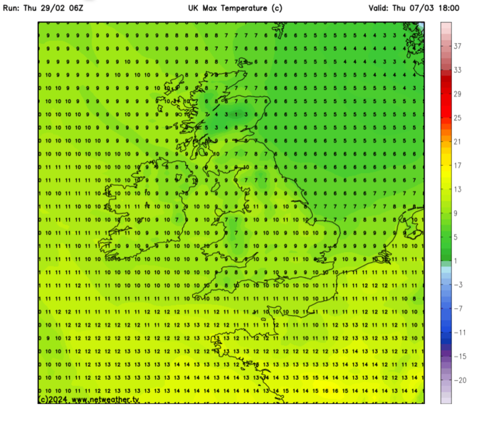
Temperatures up next week
|Netweather
Met Office meteorologist Annie Shuttleworth said: “Through the early part of next week, there will be a southerly wind coming from a milder and warmer direction.
“It is looking like we will see fairly dry air through the start of next week, so there will probably be a good chance of some sunshine and as we will be in spring, it will feel fairly warm in that sunshine.
“With higher pressure to the east, it will likely be fairly dry especially to eastern areas, but with lower pressure to the west, that’s where we are most likely to see that wet weather.”
The warmer weather will be driven by an ‘amplified’– wavy–jet stream swooping over the Atlantic driven by cold air from Greenland.
At the centre of the jet, a powerful jet core build high pressure over Britain allowing the sun to break through the cloud and the rain.
The UK’s weather is heavily influenced by the jet stream which frequently switches between two patterns.
When it is straightened out, or ‘zonal’, it tends to pull in low pressure and stormy weather from the Atlantic.
LATEST DEVELOPMENTS:
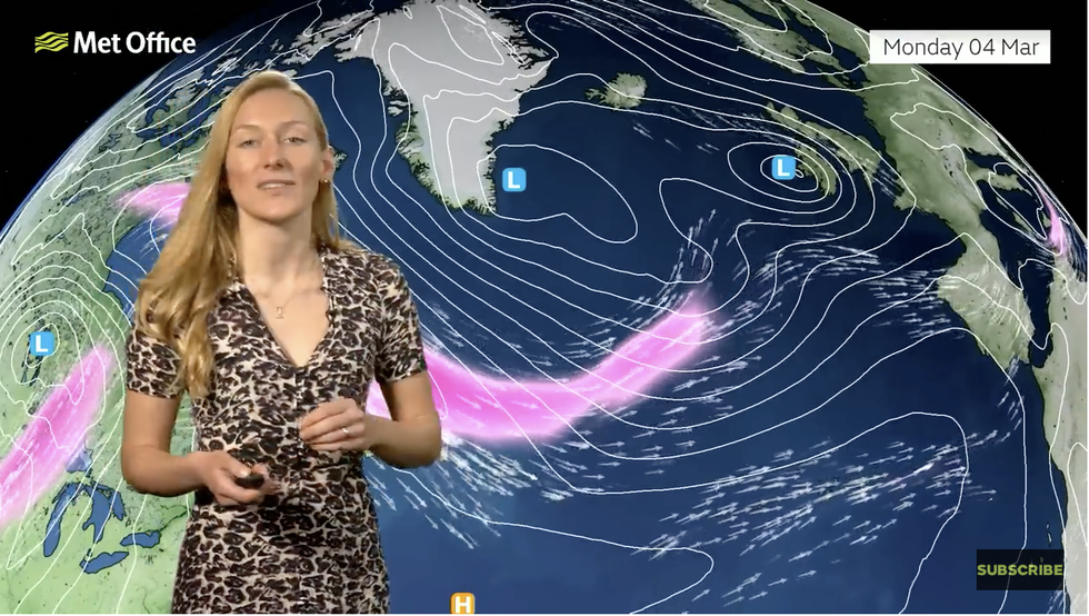
Met Office meteorologist Annie Shuttleworth describes the jet stream swooping over the Atlantic
|Met Office
In a meridional, or amplified wavy position, it allows high pressure to build in its loops, bringing warmer conditions at this time of year.
Temperatures are expected to hit double figures across the south by the middle of next week, although it will stay cooler to the north.
Ms Shuttleworth said: “We are expecting to see a shift in our weather pattern, and we need to look at the jet stream on the other side of the Atlantic.
“By Monday, we have got quite a strong jet core, and that is being strengthened by a plunge of cold air pushing off Greenland.
“When we see these amplified patterns push across the Atlantic, that can allow pressure to build, and that is what we are expecting through next week.”
Eastern regions will be drier, she said, while the west gets the worst of the rain, although showers could move across the country.
In the meantime, Britain is wrapping up for a last burst of winter with snow on the way this weekend.
Temperatures will dip as cold air floods in from the north, although the worst of the snow will be over high ground.
Jim Dale, meteorologist for British Weather Services and social commentator, said: “We are not looking at a major freeze, but it is going to turn briefly colder, and this will bring the risk of snow over high ground.
“With low pressure nearby, there will be the risk of rain and after the heavy rain we have had so far this month, that will raise the risk of flooding.”
Exacta Weather’s James Madden added: “The overall theme is for the weather to turn colder and more unsettled throughout Friday and into this weekend.
“This will initially see snow showers developing across parts of Ireland, southwest England and Wales.”