


Meterologists have predicted that a "Sudden Stratospheric Warming" could send temperatures falling in March.
It comes as forecasters said a major Sudden Stratospheric Warming (SSW) is likely to happen around March 5.
It has been forecast that the SSW may trigger a chain of changes that could bring sustained colder weather in March.
Following an early March SSW, col air could be pushed air south or southwest across Europe to bring below average temperatures and wintry conditions.
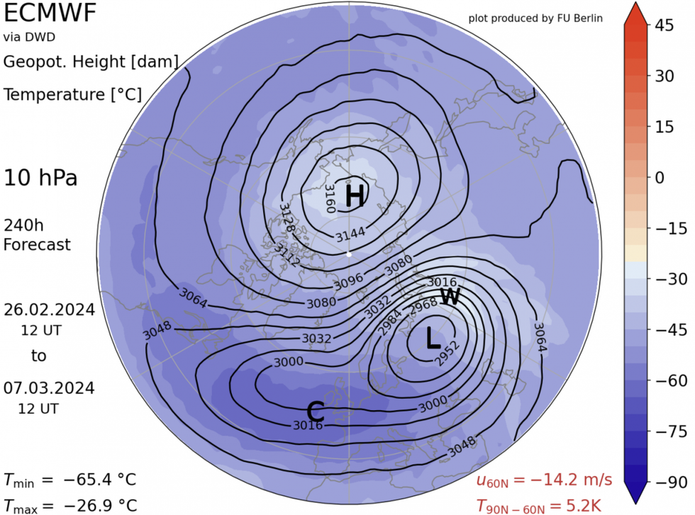
The chart showing the major Sudden Stratospheric Warming
|NetWeather
Nick Finnis from NetWeather said: "So following a winter without much cold and wintry weather away from northern Scotland, there is an increased risk of a bitter blow before spring warmth takes hold.
"But often spring warmth comes in fits and starts with cold and wintry set-backs in spring can occur without a SSW. But a SSW just increases the chances of a more prolonged below-average cold spell!
"On average, a major SSW does lead to a Negative North Atlantic Oscillation (-NAO) which is often associated with blocking high pressure near or over Greenland – which forces the Atlantic storm track further south and also causes cold air to push south into Europe, including the UK."
Meanwhile, the Met Office is predicting a more unsettled March with periods of wind and rain.
LATEST DEVELOPMENTS
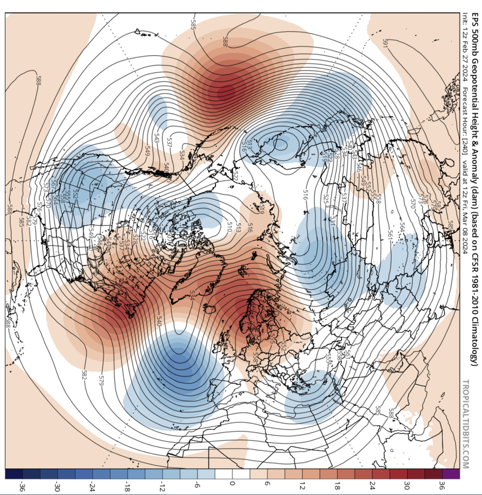
New forecasting map shows blocking developing over Scandinavia
|NetWeather
The Met Office forecast said: "Towards the middle of March, a typical mixture of conditions looks most likely with spells of rain interspersed with brighter, drier intervals. Temperatures are likely to be around, or a little above average, but some cold nights are certainly still possible.
"During the rest of the month, there is a slight increase in the chance of blocking patterns, with winds blowing more frequently from the north and east than is usual.
"At this time of year, winds from this direction can still bring wintry hazards, such as snow and ice, but the risk of these is likely to decrease as the month progresses.
"The wettest conditions are most likely to be in the south, with northern areas drier overall. Overall temperatures are more likely to be near or below average, though some warmer days are still possible at times."
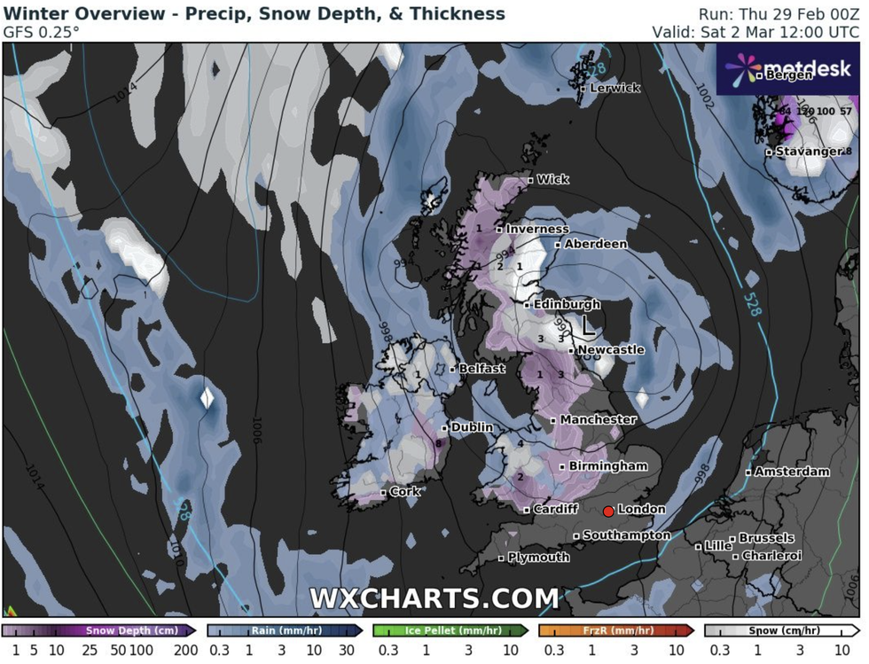
There could be colder weather in Scotland and rural areas in England
|WXCharts
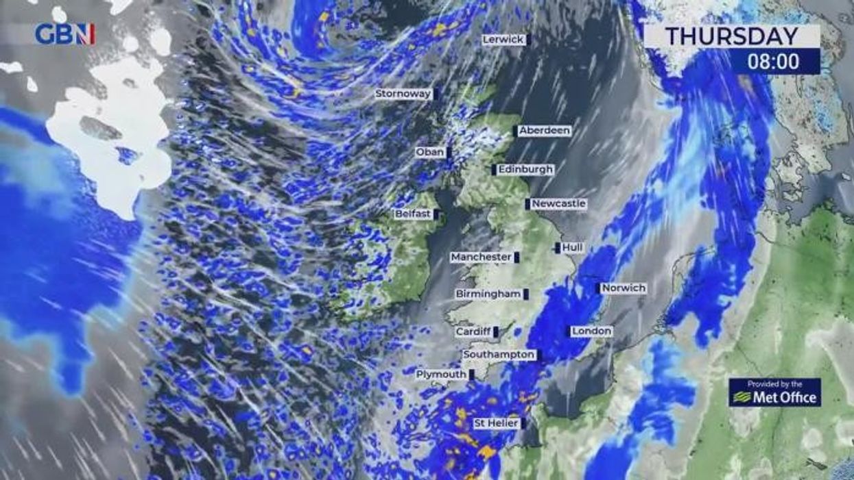
Meanwhile, the Met Office has predicted sleet could fall later this week as weather maps show temperatures plummeting across the UK.
Cooler temperatures will teeter towards freezing by the end of the week, with WXCHARTS forecasting lows of -5C in the Scottish Borders region.