
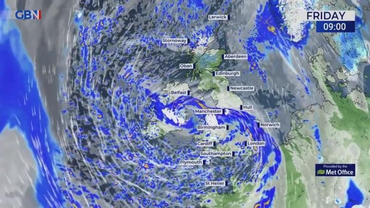


Forecasters have predicted potential delays to the Monday commute as a fontal band could include some snow.
After a potentially unsettled weekend, temperatures are set to fall, with chance of wintry showers across the UK.
The Met Office predicts heavy showers across much of England and Wales, wintry over hills, with clear intervals between allowing patchy frost and fog.
Throughout the weekend, it is forecast to be breezy and cold throughout Saturday night and Sunday morning.
There could be some snow over the weekend
|Netweather
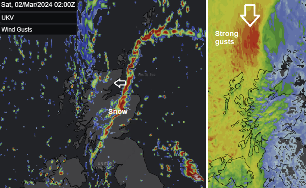
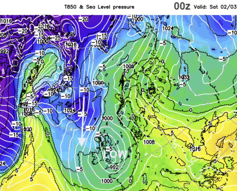
Jo Farrow from NetWeather said: "By Sunday, more of Britain will be drier but still with a fair amount of cloud. The northerly flow could bring further showery rain and hill snow to western Scotland, brushing Northern Ireland down to the Irish Sea.
"There will be an occluded band stretching from Scotland down to the south of France. This appears over the North Sea later on Sunday and might drift towards the east coast of Britain.
"It will feel cold again by day and as another frontal band approaches from the southwest on Sunday night it will come up against the cold air early on Monday.
"That could bring some travel issues for the Monday morning commute with heavy rain and maybe, snow in the mix."
LATEST DEVELOPMENTS
 Low pressure from the North could cause unsettled weather at the start of next week | Netweather
Looking into next week, the weather is set to remain unsettled, however temperatures are expected to rise to more average levels for this time of the year.
A Met Office forecaster said: "Most of the rain and showers will be across southern and western regions, with the north and east probably mostly dry.
"From the middle of next week a more widespread dry spell of weather is likely to develop with increasing amounts of sunshine and, following a chilly start to the week, temperatures should rise a little above average for the time of year.
"Some rain will be remain possible at times, though this will be confined to western parts of the UK."
It comes as forecasters said a major Sudden Stratospheric Warming (SSW) is likely to happen around March 5.
The SSW may trigger a chain of changes that could bring sustained colder weather in March.
Following an early March SSW, col air could be pushed air south or southwest across Europe to bring below average temperatures and wintry conditions.