


A blast from the continent will rip into Britain’s autumn gloom ushering a burst of sunshine.
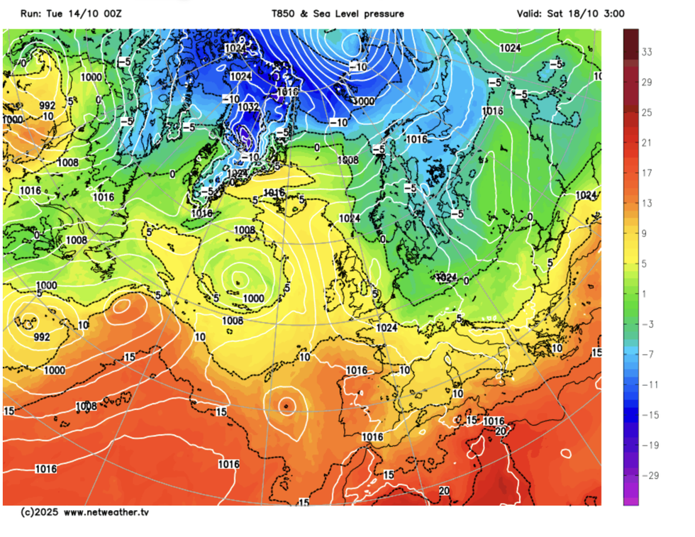
This weekend signals a dramatic shift in the weather as cracks form in a high-pressure dome smothering the country.
Southerly winds will hit the UK
|NETWEATHER
Sunshine in parts of the country will push temperatures into the upper teens, while seemingly endless murk lifts.
But with the break in the cloud will come the risk of wind and rain as the gates open to the Atlantic.
TRENDING
Stories
Videos
Your Say
Met Office meteorologist Aidan McGivern said: “High pressure starts to shift on Friday night and into Saturday, but it will be a slow process, and the winds will start to come in from the south, and there are hints in the Atlantic of a change with weather fronts starting to knock on the door.
“There will be a better chance of brighter skies with low cloud lifting a bit and ending up not as gloomy, and temperatures in the low to mid-teens.
“There will be some sunshine where the cloud breaks up nicely across south and western parts of England, and west Wales and northern Scotland.”
With the high pressure ‘anticyclone’ anchored over Britain, unstirring skies threaten a few more days of gloom.
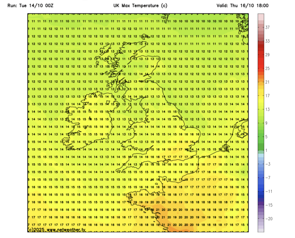
Temperatures are expected to reach 17C
|Netweather
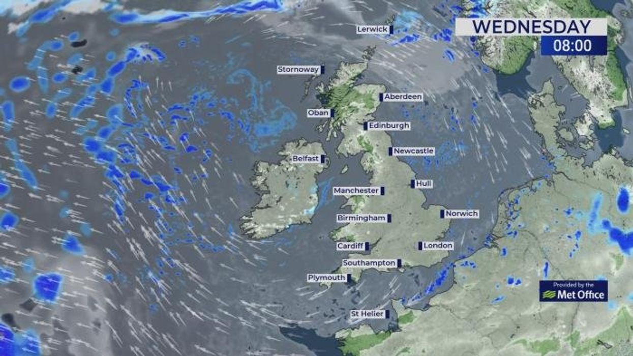
Weather maps show an absence of ‘isobars’ – pressure lines showing the location and strength of wind.
Huge night-and-day temperature swings in parts of the country will drive 17C highs and overnight frosts.
Mr McGivern said: “High pressure is right on top of the UK, with light winds for many, and there will be some breaks in the cloud here and there, and northern Scotland will be prone to some light showers.
“Into the evening and overnight where we get clear skies, there will be a touch of frost and some fog patches.
LATEST DEVELOPMENTS
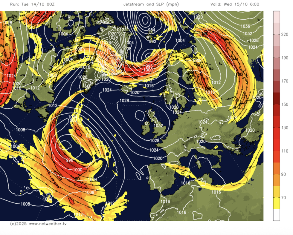
The spliced jet will give way to autumnal sun
|Netweather
“There is barely an isobar on the map, so Thursday will be a calm, settled day.”
Long-range forecasters agree this weekend will usher a major change to something wetter and windier.
Aside from Storm Amy which struck at the start of the month, Britain’s storm season has been eerily quiet.
High pressure has kept the jet stream, which acts as a storm conveyor belt, away from its usual southerly path.
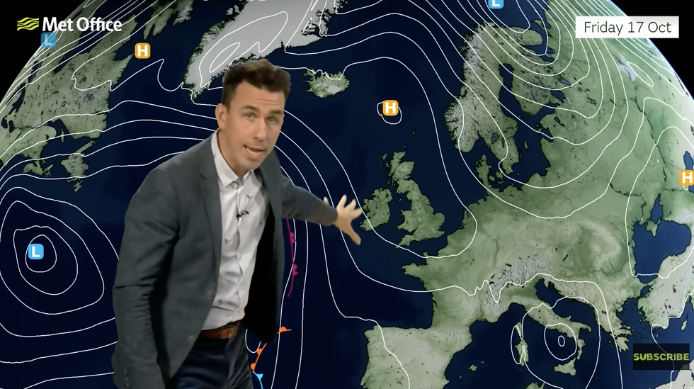
Met Office’s Aidan McGivern describes how the high will move
|Met Office
Instead, it has spliced into two branches either side of the country, steering storms to the north.
As high pressure crumbles, the jet could resume its autumnal path, putting Britain in the firing line for the next storm.
Jim Dale, meteorologist for British Weather Services and co-author of ‘Surviving Extreme Weather’, said: “The weather will undoubtedly try to achieve a balance after this very quiet period, and that would mean a return to storms.
“There is a chance that we could see a number of named storms before the end of the year, as low pressure regains dominance over the weather.
“A change is looking likely from this weekend and through the following week.”