


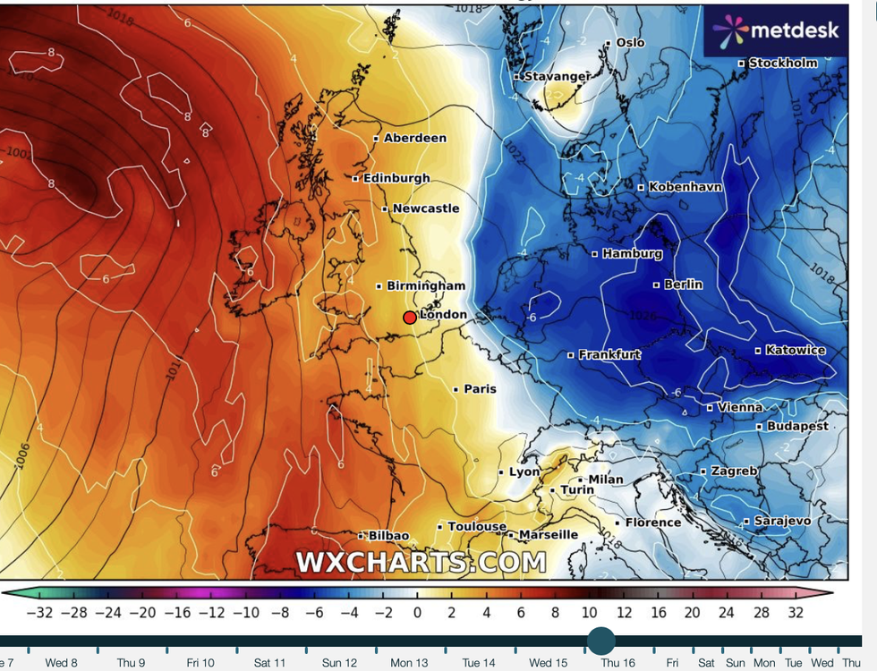
An easterly bite will plunge temperatures during the run up to mid-October driving the first proper frosts of the season.
A high-pressure dome dominating Britain’s weather is about to shift, steering in winds from Scandinavia and Eastern Europe.
Britons are set to endure frosty nights
|WX CHARTS
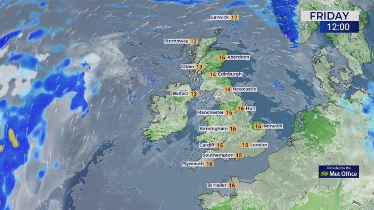
Daytime temperatures nearing 20C this weekend may dip to freezing overnight driving foggy, frosty mornings.
Met Office meteorologist Alex Burkill said: “There is some cooler air coming over the high, and there is the potential for some of this cooler air to cut in, particularly into eastern parts of the country.
TRENDING
Stories
Videos
Your Say
“It is quite likely that we will stay under the influence of the high, but there is the potential this weekend for some chillier air to cut in.
“By night, temperatures could get relatively low with a touch of frost in rural spots is definitely not out of the question.
“So, there may perhaps be a chillier feel.”
Britain’s calm, rainless weather for the past week has been dominated by high pressure.
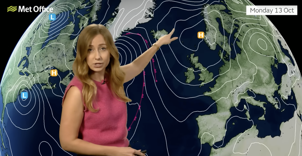
Britain has been dominated by high pressure
|MET OFFICE
A huge high over the country blocking low pressure from the Atlantic is keeping at bay the threat of any storms post Amy.
High pressure during the summer can lead to clear skies, blazing sunshine and extreme heat.
LATEST DEVELOPMENTS
- Britons issued Spain travel warning as RED weather alert issued for 91-mile stretch of coastline
- UK weather: 'Anticyclonic gloom' to smother Britain as country 'stagnates' under pressure dome
- UK weather: Britain braces for winter drought as huge 'anticyclonic' pressure lid swoops in
During the winter, depending on its position, it can drive murky, cloudy conditions and bitterly cold, frosty nights.
Meteorologists will be closely watching the next few days for the drift of the high and whether it will bring a chilly snap.
A high-pressure dome dominating Britain’s weather is about to shift
|MET OFFICE
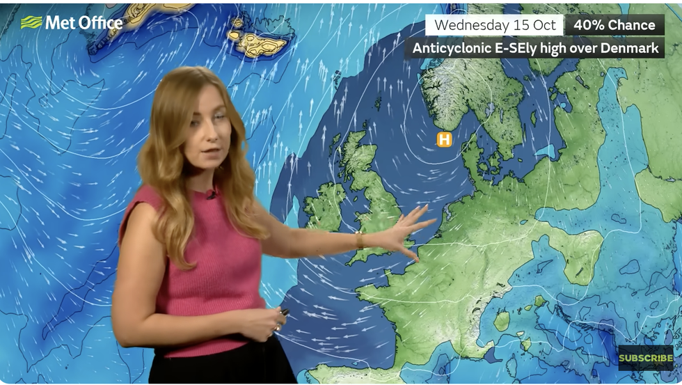
Met Office meteorologist Honor Criswick said: “High pressure will push its way eastwards into next week, and as it does this, we start to see a change in wind direction.
“But it depends where the high pressure sits, as this will determine the weather and where we see the bulk of the cloud, and we could see some mist, fog and possibly some frost into next week.
“Where we see clear skies, that is where we are going to see temperatures dip away, and there will be some clear skies over the weekend.”
Temperatures this weekend in the south will hit 18C where the sun burns through cloud, she said.
However, northern and western Britain risk waking under a shroud of eerie autumn fog, she added.
She said: “There will be highs on Saturday of 17C to 18C, and even in Scotland there will be some sunshine, but over the weekend there is going to be some mist and fog to start.
“Next week, high pressure will be to the east, and this gives more of an east, southeasterly wind direction.
“There could be some quite thick fog in western and central Scotland, parts of Wales and parts of the southwest.”
Jim Dale, meteorologist for British Weather Services, and co-author of ‘Surviving Extreme Weather’, added: “High pressure is going to remain in control through the next week, and with clear overnight skies we could see temperatures fall away to bring the risk of frost.”