


A high-pressure barricade shielding Britain from a barrage of Atlantic storms may be about to collapse.
Dull, rainless and sunless skies for another week show signs of giving way to a wet and windy end to October.
High pressure, currently wedged fast over the country, may shift after next weekend to drive the change.
A dearth of autumn storms, broken only by Storm Amy at the start of the month, could be about to reload.
TRENDING
Stories
Videos
Your Say
Jim Dale, meteorologist for British Weather Services, said: “There are signs that this high pressure may give way after next weekend, and that would spell a change in the weather.
“The stagnant situation we have at the moment is likely to give way to something more mobile and unsettled.
“It is a watching brief, but the signs are there for a shift towards the end of the month.”
As the high shifts, it will open the gates to the fury of the Atlantic with a stormy winter entrée on the cards.
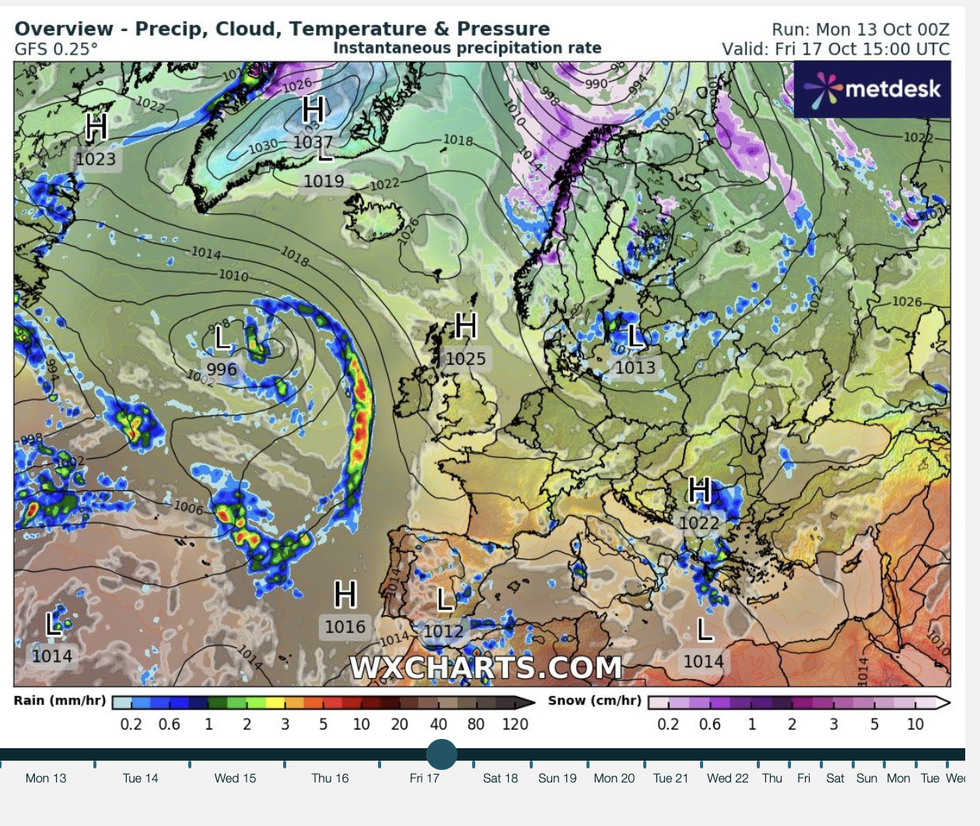
High pressure keeps the storms at bay
|WX CHARTS
The unusually calm start to the season will pendulum swing to an onslaught of wind and rain.
Dale said: “It has been usually quiet, and the weather always tends to seek a balance in these situations.
“There is the risk of a much stormier outlook going through the end of autumn, and the risk of another named storm during this period.
“Again, though, this is something we are going to have to watch over the coming days and weeks.”
LATEST DEVELOPMENTS
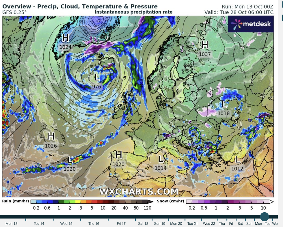
The outlook will change by the month's end
|WX CHARTS
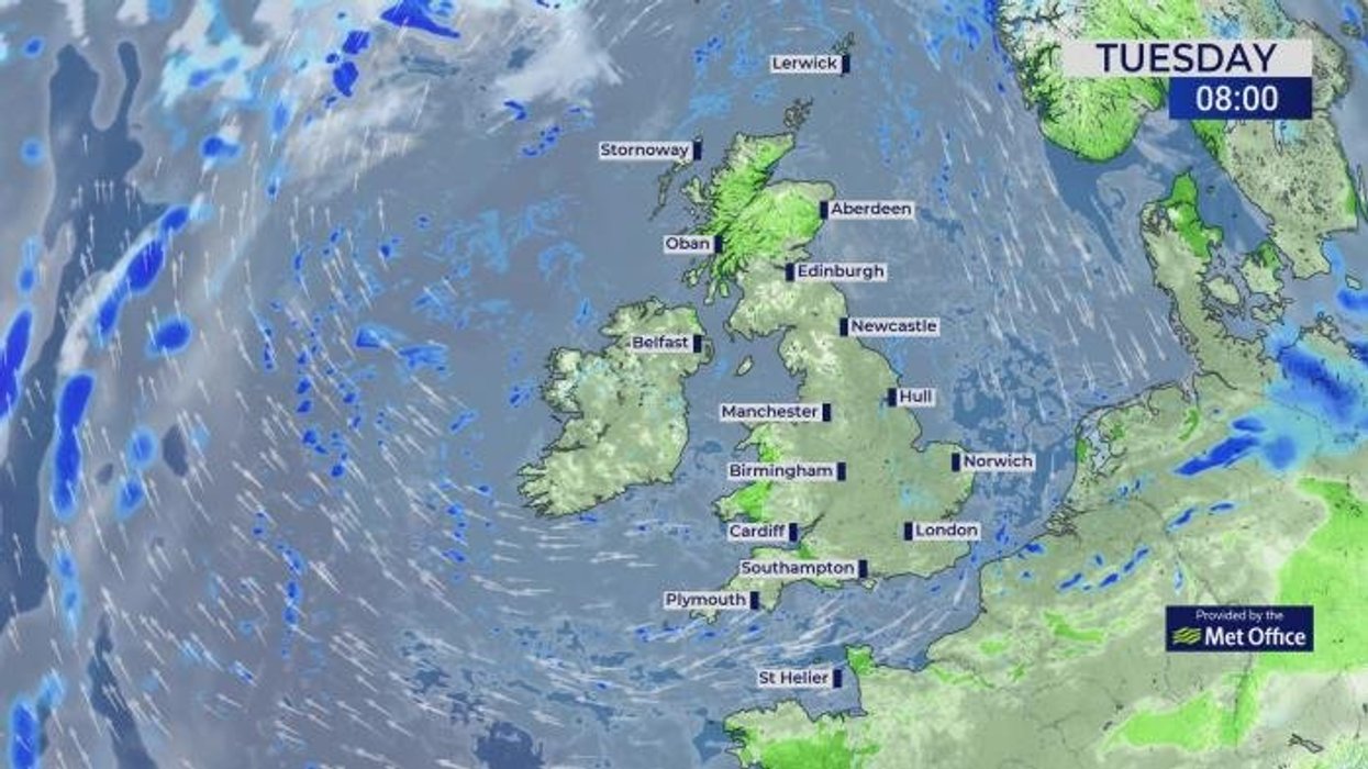
Britain’s weather will for the next week be dominated by high pressure, bringing grey skies, little rain and hardly any sun.
Otherwise known as ‘anticyclonic gloom’, the dreary spell happens the dome of pressure traps moisture and cloud.
Met Office meteorologist Tom Morgan said: “Not a lot is going to change on Tuesday, with England and Wales fairly gloomy once again.
“There is still a chance of a few spits and spots of light rain and drizzle in places, primarily across the very far east and southeast of England.
“Further north and west we could see some breaks in the cloud with some sunny spells and with the light winds temperatures won’t feel too bad.
“The cloudy theme continues through the week for the vast majority with some bright or sunny intervals.”
No change is expected for the next five days at least before low pressure from the Atlantic.
Heavy rain through the end of the month could bring the risk of flooding to parts, experts warn.
Met Office meteorologist Alex Burkill said: “Towards next week, the set up is going to become quite mobile and there will be a westerly flow with some wetter and windier weather coming through.
“That could bring some impactful rain and wind through the end of Octboer and into November.”