


Britain may be facing a cold and stormy run into winter thanks in part to changes in sea temperatures in the tropical Pacific.
Climate experts have in the past few days confirmed the likely emergence of a La Nina cooling off the coast of Peru.
La Nina, the swing-back reversal of a warming El Nino, can affect weather patterns around the world.
While its impact on the UK is usually small, it can drive colder, wetter and windier weather through autumn and winter.
A spokesman for the United States Climate Prediction Centre said: “A brief period of La Nina conditions is favoured in the autumn and early winter before reverting to neutral.
“Currently, sea surface temperatures are near to below average across most of the Pacific Ocean.”
The eastern Pacific was hit by an El Nino Southern Oscillation (ENSO) warming in 2024 which slipped into a neutral phase earlier this year.
This state of calm remained through though summer before experts spotted signs of a La Nino cooling.
LATEST DEVELOPMENTS:
Stormy weather is expected to hit the UK in the coming days
|VENTUSKY
Falling eastern Pacific sea waters can significantly shunt weather patterns in the tropics.
In the UK, they can increase the risk of cooler temperatures through the start of winter and a greater chance of wind and rain.
A spokesman for the UK Met Office said: “The El Nino Southern Oscillation (is a variation in climate in the tropical Pacific Ocean with three phases, the neutral phase, El Niño and La Niña.
“La Nina increases the risk of a cold start and mild end to the winter.
“During the latter part of winter La Niña increases the chances of westerly winds.”
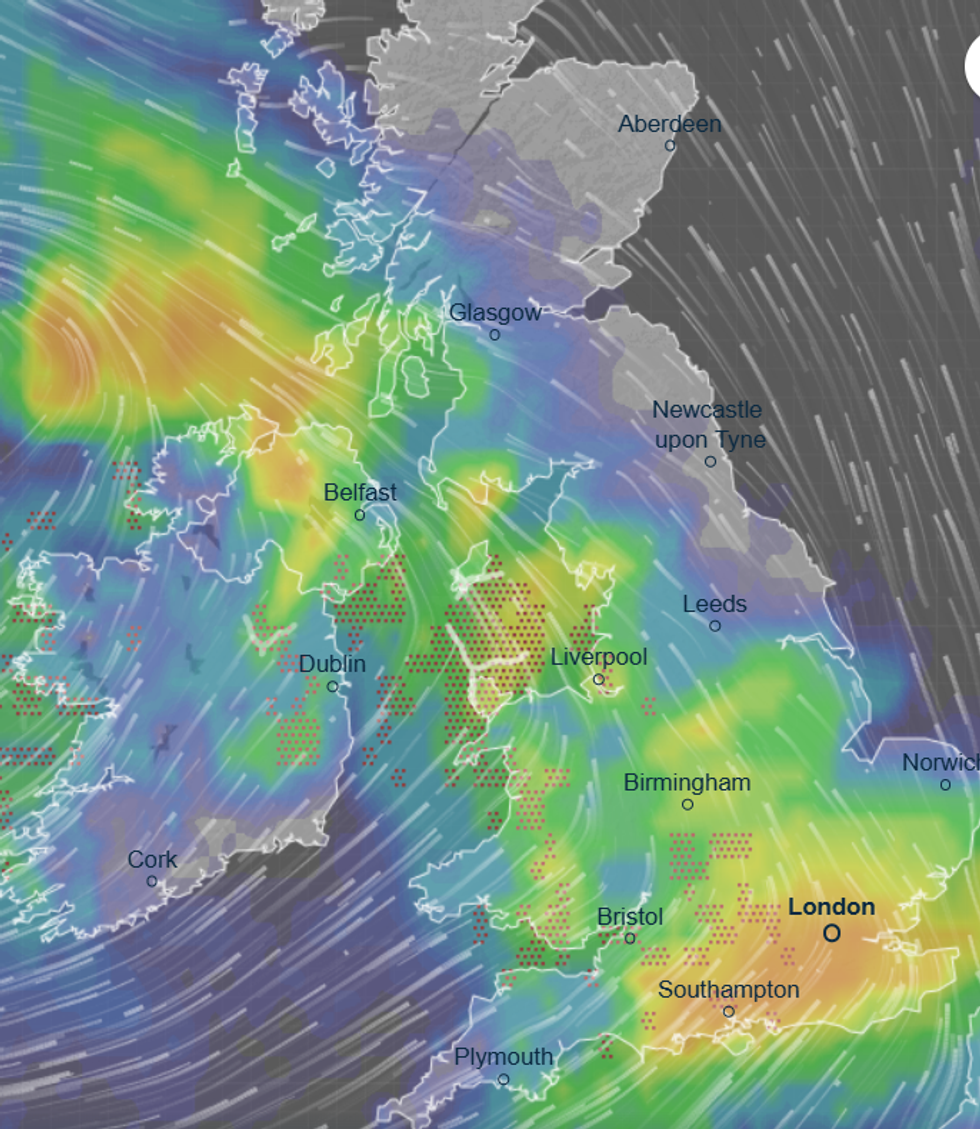
Sunshine and showers over the next couple of days will give way to heavier rain and winds on Sunday
|WXCHARTS
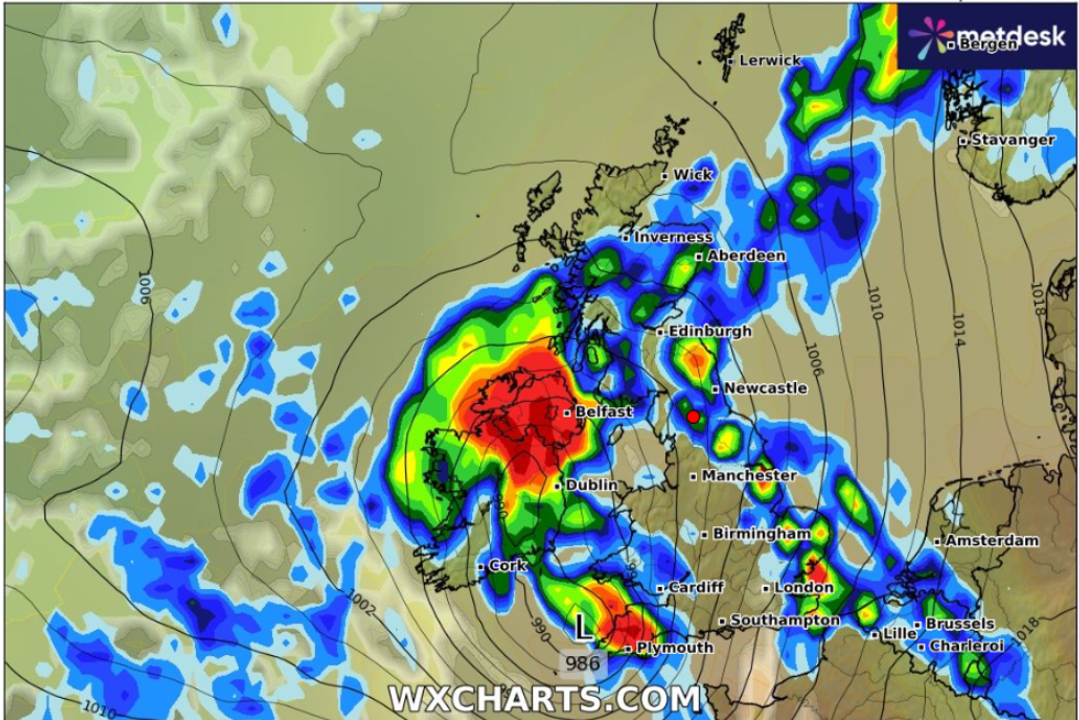
Meanwhile, Britain is battening the hatches for a weekend hammering as a hefty storm hurtles across the Atlantic.
Sunshine and showers over the next couple of days will give way to heavier rain and winds on Sunday.
However, meteorologists are still playing cat and mouse with the culprit – a low-pressure system dancing around the jet stream off the Canadian coast.
The Met Office’s Honor Criswick said: “A low-pressure system off the coast of Newfoundland is being picked up by the jet stream and has the potential to bring some wet and windy conditions on Sunday, but it depends where it sits on the jet stream.
“If it sits on the north on the cold side of the jet, it could bring some quite strong winds, but if it sits to the south, it might not develop as much, and the winds won’t be quite as strong.
There is some uncertainty as to the track of this low pressure and how much it is going to deepen, and this has an impact on where the strongest winds are going to be and how strong they are going to be.”
Sunday is likely to be widely unsettled, she warned, with showery downpours likely into mid-month.
She said: “Sunday is going to be a wet and windy day for all, and there will be outbreaks of rain, locally heavy and it is going to be windy with the chance of severe gales.
“After that, it is looking likely that we are going to see a westerly flow with more showers and longer spells of rain pushing in from the west.
“Some weather models indicate another area of low pressure pushing in towards the middle of next week, possibly pushing in another spell of wet and windy weather.”
The Met Office’s three-month outlook predicts a 45-per-cent chance autumn will be windier than usual and a greater risk of higher-than-average rainfall.
Government forecasters blame this on westerly winds off the Atlantic and the risk of an autumn La Nina.
A spokesperson said: “La Nina would increase the likelihood of westerly and north-westerly winds.
“There is a higher-than-normal chance of a wet autumn due to an increased likelihood of westerly winds from the Atlantic Ocean.”