


A vigorous "double jet stream" storm factory will plunge Britain into a fortnight of torrential rain and strong winds.
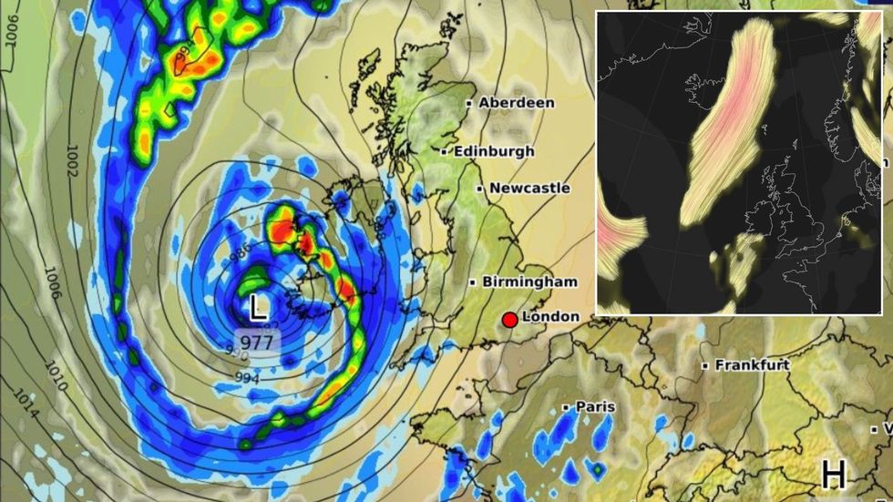
Wet and windy weather will stall in the run up to the weekend before a powerful cyclone hurtles in from the Atlantic.
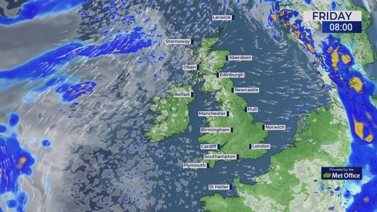
A month’s rain threatens to drench parts of the country over the weekend while exposed regions brace for strong winds.
The culprit is the jet stream, which cleaved in half, will flex two powerful arms to throw turbulent weather fronts into Britain.
A vigorous 'double jet stream' storm factory will plunge Britain into a fortnight of torrential rain and strong winds
|WXCHARTS/ NETWEATHER
Met Office meteorologist Alex Burkill said: “There are a few things on the other side of the Atlantic, and we have a double jet stream set up.
“We have a southerly jet which is going to be the driving force for an area of low pressure, but we also have a northerly jet, and this is going to start extending southwards to strengthen low pressure as it moves towards the UK.
“On Sunday, this low-pressure system is going to throw fronts across the country and so we are going to see unsettled weather at times.
“On Monday, we are still heavily under the influence of this low pressure system so still some very unsettled weather to start the working week, and that is really the theme through much of next week.”
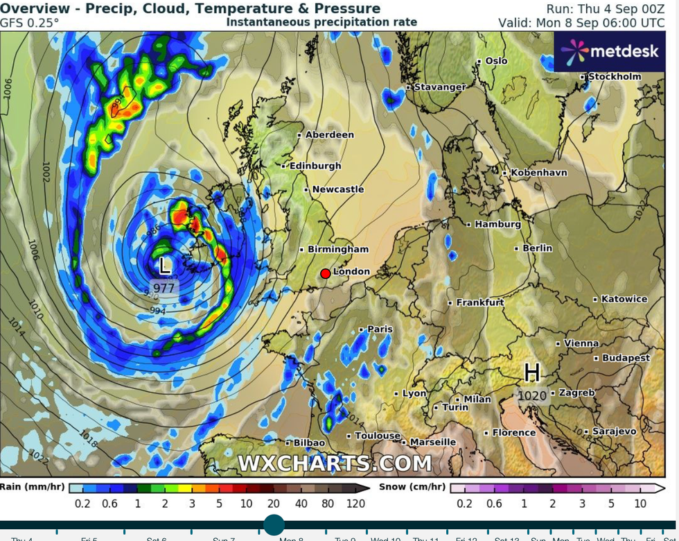
Wet and windy weather will stall in the run up to the weekend before a powerful cyclone hurtles in from the Atlantic
|WXCHARTS
An "anticyclonic high" will staunch the deluge through the start of the weekend before the rain returns, he said.
Warm air from the south promises a temperatures surge, although a blast from the Atlantic will stifle the burners, he added.
He said: “There is an area of higher pressure to the south of us and that is going to settle our weather, although for a short period.
“But we are dragging in some relatively warm air, so on paper it looks like temperatures could get into the mid- to high-20Cs.
“This is, however, unlikely, because the real effect of this low pressure to the west of us is going to be felt and it is going to drive some very wet and windy weather through and although we have that warm air over us, we are not expecting temperatures to get that high, probably low 20Cs.”
Sunday will bring the worst of the weather will an inch of rain forecast widely and more than two in the worst-hit areas.
Long-range experts agree Britain has "opened the doors to the Atlantic" with no signs yet of an Indian summer.
Although it will feel warmer in parts later this weekend, reports of an early autumn heatwave appear hyped.
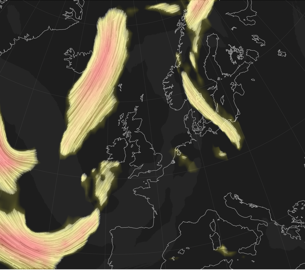
The culprit is the jet stream, which cleaved in half, will flex two powerful arms to throw turbulent weather fronts into Britain
|NETWEATHER
Eastern regions could nudge the mid-20Cs through the coming days, while it will stay cooler elsewhere.
Jim Dale, meteorologist for British Weather Services and social commentator, said: “We are not looking at a heatwave, and while it will feel warmer for a time across eastern parts, cloud and rain will make it feel widely cooler.
“We are in a mobile pattern at the moment, and it is safe to say the doors to the Atlantic are open with the risk of wind and rain continuing into the middle of the month.
“High pressure will build through the end of the week and bring a brief respite before it turns more unsettled later in the weekend.”