


The Met Office has issued a yellow weather alert warning that approximately 500 miles of the British coastline will be slammed by gale-force winds.
The warning will come into force at 8pm on Sunday and will last until 6pm on Monday.
Britain’s national forecaster warned “strong and gusty winds are likely to cause some disruption”.
Regions affected stretch from London & South East England, across South West England, across Wales and up to North West England.
The Met Office has accompanied the warning with a list of six things to expect.
Firstly, it warns that "it’s likely that some coastal routes, sea fronts and coastal communities affected by spray and/or large waves.
"There is a slight chance of some damage to buildings, such as tiles blown from roofs.
"Some delays to road, rail, air and ferry transport are likely.
LATEST DEVELOPMENTS: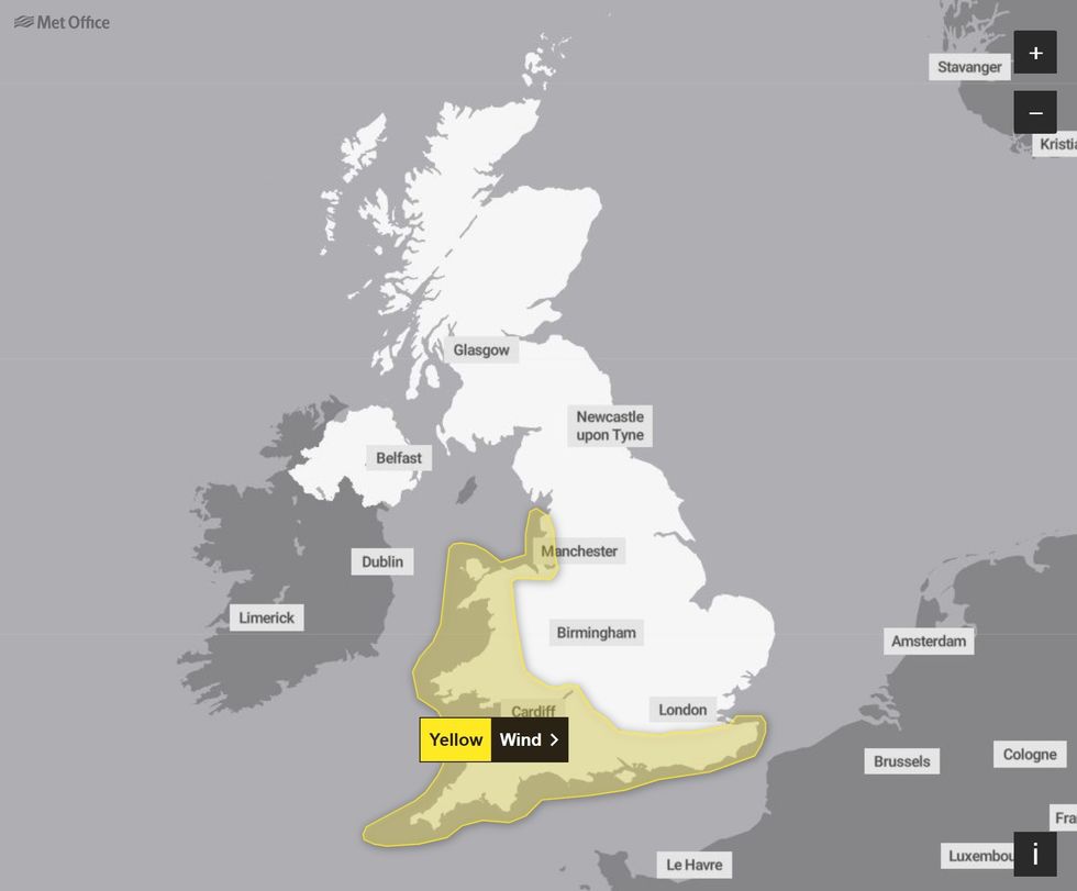
The Met Office has issued a wind warning stretching from Merseyside to Kent
|MET OFFICE
"There is a slight chance that power cuts may occur, with the potential to affect other services, such as mobile phone coverage.
"There is a small chance of injuries and danger to life from flying debris.
"There is a small chance that some roads and bridges could close."
Explaining the reasons for the alert in more detail, the Met Office said: "An area of low pressure will bring a prolonged spell of windy weather through Sunday evening and into Monday.
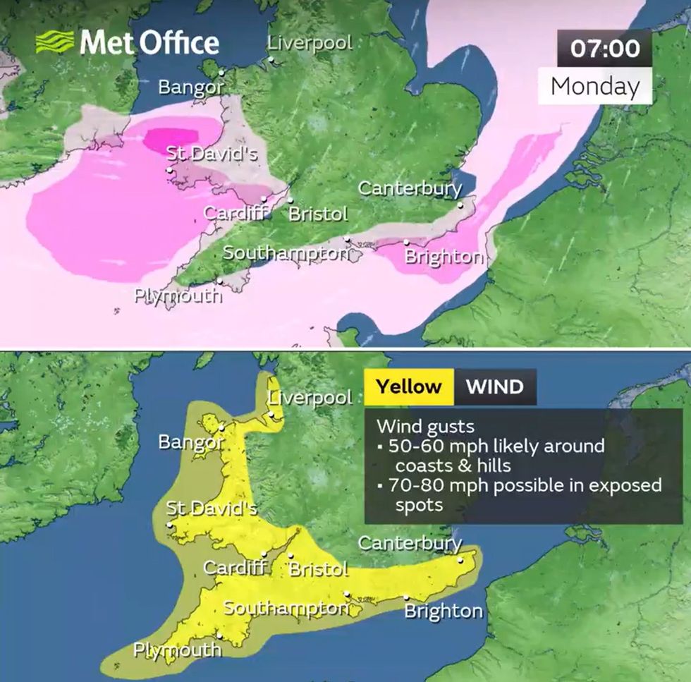
The Met Office has predicted 80mph winds in some areas
|MET OFFICE
"Gusts of around 50-60 mph are likely around coasts and hills, with 70-80 mph possible in the most exposed locations, with the windiest conditions expected on Monday morning and moving eastwards as the day progresses."
It added: "Check for loose items outside your home and plan how you could secure them. Items include; bins, garden furniture, trampolines, tents, sheds, and fences.
"If you are on the coast, stay safe during stormy weather by being aware of large waves.
"Even from the shore, large breaking waves can sweep you off your feet and out to sea.
"Take care if walking near cliffs; know your route and keep dogs on a lead.
"In an emergency, call 999 and ask for the Coastguard."
Looking further and more broadly ahead, Britain has been told to brace for a fortnight of wind and rain as the country becomes the target of a cyclonic conveyor belt funnelled by the Jet Stream.
Met Office meteorologist Alex Burkill said: "Into September, there are signs that the unsettled theme is going to continue, although as we go through the third week of September, there are signs of higher pressure at times towards the south, so there could be some quieter spells.
"However, these don’t look like big blocking highs that will last for ages, they may just be some temporary ridges."