


Summer will end with a bang as bank holiday heat erupts into a deluge of electrical thunderstorms.
Calm and settled weather is about to give way to wind and rain as stormy weather sweeps in from the Atlantic.
Cool winds from the west hitting warm humidity over Britain will light the blue touch paper for a spectacular display of fireworks.
**ARE YOU READING THIS ON OUR APP? DOWNLOAD NOW FOR THE BEST GB NEWS EXPERIENCE**
Jim Dale, meteorologist for British Weather Services, said: “It is going to turn more unsettled from the middle of the week, with more in the way of widespread rain and winds around the coast.
“As the cooler winds come in, they will trigger thunderstorms and heavy downpours along the western flank of the country.
“It is a changeable and unsettled picture, then until the weekend.”
Britain’s weather is currently at the mercy of ex-Hurricane Erin, which at the weekend arrived to the west coast.
Erin has had meteorologists scratching their heads over the past week, her path dictating the UK’s end-of-summer weather.
LATEST WEATHER:
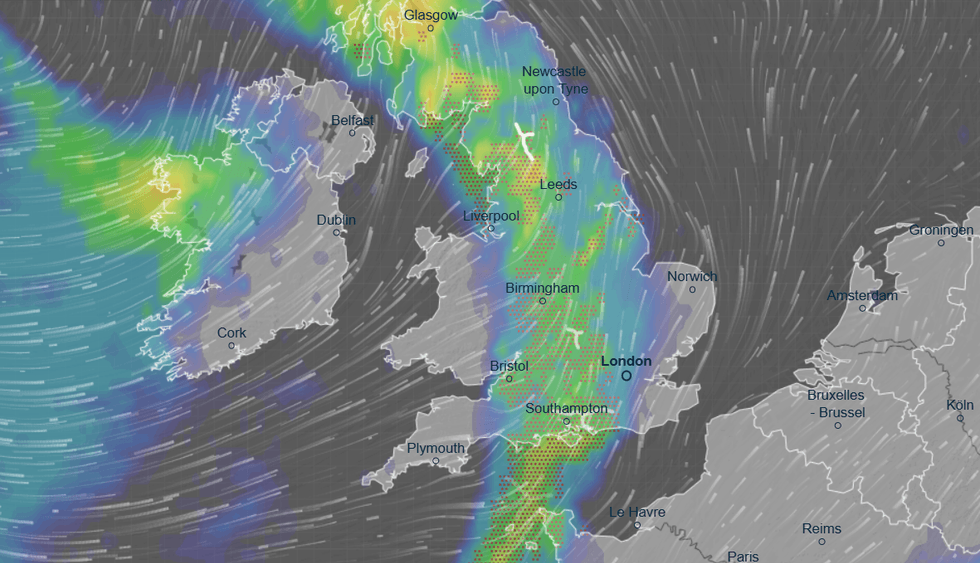
Britain is set to be hit by electrical thunderstorms
|VENTUSKY
She was initially expected to pass to the south of the UK, bringing a bank holiday washout.
Her trajectory then changed to head north to Iceland, where she will pull warmer air into the UK.
Erin's ‘ashes’ will continue to disrupt Britain’s weather through the rest of the week, as the nation battens the hatches for rain.
Dale said: “After the warm weather moves out of the way on Tuesday, the ashes of Erin will keep mixing things up through the rest of the week.
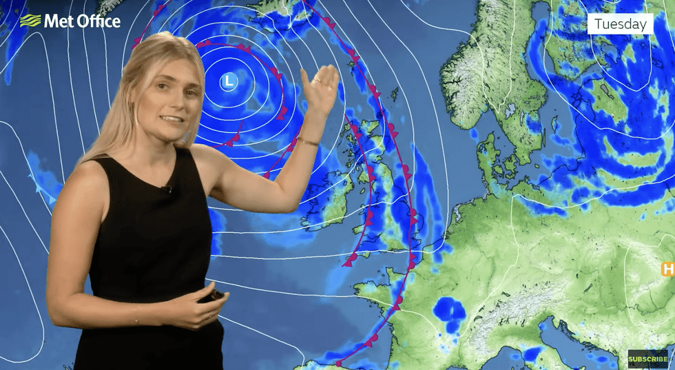
Met Office’s Kathryn Chalk describes Erin brining rain into the UK
|MET OFFICE
“Erin is sitting to the north of the country where it will bring bands of rain in from the west through the next couple of days.”
Britons should make the most of summer’s last hurrah as sunny high pressure is shoved out of the way by cyclonic lows.
These will be given a helping hand by the remains of Erin as it churns in the North Atlantic.
Western coasts are on alert for localised flooding as Erin whips sea waters into monstrous waves.
Met Office meteorologist Kathryn Chalk said: “Ex-Hurricane Erin is going to be bringing in bands of showers or heavier spells of rain as we go through the week, and also some large waves especially across western coasts.
“Tuesday morning is a bit more of an unsettled start, but the band of rain will generally start fizzling out as we go into late morning, and this will be replaced by sunny spells and a scattering of showers, some of which could be heavy at times.”
Southern Britain will cling on to the warmth through the start of the week as the west turns cooler, she said.
Temperatures in the southeast will hit 26C by this afternoon with highs between 17C and 23C elsewhere, she added.
She said: “It will be quite warm across the southeast with highs of 26C, but in the west temperatures will fall closer to average.
“It stays unsettled as we go into Wednesday and Thursday.”